world.wikisort.org - Uruguay
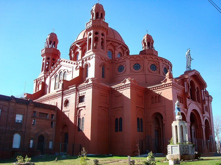
Cerrito, officially Cerrito de la Victoria, is a barrio (neighbourhood or district) of Montevideo, Uruguay. Most of the barrio is on a hill (cerrito is Spanish for "hill") on which is the very remarkable church named Santuario Nacional del Cerrito. This hill was the seat of the temporary government of General Oribe during his siege of Montevideo.
Cerrito de la Victoria | |
|---|---|
Barrio | |
 | |
 Street map of Cerrito de la Victoria | |
 Location of Cerrito in Montevideo | |
| Coordinates: 34°51′23″S 56°10′9″W | |
| Country | |
| Department | Montevideo Department |
| City | Montevideo |
Location
Cerrito de la Victoria borders Aires Puros to the west, Las Acacias to the north, Pérez Castellanos to the east, Bolívar and Brazo Oriental to the south.
Places of worship
- National Shrine of the Heart of Jesus (Roman Catholic)
- Parish Church of Our Lady of the Thirty-Three (Roman Catholic)
Sport
The neighbourhood has two sports clubs, who share a large rivalry; the Clásico del Cerrito is contested between Club Sportivo Cerrito and Rentistas.[1]
See also
- Barrios of Montevideo
- Gobierno del Cerrito
References
- "Clásicos del fútbol uruguayo". 18 April 2011.
External links
- Intendencia de Montevideo / Historia del Cerrito de la Victoria
- Revista Raíces / Historia del barrio Cerrito de la Victoria
Wikimedia Commons has media related to Cerrito de la Victoria.
Barrios of Montevideo | ||
|---|---|---|
 |
| |
This Montevideo-related article is a stub. You can help Wikipedia by expanding it. |
На других языках
- [en] Cerrito, Montevideo
[es] Cerrito de la Victoria
Cerrito de la Victoria es la denominación del barrio que se ubica en el centro-este de la ciudad de Montevideo, al sudeste del arroyo Miguelete. Su límite se encuentra delimitado por las calles Bulevar José Batlle y Ordóñez, Avenida General Flores, Cmno. Burgues y Chimborazo.[1]También en las proximidades del barrio se encuentra la Plaza del Ejército en el cruce de los ejes de la Avda. General Flores y Bulevar José Batlle y Ordoñez.Текст в блоке "Читать" взят с сайта "Википедия" и доступен по лицензии Creative Commons Attribution-ShareAlike; в отдельных случаях могут действовать дополнительные условия.
Другой контент может иметь иную лицензию. Перед использованием материалов сайта WikiSort.org внимательно изучите правила лицензирования конкретных элементов наполнения сайта.
Другой контент может иметь иную лицензию. Перед использованием материалов сайта WikiSort.org внимательно изучите правила лицензирования конкретных элементов наполнения сайта.
2019-2025
WikiSort.org - проект по пересортировке и дополнению контента Википедии
WikiSort.org - проект по пересортировке и дополнению контента Википедии