world.wikisort.org - United_Kingdom
Wettenhall is a village (at SJ624614) and civil parish in the unitary authority of Cheshire East and the ceremonial county of Cheshire, England. The village lies 3½ miles to the south west of Winsford and 6 miles to the north west of Crewe. The parish also includes the settlements of Chapel Green and Woodside.[1] Nearby villages include Alpraham, Calveley, Cholmondeston, Church Minshull, Little Budworth and Tarporley. According to the 2001 census, the parish had a population of 135,[2] increasing to 192 at the 2011 Census.[3]
| Wettenhall | |
|---|---|
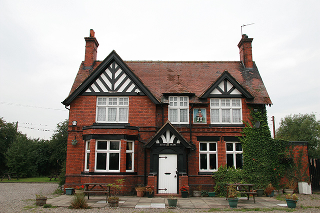 The Little Man public house, Wettenhall | |
 Wettenhall Location within Cheshire | |
| Population | 192 (2011) |
| OS grid reference | SJ621616 |
| Civil parish |
|
| Unitary authority |
|
| Ceremonial county |
|
| Region |
|
| Country | England |
| Sovereign state | United Kingdom |
| Post town | WINSFORD |
| Postcode district | CW7 |
| Dialling code | 01270 |
| Police | Cheshire |
| Fire | Cheshire |
| Ambulance | North West |
| UK Parliament |
|
History
The village is listed in the Domesday Book as Watenhale and was held by Gilbert de Venables.[4] In the Norman era, Wettenhall was within the Forests of Mara and Mondrem (now Delamere Forest) and in the mid-14th century was overseen by an underforester.[5] The village's former manor house, Wettenhall Hall, dated from 1635 and was demolished in around 1930. A drawing by John Douglas reveals that it was a brick building in the Artisan Mannerist style, with three shaped gables.[6]
The population has declined since the 19th century; the historical population figures are 228 (1801), 294 (1851), 214 (1901) and 154 (1951).[1]
Governance
Wettenhall is administered by Cholmondeston and Wettenhall Parish Council jointly with the adjacent civil parish of Cholmondeston.[7] From 1974 the civil parish was served by Crewe and Nantwich Borough Council, which was succeeded on 1 April 2009 by the unitary authority of Cheshire East.[8] Wettenhall falls in the parliamentary constituency of Eddisbury,[9] which has been represented by Edward Timpson since 2019,[10] after being represented by Stephen O'Brien (1999–2015) and Antoinette Sandbach (2015–19).
Landmarks
St David's, the village church, dates from around 1870 and was designed by J. Redford and J.A. Davenport;[11] it holds services every Sunday. The Little Man is the only remaining public house;[12] the Boot and Slipper was demolished in 2016.[13]
Geography
Wettenhall village is centred on the junction of Long Lane to Alpraham and Winsford Road between Darnhall and Cholmondeston. Wettenhall Brook flows through the village.[9] The parish includes Wettenhall Wood, part of the Wettenhall And Darnhall Woods Site of Special Scientific Interest, together with woodland in the adjacent Darnhall parish.[14][15]
Education
There are no educational facilities in the civil parish. Wettenhall falls within the catchment areas of Calveley Primary Academy and Tarporley High School.[9]
References
- Genuki: Wettenhall (accessed 15 August 2007)
- Neighbourhood Statistics: Wettenhall CP (accessed 12 August 2007)
- "Civil Parish population 2011". Neighbourhood Statistics. Office for National Statistics. Retrieved 14 March 2015.
- "Cheshire L–Z", The Domesday Book Online, retrieved 18 January 2020
- Husain, pp. 56–57
- de Figueiredo & Treuherz, p. 280
- Parish Councils A – C, Cheshire East Council, retrieved 18 January 2020
- Cheshire (Structural Changes) Order 2008 Archived 17 May 2009 at the Wayback Machine
- Search at Cheshire East Interactive Mapping; 18 January 2020
- Eddisbury Parliamentary constituency, BBC, retrieved 19 December 2019
- Hartwell et al., p.665
- Geograph: Little Man Pub, Wettenhall (accessed 15 August 2007)
- Goodwin, S. (2018). "Erection of 3 Dwellings on Land at The Former Boot and Slipper Inn, Long Lane, Wettenhall: Supporting Planning, Design and Access Statement" (PDF) (Planning statement). Goodwin Planning Services Ltd. 2.2. Retrieved 17 April 2022.
The public house was demolished in 2016...
- Natural England: Wettenhall And Darnhall Woods (accessed 16 April 2010)
- Natural England: Nature on the Map: Wettenhall & Darnhall Woods SSSI (accessed 16 April 2010)
- Sources
- C. Hartwell, M. Hyde, E. Hubbard, N. Pevsner. The Buildings of England: Cheshire (Yale University Press; 2011) (ISBN 978 0 300 17043 6)
- P. de Figueiredo, J. Treuherz. Cheshire Country Houses (Phillimore; 1988) (ISBN 0-85033-655-4)
- B. M. C. Husain. Cheshire under the Norman Earls: 1066–1237. A History of Cheshire Vol. 4 (J. J. Bagley, ed.) (Cheshire Community Council; 1973)
External links
![]() Media related to Wettenhall at Wikimedia Commons
Media related to Wettenhall at Wikimedia Commons
| Unitary authorities |
|
|---|---|
| Major settlements | |
| Rivers | |
| Topics |
|
Другой контент может иметь иную лицензию. Перед использованием материалов сайта WikiSort.org внимательно изучите правила лицензирования конкретных элементов наполнения сайта.
WikiSort.org - проект по пересортировке и дополнению контента Википедии