world.wikisort.org - United_Kingdom
Washbrook is a village and former civil parish 3 miles (4.8 km) south west of Ipswich,[1] now in the parish of Copdock and Washbrook, in the Babergh district, in the county of Suffolk, England. In 2011 the built-up area had a population of 517.[2] In 1961 the parish had a population of 368.[3] As of 1958 Washbrook Street was a secondary settlement for Washbrook.[4]
| Washbrook | |
|---|---|
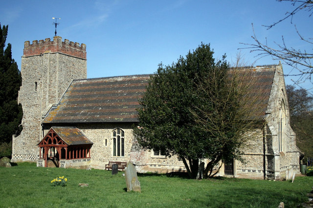 St Mary's Church | |
 Washbrook Location within Suffolk | |
| Area | 0.2175 km2 (0.0840 sq mi) |
| Population | 517 (2011 census) |
| • Density | 2,377/km2 (6,160/sq mi) |
| OS grid reference | TM118420 |
| Civil parish |
|
| District | |
| Shire county | |
| Region | |
| Country | England |
| Sovereign state | United Kingdom |
Features
Washbrook has a church called St Mary's Church.[5] Washbrook had a Sunday school that was established in 1833.[4] Washbrook formerly had a second church.[6]
History
The name "Washbrook" means 'Washing brook' or 'flooding brook'.[7] Washbrook was called "Great Belstead" in Saxon times while the present Belstead was called "Little Belstead".[8] The village is likely one of the sources of the surname Washbrook.[9] On 1 April 1994 the parish was abolished and merged with Copdock to form Copdock and Washbrook. Parts of Washbrook went to form the new parish of Pinewood and parts went to Chattisham, Sproughton and Belstead.[10]
References
- "Distance from Washbrook [52.035934, 1.086523]". GENUKI. Retrieved 22 July 2019.
- UK Census (2011). "Local Area Report – Washbrook Built-up area sub division (E34000351)". Nomis. Office for National Statistics. Retrieved 22 July 2019.
- "Population Statistics Washbrook CP/AP through time". Vision of Britain. Retrieved 22 July 2019.
- "Washbrook (also known as Great Belstead)" (PDF). Heritage Suffolk. Retrieved 22 July 2019.
- "St Mary, Washbrook". Suffolk Churches. Retrieved 22 July 2019.
- "dedication unknown, Washbrook". Suffolk Churches. Retrieved 22 July 2019.
- "Washbrook Key to English Place-names". The University of Nottingham. Retrieved 22 July 2019.
- "Washbrook Church history" (PDF). One Suffolk. Retrieved 22 July 2019.
- "Last name: Washbrook". Surname Database. Retrieved 29 July 2019.
- "The Babergh (Parishes) Order 1993" (PDF). Local Government Boundary Commission for England. Retrieved 22 July 2019.
External links
На других языках
[de] Washbrook
Washbrook ist ein Dorf in Civil Parish Copdock and Washbrook im District Babergh in der Grafschaft Suffolk, England. Washbrook ist 5 km von Ipswich entfernt. Im Jahr 2011 hatte es eine Bevölkerung von 517 Einwohnern.[1] Aufgrund einer im November 1993 erlassenen Verordnung wurde Washbrook zum 1. April 1994 mit dem südlich angrenzenden Copdock zum neuen Parish Copdock and Washbrook zusammengeschlossen.[2]- [en] Washbrook
Другой контент может иметь иную лицензию. Перед использованием материалов сайта WikiSort.org внимательно изучите правила лицензирования конкретных элементов наполнения сайта.
WikiSort.org - проект по пересортировке и дополнению контента Википедии