world.wikisort.org - United_Kingdom
Saintfield (from Irish: Tamhnaigh Naomh, meaning 'Field of Saints')[3] is a village and civil parish in County Down, Northern Ireland. It is about halfway between Belfast and Downpatrick on the A7 road. It had a population of 3,381 in the 2011 Census, made up mostly of commuters working in both south and central Belfast, which is about 18 km away. The population of the surrounding countryside is mostly involved in farming.
| Saintfield | |
|---|---|
 Main Street, Saintfield | |
 Location within County Down | |
| Population | 3,381 (2011 Census) |
| District | |
| County | |
| Country | Northern Ireland |
| Sovereign state | United Kingdom |
| Post town | BALLYNAHINCH |
| Postcode district | BT24 |
| Dialling code | 028 |
| UK Parliament | |
| NI Assembly |
|
Running east to west across the A7 is the B6 road, and to the west of this crossroads is Main Street, which takes one towards Lisburn and Ballynahinch, and to the east is Station Road which takes one towards Killyleagh.
History
The area that is now Saintfield was historically called Tawnaghnym (recorded in 1605) or Taunaghnieve (recorded in 1663), which is believed to come from the Irish Tamhnach Naomh or Tamhnaigh Naomh, meaning "field of saints". The English translation, Saintfield, did not come into use until the 18th century.[4]
In the 16th century, the Saintfield area was part of South Clannaboy owned by Sir Con McNeil Oge O'Neil. His lands were confiscated after a false accusation of disloyalty in 1602 and were granted to Sir James Hamilton in 1605 who 'planted' English and Scottish settlers in the area.[5] Saintfield was originally an early 17th-century settlement, with the first church being built about 1633.[4] In 1709 Hamilton sold the estate to Major General Nicholas Price of Hollymount, County Down, who laid the foundations of the town and renamed it Saintfield in 1712.[5]
Nicholas Price remained owner of the village until his death in 1734 and encouraged linen manufacturers and tradesmen to settle, established a barracks, repaired the parish church and established markets and fairs.[5] The village had a number of corn, flour and flax mills, the remains of which are visible today, and has retained a tradition of textile manufacture through Saintfield Yarns. Development was continued by the Price family and in 1750 the family, headed by Francis Price, grandson of Nicholas, moved to a newly built Saintfield House, just north of the village.[5]
Multiple churches were built in the late 1700s. The Price family rebuilt the Church of Ireland parish church in 1776, including an older church in the construction. The First Presbyterian Church was built one year later despite Presbyterian worship existing since the early 1600s. Society of United Irishmen members killed at the Battle of Saintfield in June 1798 are buried here. A Roman Catholic church was built in 1787 as the Chapel of the Immaculate Heart of Mary.[6]
A new Roman Catholic Church (Mary Mother of the Church) was built to a Romanesque design and opened in December 1965 off the A7 road. It can seat up to 600 people and was the highpoint of the pastorate of Fr. Hugh O'Neill PP.[7]
A Second Presbyterian Church was built in 1796 on the Ballynahinch Road.[8] The architectural and historic significance of the town centre is reflected in its designation as a Conservation Area in 1997.
1798 in Saintfield

In 1792 the Presbyterian minister Thomas Ledlie Birch convened a Saintfield branch of the Society of United Irishmen, founded the year before by liberal Protestant in Belfast, and moved their first resolutions.[9] These called for "a more equal representation of the people" in the Parliament in Dublin and the recognition of "our brethren Roman Catholics as men deprived of their just rights".[10] Faced with growing repression, the United Irishmen launched a rebellion in 1798, which began with a largely Catholic uprising in Leinster but quickly spread to the Presbyterian Ulster.
On 9 June 1798, a British force was ambushed in a wood near Saintfield. About 100 men were killed altogether, and the United Irishmen emerged victorious. The headstones of men who were killed in this battle can be seen near the river at the bottom of the First Presbyterian Church graveyard. Following a patriotic sermon delivered by Birch, the insurgents marched south to the main rebel encampment at Ballynahinch, where on 13 June they were routed by government forces. In the aftermath of the battle, Saintfield was sacked and only a few pre-1798 buildings remain.[5]
The village was subsequently rebuilt. In 1802 the Price family residence in Main Street was converted to an inn. In 1803 the Market House was built. The White Horse Inn was also built and almshouses in 1813. However, the village declined from the mid-19th century, with population reducing from 923 in 1851 to 533 just before the First World War.[5]
Places of interest

- Rowallane Garden is situated immediately south of the village on the A7 road and is a National Trust property.
- Many of the buildings on the main street have old stables and courtyards behind them.
From Lewis Topographical Dictionary (1837): The proprietor and lord of the manor, N. Price, Esq., improved the town in 1802, when he erected a large market-house and hotel, since which time Saintfield has been rapidly improving, and is now one of the most flourishing towns in the county.
- The Market House (now an Orange Hall) and the Hotel (now a private house) can be seen on Main Street.
Demography
Saintfield is classified as an intermediate settlement by the NI Statistics and Research Agency (NISRA) (i.e. with population between 2,250 and 4,500 people). On Census day there were 3,381 people living in Saintfield. Of these:
- 19.48% were aged under 16 years and 21.83% were aged 60 and over,
- 48.4% of the population were male and 51.6% were female,
- 26.32% were from a Catholic background and 65.48% were from a Protestant background,
For more details on Saintfield's demographics see: NI Neighbourhood Information Service
- In 1837 the population of Saintfield area was 7,154 of whom 1,053 lived in the town.[11]
- In 1851 the population of Saintfield rose to 1,104.[12]
People
This section does not cite any sources. (August 2020) |
- Thomas Beattie MP, Member of the Canadian House of Commons, born in Saintfield.
- Lynda Bryans, Television Presenter, from Saintfield.
- Matilda Carse (1835–1917), businesswoman, social reformer.
- Lord Faulkner, Prime Minister of Northern Ireland, died in a hunting accident at the Ballyagherty/Station Road junction just outside Saintfield.
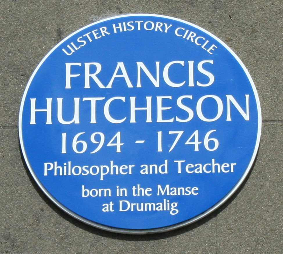
- Francis Hutcheson, philosopher & teacher born at Drumalig.
- William David Kenny, born in 1899 in Saintfield, was awarded the Victoria Cross for gallantry in India in 1918.
- Bishop Daniel Mageean, Bishop of Down & Connor, born at Darragh Cross.
- George Morrison, Unionist politician and Mayor of Lisburn, raised in Saintfield.
- Rev. Coslett Herbert Waddell, Vicar of Saintfield, botanist.
Religion
Despite being a relatively small town, Saintfield is served by five well-attended churches: the local Church of Ireland, two Presbyterian churches, Saintfield Baptist Church and Mary, Mother of the Church Roman Catholic Church.
Education
Saintfield contains two primary schools 'Saintfield Academy Primary' and 'St. Marys' and one secondary school 'Saintfield High School', with a large amount of its under-18 population travelling to schools in Downpatrick, Ballynahinch or Belfast.
Primary
- Academy Primary School
- St. Caolan's Primary School, Darragh Cross
- Millennium Integrated Primary School
- St. Mary's Primary School

Secondary
- Saintfield High School
Sport
- Saintfield AYC Football Club
- Saintfield Cricket Club
- Saintfield Mens Hockey Club
- Saintfield Ladies Hockey Club
- Saintfield United Football Club
- 2nd Saintfield Badminton Club
- St. Mochais GAC
Groups

- 1st Saintfield Scouts is based in Saintfield Parish hall with a great attendance. They celebrate their 100th anniversary in 2011 just 4 years after the Scouts was founded.
- Rowallane Community Hub (RCH), 35 Main Street, Saintfield.
- Cumann Gaelach - Crois Darach agus Tamhnaigh Naomh
Transport
Saintfield railway station opened on 10 September 1858 and finally closed on 16 January 1950.[13] The current main mode of transport is from the end of the main street on the A21/A7 which is a Translink service, Ulsterbus operates frequently to and from Belfast/Downpatrick.

See also
- Saintfield (civil parish)
References
- McDonald, Fiona. "Fae Cowie's Craig". Ulster-Scots Language Society. Archived from the original on 19 September 2015. Retrieved 8 May 2017.
- Saintfield Archived 29 July 2019 at the Wayback Machine. Placenames Database of Ireland.
- "Place Names NI". Archived from the original on 7 May 2021. Retrieved 18 August 2019.
- "Saintfield, County Down". Place Names NI. Archived from the original on 2 April 2015. Retrieved 6 March 2015.
- "Saintfield Conservation Area" (PDF). Planning NI. Archived (PDF) from the original on 7 October 2014. Retrieved 6 March 2015.
- Sandford, Ernest (1976). Discover Northern Ireland. Belfast: NI Tourist Board. p. 198. ISBN 0-9500222-7-6.
- https://www.britishnewspaperarchive.co.uk/viewer/bl/0002318/19651213/037/0005 – via British Newspaper Archive.
{{cite news}}: Missing or empty|title=(help) - "Churches in Saintfield". Discover Saintfield. Archived from the original on 8 February 2015. Retrieved 6 March 2015.
- McClelland, Aiken (1964). "Thomas Ledlie Birch, United Irishman" (PDF). Belfast Natural History and Philosophical Society (Sessions 161/62-1963/64). Second Series, 7. Archived (PDF) from the original on 16 January 2021. Retrieved 18 November 2020.
- Northern Star, 26 December 1792
- "Entry for Saintfield in Lewis Topographical Dictionary of Ireland (1837)". Archived from the original on 28 May 2007. Retrieved 11 June 2007.
- "Belfast And Ulster 1858 - 2680 | PRONI". proni.gov.uk. Archived from the original on 13 February 2019. Retrieved 12 February 2019.
- "Saintfield station" (PDF). Railscot - Irish Railways. Archived (PDF) from the original on 2 March 2011. Retrieved 24 November 2007.
- Saintfield Heritage - a publication of the Saintfield Heritage Society. Books 1 - 7. Book 7 ISBN 0-9508620-6-1
External links
Places in County Down | ||
|---|---|---|
List of places in County Down | ||
| Cities |  | |
| Towns | ||
| Villages and townlands |
| |
| Landforms |
| |
| Baronies |
| |
| ||
На других языках
- [en] Saintfield
[ru] Сэнтфильд
Сэнтфильд[уточнить] (англ. Saintfield, ирл. Seirbhís Póilíneachta Tamhnach Naomh) — деревня, расположена в графстве Даун в Северной Ирландии. Находится между Белфастом и Даунпатриком на шоссе А-7 роуд (англ. A-7 road). Население по переписи 2001 года составляет 2 959 человек.Другой контент может иметь иную лицензию. Перед использованием материалов сайта WikiSort.org внимательно изучите правила лицензирования конкретных элементов наполнения сайта.
WikiSort.org - проект по пересортировке и дополнению контента Википедии