world.wikisort.org - United_Kingdom
Lecale Lower (named after the former barony of Lecale) is a barony in County Down, Northern Ireland.[2] It lies to the east of the county with Strangford Lough to its north and the Irish Sea to its right. It is bordered by five other baronies: Lecale Upper to the south; Ards Upper to the north-east just across the mouth of Strangford Lough; Dufferin to the north; Castlereagh Upper to the north-west; and Kinelarty to the west.[2]
Lecale Lower
| |
|---|---|
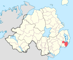 Location of Lecale Lower, County Down, Northern Ireland. | |
| Sovereign state | United Kingdom |
| Country | Northern Ireland |
| County | Down |
In medieval times the Ó Coltair (Coulter) sept is noted in the Lecale Lower area, of which the townland of Ballyculter gets its name.[3][4]
The barony of Lecale Lower was created in 1851 when the barony of Lecale was split into two, the other part being Lecale Upper.[5]
List of settlements
Below is a list of the villages and population centres in Lecale Lower:[1][6]
Villages
Hamlets
- Annacloy
- Ballyhornan
- Coney Island
- Saul
List of civil parishes
Below is a list of civil parishes in Lecale Lower:[1][7][6]
- Ardglass
- Ballee (also partly in barony of Lecale Upper (one townland))
- Ballyculter
- Dunsfort
- Inch
- Kilclief (also partly in barony of Lecale Upper)
- Rathmullan (one townland, rest in barony of Lecale Upper)
- Saul
References
- Logainm - Lecale Lower
- PRONI Baronies of Northern Ireland
- Ireland's History in Maps - The Baronies of Ireland
- Bell, Robert; The book of Ulster surnames, page 78-79. The Black Staff Press, 2003. ISBN 0-85640-602-3
- Database of Irish Historical Statistics - Literacy Notes
- "Lecale Lower". IreAtlas Townlands Database. Retrieved 15 May 2015.
- PRONI Civil Parishes of County Down
Places in County Down | ||
|---|---|---|
List of places in County Down | ||
| Cities |
|  |
| Towns |
| |
| Villages and townlands |
| |
| Landforms |
| |
| Baronies |
| |
| ||
Другой контент может иметь иную лицензию. Перед использованием материалов сайта WikiSort.org внимательно изучите правила лицензирования конкретных элементов наполнения сайта.
WikiSort.org - проект по пересортировке и дополнению контента Википедии