world.wikisort.org - United_Kingdom
Oad Street is a small hamlet in the English county of Kent.[1]
| Oad Street | |
|---|---|
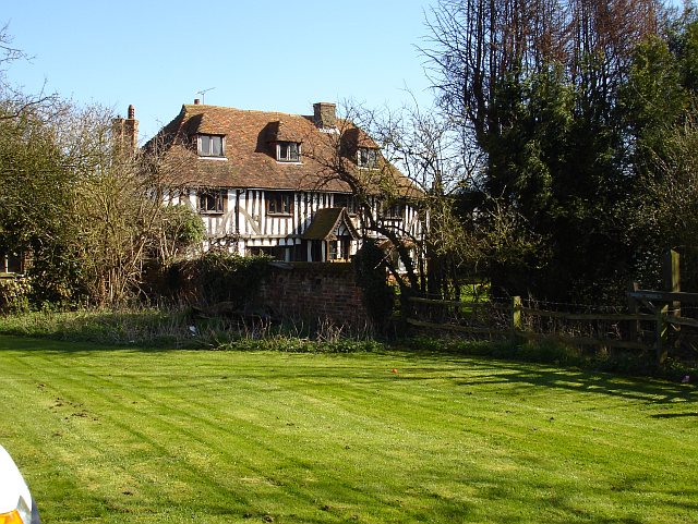 The Olde House, Oad Street | |
 Oad Street Location within Kent | |
| OS grid reference | TQ869621 |
| Civil parish | |
| District | |
| Shire county |
|
| Region | |
| Country | England |
| Sovereign state | United Kingdom |
| Post town | Sittingbourne |
| Postcode district | ME9 |
| Police | Kent |
| Fire | Kent |
| Ambulance | South East Coast |
Oad Street forms part of the civil parish of Borden which, in turn, is part of Swale district. Oad Street is located close to Junction 5 of the M2 motorway where it crosses the A249 road.
History
In 1798, Edward Hasted records that this hamlet was once called Hoade Street and Woodstreet, before becoming Oade Street. Named after a nearby Chestnut Wood (which covered the hillside down towards Danaway). In 1653, most of the parish was controlled by William Genery (from Throwley).[2]
Buildings
In the hamlet are 3 listed buildings, Grade II* listed 'Yew Tree Cottage',[3]Grade II listed 'The Olde House',[4] and Grade II listed 'Hoad House'.[5]
Also a local public house, the 'Plough & Harrow' public house.[6]
It also had a former Wesleyan Chapel (Oad Street Methodist Church),[7] now converted into a private residence.
Oad Street food and craft, a restaurant and art gallery. [8]
References
- "History of Oad Street". Kent Past. 2010. Retrieved 14 September 2015.
- Hasted, Edward (1798). "Parishes". The History and Topographical Survey of the County of Kent. Institute of Historical Research. 6: 68–80. Retrieved 9 March 2014.
- "Yew Tree Cottage, Borden". www.britishlistedbuildings.co.uk. Retrieved 9 March 2014.
- "The Olde House, Borden". www.britishlistedbuildings.co.uk. Retrieved 9 March 2014.
- "Hoad House, Borden". www.britishlistedbuildings.co.uk. Retrieved 9 March 2014.
- "Geograph:: 'Plough & Harrow' public house (C) Robert Edwards".
- "Oad Street Methodist Church". bordenheritage.org.uk. Retrieved 9 March 2014.
- "Oad Street Centre". Archived from the original on 30 January 2014. Retrieved 9 March 2014.
External links
![]() Media related to Oad Street at Wikimedia Commons
Media related to Oad Street at Wikimedia Commons
This Kent location article is a stub. You can help Wikipedia by expanding it. |
Другой контент может иметь иную лицензию. Перед использованием материалов сайта WikiSort.org внимательно изучите правила лицензирования конкретных элементов наполнения сайта.
WikiSort.org - проект по пересортировке и дополнению контента Википедии