world.wikisort.org - United_Kingdom
Dunluce Lower is a barony in County Antrim, Northern Ireland.[2] To its north runs the north-Antrim coast, and it is bordered by three other baronies: Dunluce Upper to the south, Cary to the east, and the North East Liberties of Coleraine to the west.[2] The River Bush flows through this barony.[1] Dunluce Lower also formed the northern part of the medieval territory known as the Route.[3]
Dunluce Lower
| |
|---|---|
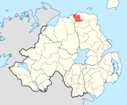 Location of DunluceLower, County Antrim, Northern Ireland | |
| Sovereign state | United Kingdom |
| Country | Northern Ireland |
| County | Antrim |
History
List of main settlements
Below is a list of settlements in Dunluce Lower:[1]
Towns
Villages
Population centres
- Priestland
List of civil parishes
Below is a list of civil parishes in Dunluce Lower:[4][5]
- Ballyrashane (also partly in barony of North-East Liberties of Coleraine)
- Ballywillan (split with barony of North-East Liberties of Coleraine)
- Billy (split with barony of Cary)
- Derrykeighan
- Dunluce
References
- "Dunluce Lower". Placenames Database of Ireland. Department of Community, Rural and Gaeltacht Affairs. Retrieved 5 June 2011.
- "Public Record Office of Northern Ireland (PRONI) - nidirect". proni.gov.uk. 4 March 2016. Retrieved 17 April 2018.
- Ulster Archaeological Society. "Ulster journal of archaeology". Belfast [Ulster Archaeological Society]. Retrieved 17 April 2018 – via Internet Archive.
- "Unavailable". applications.proni.gov.uk. Archived from the original on 27 July 2011. Retrieved 17 April 2018.
- "Unavailable". applications.proni.gov.uk. Archived from the original on 27 July 2011. Retrieved 17 April 2018.
Places in County Antrim | ||
|---|---|---|
List of places in County Antrim | ||
| Cities |
|  |
| Towns |
| |
| Villages |
| |
| Townlands |
| |
| Landforms |
| |
| Baronies |
| |
| ||
This article related to the geography of County Antrim, Northern Ireland is a stub. You can help Wikipedia by expanding it. |
Текст в блоке "Читать" взят с сайта "Википедия" и доступен по лицензии Creative Commons Attribution-ShareAlike; в отдельных случаях могут действовать дополнительные условия.
Другой контент может иметь иную лицензию. Перед использованием материалов сайта WikiSort.org внимательно изучите правила лицензирования конкретных элементов наполнения сайта.
Другой контент может иметь иную лицензию. Перед использованием материалов сайта WikiSort.org внимательно изучите правила лицензирования конкретных элементов наполнения сайта.
2019-2025
WikiSort.org - проект по пересортировке и дополнению контента Википедии
WikiSort.org - проект по пересортировке и дополнению контента Википедии