world.wikisort.org - United_Kingdom
Kilconway (from Irish: Coill Uí Chonmhaí[2]) is a barony in County Antrim, Northern Ireland.[3] It is bordered by six other baronies: Dunluce Upper to the north; Glenarm Lower to the east; Antrim Lower to the south-east; Toome Lower to the south; Loughinsholin to the south-west; and Coleraine to the north-east.[3] Kilconway also formed part of the medieval territory known as the Route. Springmount Bog is located within the barony.[1]
Kilconway
| |
|---|---|
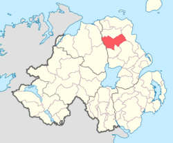 Location of Kilconway, County Antrim, Northern Ireland. | |
| Sovereign state | United Kingdom |
| Country | Northern Ireland |
| County | Antrim |
History
List of settlements
Below is a list of settlements in Kilconway:[1]
Villages
- Cargan
- Cloughmills
- Dunloy
- Rasharkin
Population centres
- Clogh
- Finvoy
- Glarryford
- Glenravel
- Killagan
- Loughguile (part in barony of Dunluce Upper)
- Newtown Crommelin
List of civil parishes
Below is a list of civil parishes in Kilconway:[4][5]
- Ballymoney (also partly in barony of Dunluce Upper, County Antrim and North East Liberties of Coleraine, County Londonderry)
- Craigs (split with barony of Toome Lower)
- Dunaghy
- Finvoy
- Grange of Dundermot
- Killagan (split with barony of Dunluce Upper)
- Loughguille (split with barony of Dunluce Upper)
- Rasharkin
- Newtown Crommelin
References
- "Kilconway". Placenames Database of Ireland. Department of Community, Rural and Gaeltacht Affairs. Retrieved 5 June 2011.
- "Kilconway, County Antrim". Place Names Northern Ireland. Retrieved 6 February 2014.
- PRONI Baronies of Northern Ireland
- "PRONI Civil Parishes of County Antrim". Archived from the original on 27 July 2011. Retrieved 26 June 2010.
- "Baronies and parishes of County Antrim". Archived from the original on 27 July 2011. Retrieved 5 February 2011.
Places in County Antrim | ||
|---|---|---|
List of places in County Antrim | ||
| Cities |
|  |
| Towns | ||
| Villages |
| |
| Townlands |
| |
| Landforms |
| |
| Baronies |
| |
| ||
This article related to the geography of County Antrim, Northern Ireland is a stub. You can help Wikipedia by expanding it. |
Текст в блоке "Читать" взят с сайта "Википедия" и доступен по лицензии Creative Commons Attribution-ShareAlike; в отдельных случаях могут действовать дополнительные условия.
Другой контент может иметь иную лицензию. Перед использованием материалов сайта WikiSort.org внимательно изучите правила лицензирования конкретных элементов наполнения сайта.
Другой контент может иметь иную лицензию. Перед использованием материалов сайта WikiSort.org внимательно изучите правила лицензирования конкретных элементов наполнения сайта.
2019-2025
WikiSort.org - проект по пересортировке и дополнению контента Википедии
WikiSort.org - проект по пересортировке и дополнению контента Википедии