world.wikisort.org - United_Kingdom
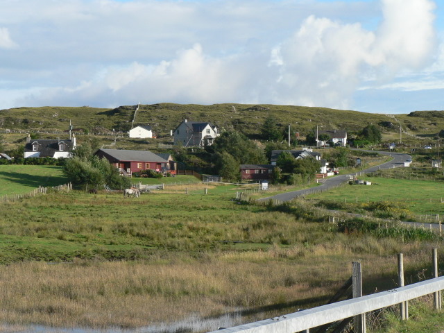
Back of Keppoch (Gaelic: Cùl na Ceapaich) is a small coastal settlement in the northwest Scottish Highlands, 40 miles (65 kilometres) west of Fort William near to the A830 road to Mallaig.[1][2]
Back of Keppoch
| |
|---|---|
 Back of Keppoch | |
 Back of Keppoch Location within the Lochaber area | |
| OS grid reference | NM654880 |
| Council area |
|
| Country | Scotland |
| Sovereign state | United Kingdom |
| Postcode district | PH39 4 |
| Police | Scotland |
| Fire | Scottish |
| Ambulance | Scottish |
The Back of Keppoch is north of Arisaig and south of Morar. Most of the houses on this road are crofts and their land is used as campsites in the summer months. A number of beaches line the road.
References
- Ordnance Survey: Landranger map sheet 40 Mallaig & Glenfinnan (Loch Shiel) (Map). Ordnance Survey. 2009. ISBN 9780319231647.
- "Ordnance Survey: 1:50,000 Scale Gazetteer" (csv (download)). www.ordnancesurvey.co.uk. Ordnance Survey. 1 January 2016. Retrieved 30 January 2016.
This Highland location article is a stub. You can help Wikipedia by expanding it. |
Текст в блоке "Читать" взят с сайта "Википедия" и доступен по лицензии Creative Commons Attribution-ShareAlike; в отдельных случаях могут действовать дополнительные условия.
Другой контент может иметь иную лицензию. Перед использованием материалов сайта WikiSort.org внимательно изучите правила лицензирования конкретных элементов наполнения сайта.
Другой контент может иметь иную лицензию. Перед использованием материалов сайта WikiSort.org внимательно изучите правила лицензирования конкретных элементов наполнения сайта.
2019-2026
WikiSort.org - проект по пересортировке и дополнению контента Википедии
WikiSort.org - проект по пересортировке и дополнению контента Википедии