world.wikisort.org - Thailand
Si Thep (Thai: ศรีเทพ, pronounced [sǐː tʰêːp]) is the southernmost district (amphoe) of Phetchabun province, Thailand, in the valley of the Pa Sak River. Si Thep, now on a tentative list of UN World Heritage Sites, is Thailand's largest ancient city.[1]
Si Thep
ศรีเทพ | |
|---|---|
District | |
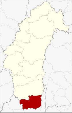 District location in Phetchabun province | |
| Coordinates: 15°27′12″N 101°4′2″E | |
| Country | Thailand |
| Province | Phetchabun |
| Seat | Khok Sa-at |
| Area | |
| • Total | 810.0 km2 (312.7 sq mi) |
| Population (2000) | |
| • Total | 63,300 |
| • Density | 78.1/km2 (202/sq mi) |
| Time zone | UTC+7 (ICT) |
| Postal code | 67170 |
| Geocode | 6706 |
History
![Khao Khlang Nok, was an ancient Dvaravati-style stupa, dated back around 8th-9th century CE, at present, it is large laterite base.[2]](http://upload.wikimedia.org/wikipedia/commons/5/57/Khao_Khlang_Nak-004.jpg)
The district was created on 13 December 1970 as a minor district (king amphoe) with territory from Wichian Buri district. It was upgraded to Si Thep District on 8 August 1976.[3]
The ancient city of Si Thep was built in the Dvaravati era.[4] Prince Damrong found the area of the old city in 1905 when he visited Monthon Phetchabun. It is now Si Thep Historical Park.
Geography
Si Thep is on a dry highland surrounded by waterways and floodplains bordered by mountains on both sides. To ensure sufficient water for city use, ancient Si Thep had an elaborate system of ponds, tank moats, and a hydraulic system to bring water from higher grounds to sustain the city.[1]
Neighboring districts are (from the north clockwise) Wichian Buri of Phetchabun Province, and Lam Sonthi, Chai Badan, and Khok Charoen of Lopburi province.
Administration
The district is divided into seven sub-districts (tambons), which are further subdivided into 93 villages (mubans). The township (thesaban tambon) Sawang Watthana covers parts of tambon Sa Kruat. There are seven tambon administrative organizations (TAO).
|
References
- Ekachai, Sanitsuda (28 September 2019). "Opening minds with an ancient 'mandala'". Bangkok Post. Retrieved 28 September 2019.
- "Virtual Si Thep Historical Park". Retrieved March 11, 2021.
- amphoe.com
- "Ancient Thailand, under threat". March 7, 2019. Retrieved March 11, 2021.
External links
This Phetchabun Province location article is a stub. You can help Wikipedia by expanding it. |
На других языках
[de] Amphoe Si Thep
Amphoe Si Thep (Thai: อำเภอ ศรีเทพ; wird auch Sri Thep oder Sithep geschrieben); ist ein Landkreis (Amphoe – Verwaltungs-Distrikt) der Provinz Phetchabun. Die Provinz Phetchabun liegt im südöstlichen Teil der Nordregion von Thailand.- [en] Si Thep district
Другой контент может иметь иную лицензию. Перед использованием материалов сайта WikiSort.org внимательно изучите правила лицензирования конкретных элементов наполнения сайта.
WikiSort.org - проект по пересортировке и дополнению контента Википедии