world.wikisort.org - Thailand
Sai Thong Watthana (Thai: ทรายทองวัฒนา, pronounced [sāːj tʰɔ̄ːŋ wát.tʰā.nāː]) is a district (amphoe) of Kamphaeng Phet province, central Thailand.
Sai Thong Watthana
ทรายทองวัฒนา | |
|---|---|
District | |
 Sai Thong Watthana District office | |
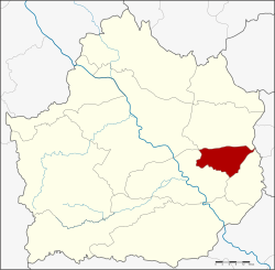 District location in Kamphaeng Phet province | |
| Coordinates: 16°18′44″N 99°49′52″E | |
| Country | Thailand |
| Province | Kamphaeng Phet |
| Seat | Thung Sai |
| Area | |
| • Total | 253.0 km2 (97.7 sq mi) |
| Population (2005) | |
| • Total | 23,971 |
| • Density | 94.7/km2 (245/sq mi) |
| Time zone | UTC+7 (ICT) |
| Postal code | 62190 |
| Geocode | 6208 |
Geography
Neighbouring districts are (from the south clockwise): Bueng Samakkhi, Khlong Khlung, and Sai Ngam of Kamphaeng Phet Province; and Sam Ngam of Phichit province.
History
The minor district (king amphoe) was established on 1 April 1992 by splitting off three tambons from Khlong Khlung district.[1] Originally named Thung Sai after the central tambon, it was renamed Sai Thong Watthana in 1995.[2] It was upgraded to a full district on 11 October 1997.[3]
Administration
Central administration
The district Sai Thong Watthana is subdivided into 3 subdistricts (Tambon), which are further subdivided into 38 administrative villages (Muban).
| No. | Name | Thai | Villages | Pop.[4] |
|---|---|---|---|---|
| 1. | Thung Sai | ทุ่งทราย | 17 | 9,509 |
| 2. | Thung Thong | ทุ่งทอง | 11 | 7,268 |
| 3. | Thawon Watthana | ถาวรวัฒนา | 10 | 6,632 |
Local administration
There is one subdistrict municipality (Thesaban Tambon) in the district:
- Thung Sai (Thai: เทศบาลตำบลทุ่งทราย) consisting of the complete subdistrict Thung Sai.
There are 2 subdistrict administrative organizations (SAO) in the district:
- Thung Thong (Thai: องค์การบริหารส่วนตำบลทุ่งทอง) consisting of the complete subdistrict Thung Thong.
- Thawon Watthana (Thai: องค์การบริหารส่วนตำบลถาวรวัฒนา) consisting of the complete subdistrict Thawon Watthana.
References
- ประกาศกระทรวงมหาดไทย เรื่อง แบ่งเขตท้องที่อำเภอคลองขลุง จังหวัดกำแพงเพชร ตั้งเป็นกิ่งอำเภอทุ่งทราย (PDF). Royal Gazette (in Thai). 109 (53 ง special): 3. April 22, 1992.
- ประกาศกระทรวงมหาดไทย เรื่อง เปลี่ยนแปลงชื่อกิ่งอำเภอทุ่งทราย อำเภอคลองขลุง จังหวัดกำแพงเพชร (PDF). Royal Gazette (in Thai). 113 (19 ง): 4. March 5, 1996.
- พระราชกฤษฎีกาตั้งอำเภอหนองปรือ อำเภอห้วยกระเจา อำเภอทรายทองวัฒนา อำเภอปางศิลาทอง อำเภอเนินสง่า อำเภอนาทม อำเภอพระพรหม อำเภอแม่วงก์ อำเภอสองแคว อำเภอบ้านใหม่ไชยพจน์ อำเภอไทยเจริญ อำเภอกาบัง อำเภอพยุห์ อำเภอเมืองจันทร์ อำเภอภูพาน อำเภอคลองหอยโข่ง อำเภอเขาฉกรรจ์ อำเภอนาวัง อำเภอพิบูลย์รักษ์ และอำเภอทุ่งศรีอุดม พ.ศ. ๒๕๔๐ (PDF). Royal Gazette (in Thai). 114 (50 ก): 24–27. September 26, 1997.
- "Population statistics 2019" (in Thai). Department of Provincial Administration. Retrieved 2020-11-30.
External links
This Kamphaeng Phet Province location article is a stub. You can help Wikipedia by expanding it. |
На других языках
[de] Amphoe Sai Thong Watthana
Amphoe Sai Thong Watthana (Thai: อำเภอ ทรายทองวัฒนา) ist ein Landkreis (Amphoe – Verwaltungs-Distrikt) im Osten der Provinz Kamphaeng Phet. Die Provinz Kamphaeng Phet liegt in der Nordregion von Thailand.- [en] Sai Thong Watthana district
Другой контент может иметь иную лицензию. Перед использованием материалов сайта WikiSort.org внимательно изучите правила лицензирования конкретных элементов наполнения сайта.
WikiSort.org - проект по пересортировке и дополнению контента Википедии