world.wikisort.org - Thailand
Sam Ngam (Thai: สามง่าม, pronounced [sǎːm ŋâːm]) is a district (amphoe) in the northwestern part of Phichit province, central Thailand.
Sam Ngam
สามง่าม | |
|---|---|
District | |
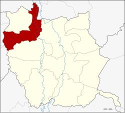 District location in Phichit province | |
| Coordinates: 16°30′32″N 100°12′17″E | |
| Country | Thailand |
| Province | Phichit |
| Seat | Sam Ngam |
| Tambon | 5 |
| Muban | 80 |
| Area | |
| • Total | 338.08 km2 (130.53 sq mi) |
| Population (2015) | |
| • Total | 42,775 |
| • Density | 130.4/km2 (338/sq mi) |
| Time zone | UTC+7 (ICT) |
| Postal code | 66140 |
| Geocode | 6607 |
History
Originally Sam Ngam was a tambon of Tha Luang district. On 1 March 1939 the government separated Tambons Sam Ngam, Rang Nok, Wang Chik, Phai Rop, Ban Na, and Noen Po from Mueang Phichit District, Kamphaeng Din and Hat Kruat from Bang Krathum district, Phitsanulok province to establish the new district, Sam Ngam.[1] Later in 1943 Tambon Wang Chik and Phai Rop were assigned to Pho Prathap Chang District.
Geography
Neighboring districts are (from the east clockwise) Mueang Phichit, Pho Prathap Chang of Phichit Province, Bueng Samakkhi, Sai Thong Watthana, Sai Ngam of Kamphaeng Phet province, Wachirabarami of Phichit Province, Bang Rakam and Bang Krathum of Phitsanulok province.
Administration
Central administration
Sam Ngam is divided into five sub-districts (tambons), which are further subdivided into 80 administrative villages (mubans).
| No. | Name | Thai | Villages | Pop.[2] |
|---|---|---|---|---|
| 1. | Sam Ngam | สามง่าม | 16 | 9,334 |
| 2. | Kamphaeng Din | กำแพงดิน | 12 | 5,826 |
| 3. | Rang Nok | รังนก | 12 | 6,113 |
| 6. | Noen Po | เนินปอ | 20 | 9,078 |
| 7. | Nong Sano | หนองโสน | 20 | 12,424 |
Missing numbers are districts which now form Wachirabarami District.
Local administration
There are three sub-district municipalities (thesaban tambons) in the district:
- Kamphaeng Din (Thai: เทศบาลตำบลกำแพงดิน) consisting of parts of sub-district Kamphaeng Din.
- Sam Ngam (Thai: เทศบาลตำบลสามง่าม) consisting of parts of sub-district Sam Ngam.
- Noen Po (Thai: เทศบาลตำบลเนินปอ) consisting of sub-district Noen Po.
There are four sub-district administrative organizations (SAO) in the district:
- Sam Ngam (Thai: องค์การบริหารส่วนตำบลสามง่าม) consisting of parts of sub-district Sam Ngam.
- Kamphaeng Din (Thai: องค์การบริหารส่วนตำบลกำแพงดิน) consisting of parts of sub-district Kamphaeng Din.
- Rang Nok (Thai: องค์การบริหารส่วนตำบลรังนก) consisting of sub-district Rang Nok.
- Nong Sano (Thai: องค์การบริหารส่วนตำบลหนองโสน) consisting of sub-district Nong Sano.
References
- ประกาศสำนักนายกรัฐมนตรี เรื่อง ตั้งอำเภอสามง่าม จังหวัดพิจิตร (PDF). Royal Gazette (in Thai). 55 (ง): 4073. February 27, 1939.
- "Population statistics 2015" (in Thai). Department of Provincial Administration. Retrieved 2016-03-03.
External links
This Phichit Province location article is a stub. You can help Wikipedia by expanding it. |
Другой контент может иметь иную лицензию. Перед использованием материалов сайта WikiSort.org внимательно изучите правила лицензирования конкретных элементов наполнения сайта.
WikiSort.org - проект по пересортировке и дополнению контента Википедии