world.wikisort.org - Thailand
Na Haeo (Thai: นาแห้ว; IPA: [nāː hɛ̂w]) is the westernmost district (amphoe) of Loei province, northeastern Thailand.
Na Haeo
นาแห้ว | |
|---|---|
District | |
 | |
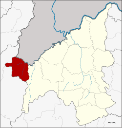 District location in Loei province | |
| Coordinates: 17°29′6″N 101°4′12″E | |
| Country | Thailand |
| Province | Loei |
| Seat | Na Haeo |
| Area | |
| • Total | 628.0 km2 (242.5 sq mi) |
| Population (2005) | |
| • Total | 11,011 |
| • Density | 17.5/km2 (45/sq mi) |
| Time zone | UTC+7 (ICT) |
| Postal code | 42170 |
| Geocode | 4206 |
History
Na Haeo area was the rural part of Dan Sai district. For people in Na Haeo it was inconvenient due to the distance involved. The government split off the two tambons Na Haeo and Na Phueng from Dan Sai District and created a minor district (king amphoe) on 15 February 1970.[1] It was upgraded to a full district on 8 September 1976.[2]
Geography
Neighboring districts are (from the east clockwise): Dan Sai of Loei Province, Nakhon Thai and Chat Trakan of Phitsanulok province. To the north is Xaignabouli province of Laos.
The important water resource is the Hueang River.
Phu Suan Sai National Park is in this district.[3]
The northern part of the district reaches the southern end of the Luang Prabang Range mountain area of the Thai highlands.[4]
Administration
The district is divided into five subdistricts (tambons), which are further subdivided into 34 villages (mubans). Na Haeo is a township (thesaban tambon) which covers parts of tambon Na Haeo. There are a further four tambon administrative organizations (TAO).
| No. | Name | Thai name | Villages | Pop. | |
|---|---|---|---|---|---|
| 1. | Na Haeo | นาแห้ว | 7 | 2,020 | |
| 2. | Saeng Pha | แสงภา | 6 | 1,782 | |
| 3. | Na Phueng | นาพึง | 8 | 2,123 | |
| 4. | Na Ma La | นามาลา | 8 | 2,920 | |
| 5. | Lao Ko Hok | เหล่ากอหก | 5 | 2,166 |
References
- ประกาศกระทรวงมหาดไทย เรื่อง แบ่งท้องที่ตั้งเป็นกิ่งอำเภอ (PDF). Royal Gazette (in Thai). 87 (17 ง): 854. March 3, 1970.
- พระราชกฤษฎีกาตั้งอำเภอเลาขวัญ อำเภอคำม่วง อำเภอพิปูน อำเภอศรีเทพ อำเภอนาแห้ว อำเภอส่องดาว อำเภอควนกาหลง อำเภอค่ายบางระจัน อำเภอบ้านตาขุน และอำเภอกุดจับ พ.ศ. ๒๕๑๙ (PDF). Royal Gazette (in Thai). 93 (109 ก special): 31–34. September 8, 1976.
- "Phu Suan Sai National Park". Department of National Parks (DNP) Thailand. Archived from the original on 26 March 2016. Retrieved 2 October 2015.
- ดร.กระมล ทองธรรมชาติ และคณะ, สังคมศึกษา ศาสนาและวัฒนธรรม ม.1, สำนักพิมพ์ อักษรเจริญทัศน์ อจท. จำกัด, 2548, หน้า 24-25
External links
This Loei Province location article is a stub. You can help Wikipedia by expanding it. |
Другой контент может иметь иную лицензию. Перед использованием материалов сайта WikiSort.org внимательно изучите правила лицензирования конкретных элементов наполнения сайта.
WikiSort.org - проект по пересортировке и дополнению контента Википедии