world.wikisort.org - Thailand
Pha Khao (Thai: ผาขาว; IPA: [pʰǎː kʰǎːw]) is a district (amphoe) of Loei Province, northeastern Thailand.
Pha Khao
ผาขาว | |
|---|---|
District | |
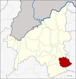 District location in Loei Province | |
| Coordinates: 17°4′0″N 102°1′36″E | |
| Country | Thailand |
| Province | Loei |
| Seat | Non Po Daeng |
| Area | |
| • Total | 463.0 km2 (178.8 sq mi) |
| Population (2005) | |
| • Total | 40,047 |
| • Density | 86.5/km2 (224/sq mi) |
| Time zone | UTC+7 (ICT) |
| Postal code | 42240 |
| Geocode | 4212 |
Geography
Neighboring districts are (from the south clockwise): Phu Kradueng, Nong Hin, Wang Saphung, and Erawan of Loei Province; and Si Bun Rueang of Nong Bua Lamphu Province.
History
The minor district (king amphoe) was established on 1 January 1988, when the four tambons, Pha Khao, Tha Chang Khlong, Non Po Daeng, and Non Pa Sang, were split off from Phu Kradueng.[1] It was upgraded to a full district on 3 November 1993.[2]
Administration
The district is divided into five sub-districts (tambons), which are further subdivided into 64 villages (mubans). There are no municipal (thesaban) areas. There are five tambon administrative organizations (TAO).
| No. | Name | Thai name | Villages | Pop. | |
|---|---|---|---|---|---|
| 1. | Pha Khao | ผาขาว | 12 | 6,405 | |
| 2. | Tha Chang Khlong | ท่าช้างคล้อง | 14 | 10,458 | |
| 3. | Non Po Daeng | โนนปอแดง | 16 | 10,365 | |
| 4. | Non Pa Sang | โนนป่าซาง | 13 | 7,445 | |
| 5. | Ban Phoem | บ้านเพิ่ม | 9 | 5,374 |
References
- ประกาศกระทรวงมหาดไทย เรื่อง แบ่งเขตท้องที่อำเภอภูกระดึง จังหวัดเลย ตั้งเป็นกิ่งอำเภอผาขาว (PDF). Royal Gazette (in Thai). 105 (5 ง): 109. 7 January 1988.
- พระราชกฤษฎีกาตั้งอำเภอลำทับ อำเภอร่องคำ อำเภอเวียงแหง อำเภอนาโยง อำเภอแก้งสนามนาง อำเภอโนนแดง อำเภอบ้านหลวง อำเภอกะพ้อ อำเภอศรีบรรพต อำเภอแก่งกระจาน อำเภอหนองสูง อำเภอสบเมย อำเภอเมยวดี อำเภอโคกเจริญ อำเภอทุ่งหัวช้าง อำเภอผาขาว อำเภอวังหิน อำเภอดอนพุด อำเภอบึงโขงหลง และอำเภอห้วยคต พ.ศ. ๒๕๓๖ (PDF). Royal Gazette (in Thai). 110 (179 ก special): 1–3. 3 November 1993.
External links
This Loei Province location article is a stub. You can help Wikipedia by expanding it. |
Другой контент может иметь иную лицензию. Перед использованием материалов сайта WikiSort.org внимательно изучите правила лицензирования конкретных элементов наполнения сайта.
WikiSort.org - проект по пересортировке и дополнению контента Википедии