world.wikisort.org - Thailand
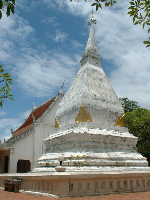
Dan Sai (Thai: ด่านซ้าย; IPA: [dàːn sáːj]) is a district (amphoe) in the western part of Loei province, northeastern Thailand.
Dan Sai
ด่านซ้าย | |
|---|---|
District | |
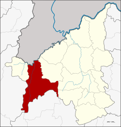 District location in Loei province | |
| Coordinates: 17°16′48″N 101°8′48″E | |
| Country | Thailand |
| Province | Loei |
| Seat | Dan Sai |
| Subdistricts | 10 |
| Mubans | 99 |
| Area | |
| • Total | 1,732.0 km2 (668.7 sq mi) |
| Population (2015) | |
| • Total | 51,564 |
| • Density | 28.4/km2 (74/sq mi) |
| Time zone | UTC+7 (ICT) |
| Postal code | 42120 |
| Geocode | 4205 |
Geography
Neighboring districts are (from the east clockwise): Phu Ruea of Loei Province; Lom Kao and Khao Kho of Phetchabun province; Nakhon Thai of Phitsanulok province; and Na Haeo of Loei. To the north is Xaignabouli province of Laos.
The source of the Pa Sak River is in the mountains in the eastern part of the district. A large part of the district is a portion of the Phu Hin Rong Kla National Park. Phu Thap Buek, the highest mountain of the Phetchabun Range, is at the southern end of the district.[1] To the southeast is the Phu Luang Wildlife Sanctuary.
The northern part of the district reaches the southern end of the Luang Prabang Range mountain area of the Thai highlands.[2]
History
According to General Apirat Kongsompong, on 5 November 1976, King Rama X, then an army captain and crown prince, engaged with communist insurgents in Ban Mak Kheng of Dan Sai District. The general noted that, "His Majesty was in the operation base, ate and slept like other soldiers. His Majesty visited local residents, gave moral support and fought shoulder by shoulder with brave soldiers."[3]
Administration

Central administration
Dan Sai is divided into 10 sub-districts (tambons), which are further subdivided into 99 administrative villages (mubans).
| No. | Name | Thai | Villages | Pop.[4] |
|---|---|---|---|---|
| 1. | Dan Sai | ด่านซ้าย | 15 | 9,490 |
| 2. | Pak Man | ปากหมัน | 7 | 3,034 |
| 3. | Na Di | นาดี | 9 | 3,810 |
| 4. | Khok Ngam | โคกงาม | 7 | 4,854 |
| 5. | Phon Sung | โพนสูง | 9 | 5,026 |
| 6. | Ipum | อิปุ่ม | 13 | 4,723 |
| 7. | Kok Sathon | กกสะทอน | 12 | 7,854 |
| 8. | Pong | โป่ง | 11 | 6,092 |
| 9. | Wang Yao | วังยาว | 7 | 3,686 |
| 10. | Na Ho | นาหอ | 9 | 2,995 |
Local administration
There are two sub-district municipalities (thesaban tambons) in the district:
- Dan Sai (Thai: เทศบาลตำบลด่านซ้าย) consisting of parts of sub-district Dan Sai.
- Si Song Rak (Thai: เทศบาลตำบลศรีสองรัก) consisting of parts of sub-district Dan Sai.
There are nine sub-district administrative organizations (SAO) in the district:
- Pak Man (Thai: องค์การบริหารส่วนตำบลปากหมัน) consisting of sub-district Pak Man.
- Na Di (Thai: องค์การบริหารส่วนตำบลนาดี) consisting of sub-district Na Di.
- Khok Ngam (Thai: องค์การบริหารส่วนตำบลโคกงาม) consisting of sub-district Khok Ngam.
- Phon Sung (Thai: องค์การบริหารส่วนตำบลโพนสูง) consisting of sub-district Phon Sung.
- Ipum (Thai: องค์การบริหารส่วนตำบลอิปุ่ม) consisting of sub-district Ipum.
- Kok Sathon (Thai: องค์การบริหารส่วนตำบลกกสะทอน) consisting of sub-district Kok Sathon.
- Pong (Thai: องค์การบริหารส่วนตำบลโป่ง) consisting of sub-district Pong.
- Wang Yao (Thai: องค์การบริหารส่วนตำบลวังยาว) consisting of sub-district Wang Yao.
- Na Ho (Thai: องค์การบริหารส่วนตำบลนาหอ) consisting of sub-district Na Ho.
References
- Phu Thap Buek - Cabbage farms
- ดร.กระมล ทองธรรมชาติ และคณะ, สังคมศึกษา ศาสนาและวัฒนธรรม ม.1, สำนักพิมพ์ อักษรเจริญทัศน์ อจท. จำกัด, 2548, หน้า 24-25
- Nanuam, Wassana (11 October 2019). "Army chief: Monarchy, military, people inseparable". Bangkok Post. Reuters. Retrieved 12 October 2019.
- "Population statistics 2015" (in Thai). Department of Provincial Administration. Retrieved 2016-06-09.
External links
- amphoe.com (Thai)
This Loei Province location article is a stub. You can help Wikipedia by expanding it. |
На других языках
[de] Amphoe Dan Sai
Amphoe Dan Sai (Thai: อำเภอ ด่านซ้าย, Aussprache: .mw-parser-output .IPA a{text-decoration:none}ʔāmpʰɤ̄ː dàːn sáːj) ist ein Landkreis (Amphoe – Verwaltungs-Distrikt) im Westen der Provinz Loei. Die Provinz Loei liegt im nordwestlichen Teil der Nordostregion von Thailand, dem so genannten Isan.- [en] Dan Sai district
Другой контент может иметь иную лицензию. Перед использованием материалов сайта WikiSort.org внимательно изучите правила лицензирования конкретных элементов наполнения сайта.
WikiSort.org - проект по пересортировке и дополнению контента Википедии