world.wikisort.org - Thailand
Khlung (Thai: ขลุง, pronounced [kʰlǔŋ]) is the southernmost district (amphoe) of Chanthaburi province, eastern Thailand.
This article does not cite any sources. (July 2017) |
Khlung
ขลุง | |
|---|---|
District | |
 Waterfall, Namtok Phlio National Park | |
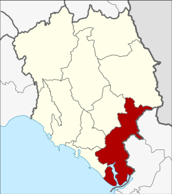 District location in Chanthaburi province | |
| Coordinates: 12°27′17″N 102°13′17″E | |
| Country | Thailand |
| Province | Chanthaburi |
| Seat | Khlung |
| Area | |
| • Total | 756.038 km2 (291.908 sq mi) |
| Population (2005) | |
| • Total | 55,044 |
| • Density | 72.8/km2 (189/sq mi) |
| Time zone | UTC+7 (ICT) |
| Postal code | 22110 |
| Geocode | 2202 |
Geography
Neighboring districts are (from the northwest clockwise) Laem Sing, Mueang Chanthaburi, Makham, Pong Nam Ron of Chanthaburi Province, Bo Rai, Khao Saming, and Laem Ngop of Trat province. To the southeast is the Gulf of Thailand.
Administration
The district is divided into 12 sub-districts (tambons), which are further subdivided into 90 villages (mubans). Khlung is a town (thesaban mueang) which covers tambon Khlung. There are a further 11 tambon administrative organizations (TAO).
| No. | Name | Thai name | Villages | Pop. | |
|---|---|---|---|---|---|
| 1. | Khlung | ขลุง | - | 11,259 | |
| 2. | Bo | บ่อ | 10 | 6,715 | |
| 3. | Kwian Hak | เกวียนหัก | 10 | 4,400 | |
| 4. | Tapon | ตะปอน | 6 | 3,274 | |
| 5. | Bang Chan | บางชัน | 6 | 3,735 | |
| 6. | Wan Yao | วันยาว | 8 | 5,346 | |
| 7. | Sueng | ซึ้ง | 11 | 4,830 | |
| 8. | Map Phai | มาบไพ | 6 | 2,350 | |
| 9. | Wang Sappharot | วังสรรพรส | 9 | 2,859 | |
| 10. | Trok Nong | ตรอกนอง | 6 | 2,358 | |
| 11. | Tok Phrom | ตกพรม | 11 | 3,844 | |
| 12. | Bo Wen | บ่อเวฬุ | 7 | 4,074 |
External links
This Chanthaburi Province location article is a stub. You can help Wikipedia by expanding it. |
Текст в блоке "Читать" взят с сайта "Википедия" и доступен по лицензии Creative Commons Attribution-ShareAlike; в отдельных случаях могут действовать дополнительные условия.
Другой контент может иметь иную лицензию. Перед использованием материалов сайта WikiSort.org внимательно изучите правила лицензирования конкретных элементов наполнения сайта.
Другой контент может иметь иную лицензию. Перед использованием материалов сайта WikiSort.org внимательно изучите правила лицензирования конкретных элементов наполнения сайта.
2019-2026
WikiSort.org - проект по пересортировке и дополнению контента Википедии
WikiSort.org - проект по пересортировке и дополнению контента Википедии