world.wikisort.org - Thailand
Makham (Thai: มะขาม, pronounced [mā.kʰǎːm]) is a district (amphoe) in the centre of Chanthaburi province, eastern Thailand.
Makham
มะขาม | |
|---|---|
District | |
 Ban Wang Dab, a village in Ang Khiri sub-district | |
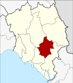 District location in Chanthaburi province | |
| Coordinates: 12°40′25″N 102°11′48″E | |
| Country | Thailand |
| Province | Chanthaburi |
| Area | |
| • Total | 480.1 km2 (185.4 sq mi) |
| Population (2005) | |
| • Total | 29,479 |
| • Density | 61.4/km2 (159/sq mi) |
| Time zone | UTC+7 (ICT) |
| Postal code | 22150 |
| Geocode | 2205 |
History
The district was established in 1899, then named Tha Luang District. It dates back to an ancient Khmer city, which was under Thai rule since the Ayutthaya era. In 1917, it was renamed Makham.[1]
Geography
Neighboring districts are (from the southwest clockwise) Mueang Chanthaburi, Khao Khitchakut, Pong Nam Ron, and Khlung of Chanthaburi Province.
The important water resource is the Chanthaburi River.
Administration
The district is divided into six sub-districts (tambons), which are further subdivided into 59 villages (mubans). Makham is a sub-district municipality (thesaban tambon) which covers parts of tambon Makham. There are a further six tambon administrative organizations (TAO).
| No. | Name | Thai | Villages | Pop.[2] |
|---|---|---|---|---|
| 1. | Makham | มะขาม | 10 | 7,879 |
| 2. | Tha Luang | ท่าหลวง | 8 | 2,328 |
| 3. | Patthawi | ปัถวี | 12 | 6,884 |
| 4. | Wang Saem | วังแซ้ม | 12 | 4,018 |
| 6. | Chaman | ฉมัน | 9 | 4,021 |
| 8. | Ang Khiri | อ่างคีรี | 8 | 4,916 |
Missing numbers are tambon which now form Khao Khitchakut District.
References
- ประกาศกระทรวงมหาดไทย เรื่อง เปลี่ยนชื่ออำเภอ (PDF). Royal Gazette (in Thai). 34 (ก): 40–68. 1917-04-29.
- "Population statistics 2008". Department of Provincial Administration. Archived from the original on 2012-08-19.
External links
- amphoe.com (Thai)
This Chanthaburi Province location article is a stub. You can help Wikipedia by expanding it. |
Другой контент может иметь иную лицензию. Перед использованием материалов сайта WikiSort.org внимательно изучите правила лицензирования конкретных элементов наполнения сайта.
WikiSort.org - проект по пересортировке и дополнению контента Википедии