world.wikisort.org - Thailand
Soi Dao (Thai: สอยดาว, pronounced [sɔ̌j dāːw]) is a district (amphoe) in the northern part of Chanthaburi province, eastern Thailand.
Soi Dao
สอยดาว | |
|---|---|
District | |
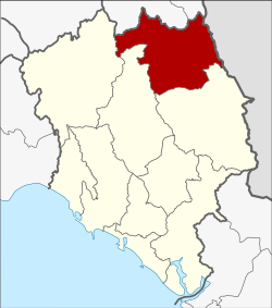 District location in Chanthaburi province | |
| Coordinates: 13°8′14″N 102°13′8″E | |
| Country | Thailand |
| Province | Chanthaburi |
| Seat | Patong |
| Area | |
| • Total | 733.8 km2 (283.3 sq mi) |
| Population (2005) | |
| • Total | 62,340 |
| • Density | 85.0/km2 (220/sq mi) |
| Time zone | UTC+7 (ICT) |
| Postal code | 22180 |
| Geocode | 2207 |
History
The government created the minor district (king amphoe) Soi Dao on 1 January 1988, by splitting off five tambon from Pong Nam Ron district.[1] It was upgraded to a full district on 9 May 1992.[2]
Geography
Neighboring districts are (from the south clockwise) Pong Nam Ron, Khao Khitchakut, Kaeng Hang Maeo of Chanthaburi Province, Wang Sombun, and Khlong Hat of Sa Kaeo province. To the east is Battambang province of Cambodia.
Administration
The district is divided into five sub-districts (tambons), which are further subdivided into 68 villages (mubans). Sai Khao is a township (thesaban tambon) which covers parts of tambon Sai Khao and Pa Tong. There are a further five tambon administrative organizations (TAO).
| No. | Name | Thai name | Villages | Pop. | |
|---|---|---|---|---|---|
| 1. | Patong | ปะตง | 11 | 14,902 | |
| 2. | Thung Khanan | ทุ่งขนาน | 16 | 10,362 | |
| 3. | Thap Chang | ทับช้าง | 16 | 15,840 | |
| 4. | Sai Khao | ทรายขาว | 13 | 12,474 | |
| 5. | Saton | สะตอน | 12 | 8,762 |
References
- ประกาศกระทรวงมหาดไทย เรื่อง แบ่งเขตท้องที่อำเภอโป่งน้ำร้อน จังหวัดจันทบุรี ตั้งเป็นกิ่งอำเภอสอยดาว (PDF). Royal Gazette (in Thai). 105 (5 ง): 105. 7 Jan 1988.
- พระราชกฤษฎีกาตั้งอำเภอสอยดาว อำเภอโพนสวรรค์ อำเภอบางขัน อำเภอหว้านใหญ่ อำเภอเมืองปาน อำเภอภูหลวง อำเภอโคกศรีสุพรรณ และอำเภอสำโรง พ.ศ. ๒๕๓๕ (PDF). Royal Gazette (in Thai). 109 (45 ก): 27–29. 9 Apr 1992.
External links
This Chanthaburi Province location article is a stub. You can help Wikipedia by expanding it. |
Другой контент может иметь иную лицензию. Перед использованием материалов сайта WikiSort.org внимательно изучите правила лицензирования конкретных элементов наполнения сайта.
WikiSort.org - проект по пересортировке и дополнению контента Википедии