world.wikisort.org - Thailand
Ban Sang (Thai: บ้านสร้าง, pronounced [bâːn sâːŋ]) is the westernmost district (amphoe) of Prachinburi province, central Thailand.[1]
Ban Sang
บ้านสร้าง | |
|---|---|
District | |
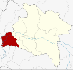 District location in Prachinburi province | |
| Coordinates: 13°59′42″N 101°13′17″E | |
| Country | Thailand |
| Province | Prachinburi |
| Area | |
| • Total | 361.2 km2 (139.5 sq mi) |
| Population (2005) | |
| • Total | 30,807 |
| • Density | 85.3/km2 (221/sq mi) |
| Time zone | UTC+7 (ICT) |
| Postal code | 25150 |
| Geocode | 2506 |
History
In the past, the area of the district was dense forest with many wild elephants. Laotians from Vientiane moved to settle their village in the area, which they named Ban Chang (lit., 'elephant village'). Later the name changed to Ban Sang. Ban Sang district was established in 1905.
Geography
Neighboring districts are (from the northwest clockwise): Ongkharak, Mueang Nakhon Nayok, and Pak Phli of Nakhon Nayok province; Mueang Prachinburi and Si Mahosot of Prachinburi Province; Ratchasan, Bang Khla, Khlong Khuean and Bang Nam Priao of Chachoengsao province.
The important water resource is the Prachinburi River.
Administration
The district is divided into nine sub-districts (tambons), which are further subdivided into 93 villages (mubans). Ban Sang itself is a township (thesaban tambon) which covers parts of tambons Ban Sang and Bang Krabao. There are a further seven tambon administrative organizations (TAO).
| No. | Name | Thai name | Villages | Pop. | |
|---|---|---|---|---|---|
| 1. | Ban Sang | บ้านสร้าง | 15 | 5,440 | |
| 2. | Bang Krabao | บางกระเบา | 10 | 3,326 | |
| 3. | Bang Toei | บางเตย | 10 | 2,772 | |
| 4. | Bang Yang | บางยาง | 13 | 3,839 | |
| 5. | Bang Taen | บางแตน | 13 | 4,296 | |
| 6. | Bang Phluang | บางพลวง | 11 | 5,800 | |
| 7. | Bang Pla Ra | บางปลาร้า | 8 | 2,268 | |
| 8. | Bang Kham | บางขาม | 6 | 1,640 | |
| 9. | Krathum Phaeo | กระทุ่มแพ้ว | 7 | 1,426 |
References
- Land Reform, Land Settlement and Cooperatives. Food and Agriculture Organization of the United Nations. 1972. p. 20. Retrieved 9 July 2018.[not specific enough to verify]
This Prachinburi Province location article is a stub. You can help Wikipedia by expanding it. |
Другой контент может иметь иную лицензию. Перед использованием материалов сайта WikiSort.org внимательно изучите правила лицензирования конкретных элементов наполнения сайта.
WikiSort.org - проект по пересортировке и дополнению контента Википедии