world.wikisort.org - Thailand
Si Mahosot (Thai: ศรีมโหสถ, pronounced [sǐː mā.hǒː.sòt]) is a district (amphoe) of Prachinburi province, eastern Thailand. It may also be spelled Sri Mahosot.
Si Mahosot
ศรีมโหสถ | |
|---|---|
District | |
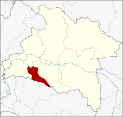 District location in Prachinburi province | |
| Coordinates: 13°52′54″N 101°24′24″E | |
| Country | Thailand |
| Province | Prachinburi |
| Seat | Khok Pip |
| Area | |
| • Total | 130.830 km2 (50.514 sq mi) |
| Population (2005) | |
| • Total | 18,137 |
| • Density | 138.6/km2 (359/sq mi) |
| Time zone | UTC+7 (ICT) |
| Postal code | 25190 |
| Geocode | 2509 |
Geography
Neighboring districts are (from the west clockwise): Ban Sang, Mueang Prachinburi and Si Maha Phot of Prachinburi Province; and Phanom Sarakham of Chachoengsao province.
History
The minor district (king amphoe) Khok Pip was established on 15 February 1970, when the three tambons, Khok Pip, Khu Lam Phan, and Phai Cha Lueat were split off from Si Maha Phot district.[1] It was upgraded to a full district on 13 April 1977,[2] and renamed Si Mahosot on 3 June 1993.[3]
Administration
The district is divided into four sub-districts (tambons), which are further subdivided into 24 villages (mubans). Khok Pip is a township (thesaban tambon) which covers parts of tambon Khok Pip. There are a further three tambon administrative organizations (TAO).
| No. | Name | Thai name | Villages | Pop. | |
|---|---|---|---|---|---|
| 1. | Khok Pip | โคกปีบ | 9 | 9,090 | |
| 2. | Khok Thai | โคกไทย | 7 | 6,000 | |
| 3. | Khu Lam Phan | คู้ลำพัน | 4 | 1,193 | |
| 4. | Phai Cha Lueat | ไผ่ชะเลือด | 4 | 1,854 |
References
- ประกาศกระทรวงมหาดไทย เรื่อง แบ่งท้องที่ตั้งเป็นอำเภอ กิ่งอำเภอโคกปีบ จังหวัดปราจีนบุรี (PDF). Royal Gazette (in Thai). 83 (14 ง): 680. February 24, 1970.
- พระราชกฤษฎีกาตั้งอำเภอปลายพระยา อำเภอห้วยเม็ก อำเภอละแม อำเภอแม่จริม อำเภอหนองกี่ อำเภอโคกปีบ อำเภอเกาะพะงัน อำเภอสนม อำเภอโซ่พิสัย อำเภอโนนสะอาด และอำเภอนาจะหลวย พ.ศ. ๒๕๒๐ (PDF). Royal Gazette (in Thai). 94 (31 ก): 326–330. April 12, 1977.
- พระราชกฤษฎีกาเปลี่ยนชื่ออำเภอโคกปีบ จังหวัดปราจีนบุรี พ.ศ. ๒๕๓๖ (PDF). Royal Gazette (in Thai). 110 (72 ก special): 3. June 2, 1993.
External links
This Prachinburi Province location article is a stub. You can help Wikipedia by expanding it. |
Другой контент может иметь иную лицензию. Перед использованием материалов сайта WikiSort.org внимательно изучите правила лицензирования конкретных элементов наполнения сайта.
WikiSort.org - проект по пересортировке и дополнению контента Википедии