world.wikisort.org - Thailand
Kabin Buri (Thai: กบินทร์บุรี, pronounced [kā.bīn bū.rīː]) is a district (amphoe) in the southeastern part of Prachinburi province, eastern Thailand.
Kabin
กบินทร์บุรี | |
|---|---|
District | |
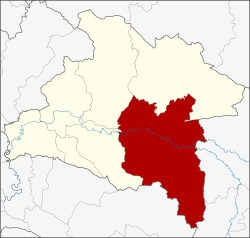 District location in Prachinburi province | |
| Coordinates: 13°56′48″N 101°42′48″E | |
| Country | Thailand |
| Province | Prachinburi |
| Area | |
| • Total | 1,309.28 km2 (505.52 sq mi) |
| Population (2005) | |
| • Total | 134,794 |
| • Density | 103.0/km2 (267/sq mi) |
| Time zone | UTC+7 (ICT) |
| Postal code | 25110 |
| Geocode | 2502 |
History
Mueang Kabin Buri was an ancient city of the Ayutthaya kingdom. The city hall was in Ban Hanuman. In 1906 the city hall was moved to Ban Paknam, the area where the Hanuman and Phra Prong Rivers join to become the Bang Pakong River. On 1 April 1926 the province was abolished and the two districts, Mueang Kabin Buri and Aranyapathret, became districts of Prachinburi Province.[1]
Geography
Neighboring districts are (from the west clockwise): Si Maha Phot, Prachantakham, Na Di of Prachinburi Province; Mueang Sa Kaeo and Khao Chakan of Sa Kaeo province; and Sanam Chai Khet of Chachoengsao province.
The important water resources are the Hanuman, Phra Prong, and Bang Pakong Rivers.
Climate
| Climate data for Kabin Buri (1981–2010) | |||||||||||||
|---|---|---|---|---|---|---|---|---|---|---|---|---|---|
| Month | Jan | Feb | Mar | Apr | May | Jun | Jul | Aug | Sep | Oct | Nov | Dec | Year |
| Record high °C (°F) | 38.2 (100.8) |
39.8 (103.6) |
40.8 (105.4) |
42.9 (109.2) |
41.7 (107.1) |
38.2 (100.8) |
36.7 (98.1) |
36.1 (97.0) |
38.0 (100.4) |
38.4 (101.1) |
37.7 (99.9) |
36.1 (97.0) |
42.9 (109.2) |
| Average high °C (°F) | 33.5 (92.3) |
35.2 (95.4) |
36.5 (97.7) |
37.0 (98.6) |
35.0 (95.0) |
33.5 (92.3) |
32.7 (90.9) |
32.4 (90.3) |
32.5 (90.5) |
32.7 (90.9) |
32.5 (90.5) |
32.0 (89.6) |
33.8 (92.8) |
| Daily mean °C (°F) | 26.3 (79.3) |
27.8 (82.0) |
29.1 (84.4) |
29.8 (85.6) |
28.9 (84.0) |
28.4 (83.1) |
27.9 (82.2) |
27.7 (81.9) |
27.7 (81.9) |
27.5 (81.5) |
26.7 (80.1) |
25.6 (78.1) |
27.8 (82.0) |
| Average low °C (°F) | 19.9 (67.8) |
21.9 (71.4) |
23.7 (74.7) |
24.9 (76.8) |
25.0 (77.0) |
24.8 (76.6) |
24.5 (76.1) |
24.4 (75.9) |
24.3 (75.7) |
23.9 (75.0) |
22.2 (72.0) |
19.8 (67.6) |
23.3 (73.9) |
| Record low °C (°F) | 11.0 (51.8) |
13.0 (55.4) |
14.5 (58.1) |
20.0 (68.0) |
20.0 (68.0) |
19.3 (66.7) |
20.5 (68.9) |
20.5 (68.9) |
19.2 (66.6) |
16.4 (61.5) |
14.5 (58.1) |
11.0 (51.8) |
11.0 (51.8) |
| Average rainfall mm (inches) | 9.0 (0.35) |
24.9 (0.98) |
51.5 (2.03) |
98.8 (3.89) |
192.3 (7.57) |
197.9 (7.79) |
241.2 (9.50) |
290.4 (11.43) |
303.3 (11.94) |
154.5 (6.08) |
29.1 (1.15) |
3.9 (0.15) |
1,596.8 (62.87) |
| Average rainy days | 0.8 | 2.1 | 4.7 | 8.6 | 17.3 | 18.4 | 20.2 | 21.6 | 20.3 | 14.6 | 4.2 | 0.8 | 133.6 |
| Average relative humidity (%) | 68 | 68 | 70 | 73 | 80 | 82 | 84 | 85 | 85 | 81 | 72 | 68 | 76 |
| Mean monthly sunshine hours | 263.5 | 211.9 | 201.5 | 204.0 | 155.0 | 114.0 | 117.8 | 58.9 | 108.0 | 145.7 | 222.0 | 260.4 | 2,062.7 |
| Mean daily sunshine hours | 8.5 | 7.5 | 6.5 | 6.8 | 5.0 | 3.8 | 3.8 | 1.9 | 3.6 | 4.7 | 7.4 | 8.4 | 5.7 |
| Source 1: Thai Meteorological Department[2] | |||||||||||||
| Source 2: Office of Water Management and Hydrology, Royal Irrigation Department (sun and humidity)[3] | |||||||||||||
Highways
 Highway 304 passes through Kabin Buri from Nonthaburi to Korat.
 Highway 33 passes through north side of Kabin Buri from Saraburi to Aranyaprathet.
- Highway 359 passes through the south side of the district connecting Highways 304 to Highway 33 and Highway 317.
Administration
The district is divided into 14 sub-districts (tambons), which are further subdivided into 192 villages (mubans). There are three townships (thesaban tambons): Kabin covers parts of tambon Kabin, Mueang Kao covers parts of tambons Mueang Kao and Kabin, and Sa Bua parts of tambon Lat Takhian. There are a further 14 tambon administrative organizations (TAO).
| No. | Name | Thai name | Villages | Pop. | |
|---|---|---|---|---|---|
| 1. | Kabin | กบินทร์ | 12 | 14,865 | |
| 2. | Mueang Kao | เมืองเก่า | 22 | 16,704 | |
| 3. | Wang Dan | วังดาล | 16 | 7,154 | |
| 4. | Nonsi | นนทรี | 16 | 7,746 | |
| 5. | Yan Ri | ย่านรี | 12 | 8,229 | |
| 6. | Wang Takhian | วังตะเคียน | 17 | 10,569 | |
| 7. | Hat Nang Kaeo | หาดนางแก้ว | 7 | 4,245 | |
| 8. | Lat Takhian | ลาดตะเคียน | 13 | 10,608 | |
| 9. | Ban Na | บ้านนา | 11 | 8,661 | |
| 10. | Bo Thong | บ่อทอง | 10 | 6,010 | |
| 11. | Nong Ki | หนองกี่ | 12 | 11,574 | |
| 12. | Na Khaem | นาแขม | 11 | 4,524 | |
| 13. | Khao Mai Kaeo | เขาไม้แก้ว | 11 | 8,481 | |
| 14. | Wang Tha Chang | วังท่าช้าง | 22 | 15,424 |
References
- ประกาศ เรื่อง ยุบจังหวัดกบินทร์บุรีลงเป็นอำเภอขึ้นจังหวัดปราจีน (PDF). Royal Gazette (in Thai). 42 (ก): 430–431. March 31, 1926.
- "Climatological Data for the Period 1981–2010". Thai Meteorological Department. p. 18. Retrieved 4 August 2016.
- "ปริมาณการใช้น้ำของพืชอ้างอิงโดยวิธีของ Penman Monteith (Reference Crop Evapotranspiration by Penman Monteith)" (PDF) (in Thai). Office of Water Management and Hydrology, Royal Irrigation Department. p. 90. Retrieved 4 August 2016.
External links
This Prachinburi Province location article is a stub. You can help Wikipedia by expanding it. |
Другой контент может иметь иную лицензию. Перед использованием материалов сайта WikiSort.org внимательно изучите правила лицензирования конкретных элементов наполнения сайта.
WikiSort.org - проект по пересортировке и дополнению контента Википедии