world.wikisort.org - Sri_Lanka
Ja-Ela (Sinhala: ජා-ඇල, Tamil: ஜா-எல) is a suburb of Colombo, located approximately 20 km (12 mi) north of the Colombo city centre. Ja-Ela lies on the A3 road which overlaps with the Colombo – Katunayake Expressway at the Ja-Ela Interchange.
This article includes a list of general references, but it lacks sufficient corresponding inline citations. (March 2016) |
Ja-Ela
ජා-ඇල ஜா-எல | |
|---|---|
Suburb | |
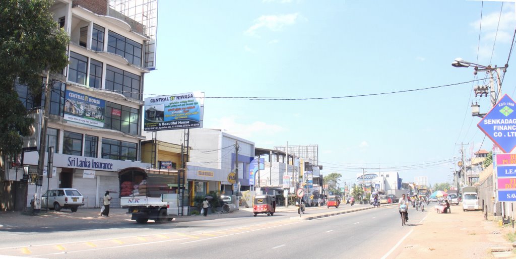 A Stretch of the Ja-Ela town through the culverts of Negombo-Colombo Road | |
 Ja-Ela | |
| Coordinates: 7°4′0″N 79°53′36″E | |
| Country | Sri Lanka |
| Province | Western Province |
| District | Gampaha District |
| Government | |
| • Urban Council | Ja-Ela Urban Council |
| • Mayor | Shammika Dias (UPFA) |
| Time zone | UTC+5:30 (SLST) |
| Postal code | 11350 |
| Area code(s) | 011 |
| Website | www |
Etymology
The etymology of the name is uncertain, and there are several yet arguable interpretations of the name. Howbeit, based on verified historical shreds of evidence, the etymology of the place, Ja Ela is based on both Malay and Sinhala languages. "Ja" and "Javan" are referential terms used by the Sinhalese, Moors & Tamils to address the Malays/Javanese or those of Indonesian descent and the term "Ela" is derived from Sinhala language meaning stream, lake or canal.[1]
Local government council
Ja-Ela is administered by the Ja-Ela Urban Council.
Economy
The economy in Ja-Ela consists of commercial enterprises, office and industrial employment.
Populations
32,175
Shopping malls
- K-Zone Ja-Ela
- Realty Plaza Ja-Ela
- Orex city shopping complex Ekala,Ja-Ela.
Movie theatres
- Cinemax 3D
- Vista Lite 3D
Demographics
Majority of the people from Ja-Ela are generally Sinhalese, along with other minority communities such as Tamils, Muslims and Burghers.
The following table summarises the population of Ja-Ela DS Area which covers both urban sectors and rural sectors, according to ethnicity (2011 Census)
| Ethnicity | Population | % of Total |
|---|---|---|
| Sinhalese | 186,085 | 92.3% |
| Sri Lankan Moors | 854 | 0.423% |
| Sri Lankan Tamils | 8,042 | 4% |
| Indian Tamils | 1,236 | 0.613% |
| Burghers | 3,453 | 1.71% |
| Bharatha | 45 | 0.02% |
| Sri Lankan Malays | 1,239 | 0.614% |
| Sri Lankan Chetty | 120 | 0.06% |
| Others | 447 | 0.22% |
| Total | 201,521 | 100% |
Source: Department of Census and Statistics, 2012[2]
Transport
This suburb is situated on the main road A3, between Colombo municipality and Negombo municipality. Ja-Ela is situated very close to the Bandaranaike International Airport. There is also a bus stand in Ja-Ela which provides access to Colombo, Negombo, Gampaha. The traffic issues at Ja-Ela have been reduced after the introduction of the Colombo – Katunayake Expressway, which serves an interchange at Ja-Ela.
Railway
The Ja-Ela railway station is located on the Puttalam line and was opened in 1908. It is the fourth station on the line and is 22.15 km (13.76 mi) from Colombo Fort railway station. The station provides commuter access to the Colombo, Putlam and Chilaw areas. Not only the station is in the heart of the Ja- Ela town and also it is the nearest station to the Negombo - Colombo Main road. Therefore, it known as one of the most popular stations in the area.
Schools
- Christ King College - Thudalla
- De Mazenod College - Kandana
- G. B. Senananayake national college - Ekala
- Holy Rosary Vidyalaya - Dehiyagatha
- Jayanthi Vidyalaya - Ja-Ela
- King's International College - Kapuwatta[3]
- Mary Immaculate Convent - Thudalla
- OKI International School - Hapugoda
- St. Mary's College - Ja-Ela
- St. Xavior Vidyalaya - Waewala
- St. Sebastian Maha Vidyalaya - Kandana
Geography
Climate
| Climate data for Ja-Ela, Sri Lanka | |||||||||||||
|---|---|---|---|---|---|---|---|---|---|---|---|---|---|
| Month | Jan | Feb | Mar | Apr | May | Jun | Jul | Aug | Sep | Oct | Nov | Dec | Year |
| Average high °C (°F) | 30 (86) |
31 (88) |
33 (91) |
34 (93) |
34 (93) |
32 (90) |
32 (90) |
32 (90) |
32 (90) |
31 (88) |
30 (86) |
29 (84) |
32 (90) |
| Average low °C (°F) | 22 (72) |
22 (72) |
24 (75) |
26 (79) |
26 (79) |
25 (77) |
24 (75) |
24 (75) |
24 (75) |
24 (75) |
23 (73) |
22 (72) |
24 (75) |
| Average precipitation mm (inches) | 16 (0.6) |
19 (0.7) |
22 (0.9) |
63 (2.5) |
54 (2.1) |
87 (3.4) |
130 (5.1) |
140 (5.5) |
111 (4.4) |
192 (7.6) |
141 (5.6) |
71 (2.8) |
1,046 (41.2) |
| Average precipitation days | 1 | 1 | 2 | 3 | 3 | 2 | 3 | 4 | 5 | 8 | 7 | 4 | 43 |
| Source: World Climate Guide. To check the current Weather - Visit: https://www.worldweatheronline.com/ja-ela-weather/western/lk.aspx | |||||||||||||
References
- Careem, Tuan M. Zameer.(2017). Persaudaraan (Brotherhood). Malay Life in Sri Lanka (2nd ed). Colombo: S Godage & Brothers. Print
- "Population by divisional secretariat division,sex and sector" (PDF). statistics.gov.lk. Department of Census and Statistics. Retrieved 29 June 2022.
- "King's International College". King's International. King's Care. Retrieved 16 February 2019.
Metropolitan cities of Sri Lanka | ||
|---|---|---|
| National capitals# |
| |
| Municipal councils |
| |
| Urban councils |
| |
Note: * also a Provincial capital, # also a Municipal council | ||
This Western Province, Sri Lanka location article is a stub. You can help Wikipedia by expanding it. |
Другой контент может иметь иную лицензию. Перед использованием материалов сайта WikiSort.org внимательно изучите правила лицензирования конкретных элементов наполнения сайта.
WikiSort.org - проект по пересортировке и дополнению контента Википедии