world.wikisort.org - Sri_Lanka
Bambalapitiya is a southern coastal neighbourhood of Colombo, Sri Lanka.[2]
Bambalapitiya
බම්බලපිටිය பம்பலப்பிட்டி | |
|---|---|
Suburb | |
 Railway tracks running along Marine Drive, Bambalapitiya | |
 Bambalapitiya | |
| Coordinates: 6°53′20″N 79°51′24″E | |
| Country | Sri Lanka |
| Province | Western Province |
| District | Colombo District |
| Time zone | UTC+5:30 (Sri Lanka Standard Time Zone) |
| Postal Code | 00400 [1] |
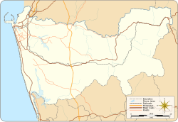
The area also known as Colombo 4, spans about 1.5 km2 (370 acres) along Galle Road. The western boundary of the suburb is the Indian Ocean and it is bordered to the east by Havelock Town, the north by Kollupitiya, and to the south by Wellawatte. It falls within the Kollupitiya (Colpetty) Ward of the Colombo Municipal Council.
Educational institutions
Bambalapitiya is regarded as an educational hub. Many private sector schools and colleges such as ICBS, ICBT Campus, IDM Computer Studies, ESOFT Computer Studies, and PIBT[3] are in this area. It is home to educational establishments including Lindsay Girls School, Muslim Ladies College, St. Peter's College, Holy Family Convent, Visakha Vidyalaya and Colombo Hindu College.
Diplomatic missions
- Honorary Consulate General of Greece
- Consulate of Singapore
- Honorary Consulate of Ireland
Transport
The A2 Highway (Galle Road) and Marine Drive, runs through the suburb, parallel to the coast.
The Bambalapitiya railway station services the area. It is the fourth station on the Coastal line.
Commercial
- Majestic City and Pearl Grand Town, the seven-storey commercial and shopping complex.
References
- "Bambalapitiya (None) – Sri Lanka Postal Codes". Mohanjith. Archived from the original on 13 September 2010. Retrieved 20 September 2010.
- Wright, Arnold, ed. (1999). Twentieth Century Impressions of Ceylon: Its History, People, Commerce, Industries, and Resources. Asian Educational Services. p. 389. ISBN 9788120613355.
- PIBT
External links
Другой контент может иметь иную лицензию. Перед использованием материалов сайта WikiSort.org внимательно изучите правила лицензирования конкретных элементов наполнения сайта.
WikiSort.org - проект по пересортировке и дополнению контента Википедии