world.wikisort.org - Spain
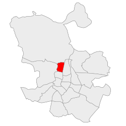
Tetuán is a district of Madrid, Spain.
Tetuán | |
|---|---|
City district | |
 | |
 | |
| Country | Spain |
| Region | Community of Madrid |
| Municipality | Madrid |
| Area | |
| • Total | 5.38 km2 (2.08 sq mi) |
| Population | 155,649 |
| • Density | 28,888/km2 (74,820/sq mi) |
| Madrid district number | 6 |
Geography
Subdivision
Featuring a total area of around 540 hectares (1,300 acres), the district is divided into 6 administrative neighborhoods (barrios): Almenara, Bellas Vistas, Berruguete, Castillejos, Cuatro Caminos and Valdeacederas.[1]

History

When Leopoldo O'Donnell returned with his forces to Spain after the 1859–60 African War, the latter camped at a spot north of Madrid known as the Campos de Amaniel (Fields of Amaniel) while a triumphal entry into the capital was being arranged. The camp, which acquired permanent structures as well as shops over time, became the Madrid neighborhood known as "Tetuán de las Victorias" (Tetouan of the Victories), after Tetouan, the North-African city where the victorious soldiers had come from.[2]
The current district also comprises part of the territory of the former municipality of Chamartín de la Rosa, annexed by the municipality of Madrid in 1948.[3]
The community is culturally diverse, with significant populations of African and South American immigrants, although Filipinos constitute the largest foreign population group in the district.[4] Filipinos form the largest immigrant group in four of the district's six neighborhoods (Bellas Vistas, Berruguete, Castillejos and Cuatro Caminos),[5] and the majority of Madrid's Filipino community lives in the district.[6]
Architecture
Some areas of Tetuán have old and modest housing, characterised by one or two storeys and a rural appearance.[1] Those areas are contrasted by the business area of AZCA (Cuatro Caminos neighborhood),[1] located in the southeastern corner of the district, and that features skycrapers such as the Torre Picasso. Many neighbors frame the contrast in terms of a dichotomy lined up along the calle de Bravo Murillo: East of the street–rich; West of the street–poor.[1]
Tetuán hosts the Madrid Central Mosque, the oldest and one of the two most important mosques in Madrid along the M-30 mosque.[7]
References
- Citations
- Sánchez, Bárbara (4 December 2014). "Las dos aceras de Tetuán". El País.
- Calvo Peña 2014, p. 13.
- "70 años de la anexión de Chamartín de la Rosa a Madrid". Diario Madrid. Ayuntamiento de Madrid. 22 October 2018.
- "Los filipinos ya son los extranjeros mayoritarios en Tetuán y los chinos en Arganzuela" [Filipinos are now the largest group of foreigners in Tetuán and the Chinese in Arganzuela] (in Spanish). Europa Press. April 10, 2016. Retrieved October 15, 2021.
- "Los chinos ya son los extranjeros mayoritarios en 19 barrios madrileños y los filipinos en 8" [The Chinese are now the largest group of foreigners in 19 Madrid neighborhoods and the Filipinos in 8]. La Vanguardia (in Spanish). April 29, 2018. Retrieved October 15, 2021.
- Viejo, Manuel (November 5, 2021). "Peregrinación de filipinos a la Puerta del Sol para comer pollo frito" [The Filipinos' pilgrimage to the Puerta del Sol to eat fried chicken]. El País (in Spanish). Retrieved January 22, 2022.
- "La Mezquita de la M-30 vuelve a abrir sus puertas a no musulmanes por Ramadán". eldiario.es. 9 June 2018.
- Bibliography
- Calvo Peña, Beatriz (2014). Tetuán. TEMPORAE. ISBN 978-84-15801-17-7.
External links
![]() Media related to Tetuán District, Madrid at Wikimedia Commons
Media related to Tetuán District, Madrid at Wikimedia Commons
Authority control | |
|---|---|
| General |
|
| National libraries | |
Другой контент может иметь иную лицензию. Перед использованием материалов сайта WikiSort.org внимательно изучите правила лицензирования конкретных элементов наполнения сайта.
WikiSort.org - проект по пересортировке и дополнению контента Википедии