world.wikisort.org - Spain
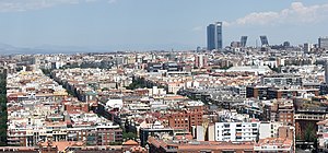
Arapiles is an administrative neighborhood (barrio) of Madrid belonging to the district of Chamberí. It has an area of 0.578534 km2 (0.223373 sq mi).[1] As of 1 February 2021, it has a population of 24,348.[2]
Arapiles | |
|---|---|
Ward of Madrid | |
 | |
 | |
| Country | Spain |
| Autonomous community | Madrid |
| Municipality | Madrid |
| District | Chamberí |
| Area | |
| • Total | 0.578534 km2 (0.223373 sq mi) |
| Population (2021) | 24,348 |
| • Density | 42,000/km2 (110,000/sq mi) |
References
- "Callejero vigente. Barrios". Ayuntamiento de Madrid. Archived from the original on 2018-09-24. Retrieved 2 March 2021.
- "Población por distrito y barrio". Ayuntamiento de Madrid. Archived from the original on 2011-01-10. Retrieved 2 March 2021.
Текст в блоке "Читать" взят с сайта "Википедия" и доступен по лицензии Creative Commons Attribution-ShareAlike; в отдельных случаях могут действовать дополнительные условия.
Другой контент может иметь иную лицензию. Перед использованием материалов сайта WikiSort.org внимательно изучите правила лицензирования конкретных элементов наполнения сайта.
Другой контент может иметь иную лицензию. Перед использованием материалов сайта WikiSort.org внимательно изучите правила лицензирования конкретных элементов наполнения сайта.
2019-2025
WikiSort.org - проект по пересортировке и дополнению контента Википедии
WikiSort.org - проект по пересортировке и дополнению контента Википедии