world.wikisort.org - Spain
La Frontera (Spanish for "the border") is a municipality in the northwestern part of the island El Hierro, Santa Cruz de Tenerife, Canary Islands, Spain. In 2007, the southern part of the territory of La Frontera was split off to form the new municipality of El Pinar.
Frontera | |
|---|---|
Municipality | |
 Flag  Coat of arms | |
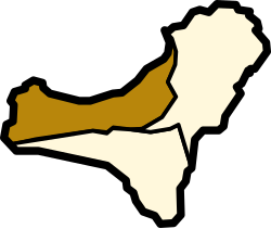 | |
 Frontera Location in the Canary Islands  Frontera Frontera (Spain, Canary Islands) | |
| Coordinates: 27°45′0″N 18°1′0″W | |
| Country | |
| Autonomous community | |
| Province | |
| Island | |
| Area | |
| • Total | 84.20 km2 (32.51 sq mi) |
| Elevation | 300 m (1,000 ft) |
| Population (2018)[2] | |
| • Total | 4,018 |
| • Density | 48/km2 (120/sq mi) |
| Postal code | E-38911 |
| Climate | BSh |
| Website | http://www.aytofrontera.org/ |
Sites of interest
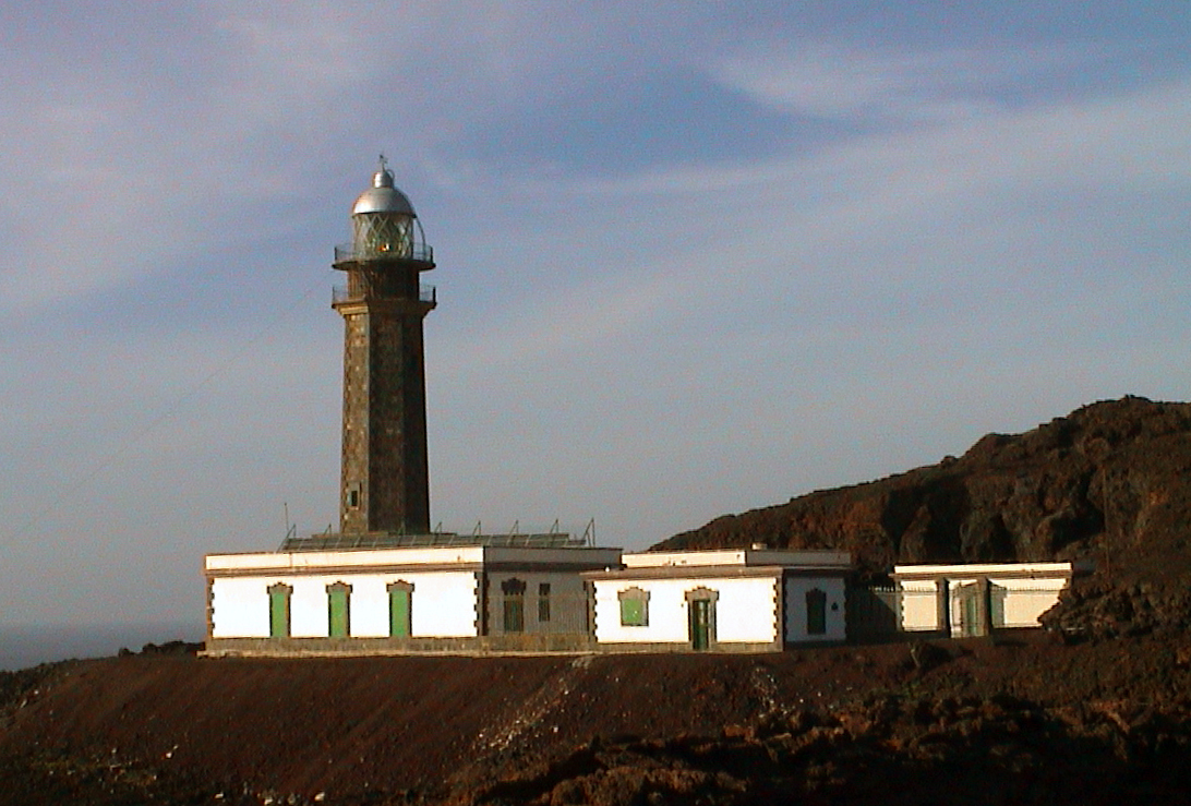
- Punta de la Orchilla – the lighthouse west of the municipality; after building taken to be the prime meridian, being the westernmost point of the known world – identified with the island at large by Ptolemy in the 2nd century AD. It was taken as one of two prime meridians by Richelieu and hence scientists and cartographers under Louis XIII of France in 1634. Many 16th and 17th century international maps noted a co- or nominal only prime meridian here, among other contenders such as Rome or Paris. In 1884 the International Meridian Conference agreed to use the meridian of the Greenwich Royal Observatory as the standard prime meridian, which institution had carried out major work on the studies of longitude. Between these years the island bore an alternate name equally used, Isla del Meridiano (Meridian Island).
- La Dehesa - the hermitage of the Virgen de los Reyes, patron saint of the island whose feast day is 24 September, the statue of which is celebrated in a procession across every settlement of the island every four years on the first Saturday of July, examples being 2001, 2021 etc.
Historical population


| Year | Population |
|---|---|
| 1991 | 3,612 |
| 1996 | 4,409 |
| 2001 | 4,455 |
| 2002 | 5,359 |
| 2003 | 5,435 |
| 2004 | 5,231 |
| 2013 | 4,058 |
See also
- List of municipalities in Santa Cruz de Tenerife
- Pico de Malpaso
References
- "SUPERFICIE, PERÍMETRO Y ALTITUD DE LOS MUNICIPIOS DE CANARIAS" (in Spanish). Instituto Canario de Estadística (ISTAC). Archived from the original on 2012-12-04.
- Municipal Register of Spain 2018. National Statistics Institute.
External links
Wikimedia Commons has media related to La Frontera, El Hierro.
Places adjacent to La Frontera, Santa Cruz de Tenerife | ||||||||||||||||
|---|---|---|---|---|---|---|---|---|---|---|---|---|---|---|---|---|
| ||||||||||||||||
Municipalities of El Hierro | ||
|---|---|---|
| ||
Municipalities in the province of Santa Cruz de Tenerife | ||
|---|---|---|
| Tenerife |
| |
| La Palma |
| |
| La Gomera |
| |
| El Hierro |
| |
| Authority control |
|
|---|
На других языках
- [en] La Frontera, Santa Cruz de Tenerife
[es] La Frontera (Santa Cruz de Tenerife)
La Frontera es una localidad y municipio español situado en la parte occidental de la isla de El Hierro, en la provincia de Santa Cruz de Tenerife, comunidad autónoma de Canarias. A orillas del océano Atlántico, este municipio limita con los de Valverde y El Pinar de El Hierro.[ru] Фронтера (Санта-Крус-де-Тенерифе)
Фронтера (исп. La Frontera) — муниципалитет в Испании, входит в провинцию Санта-Крус-де-Тенерифе в составе автономного сообщества Канарские острова. Находится на острове Иерро. Занимает площадь 84,20 км². Население — 4124 человека (на 2010 год).Текст в блоке "Читать" взят с сайта "Википедия" и доступен по лицензии Creative Commons Attribution-ShareAlike; в отдельных случаях могут действовать дополнительные условия.
Другой контент может иметь иную лицензию. Перед использованием материалов сайта WikiSort.org внимательно изучите правила лицензирования конкретных элементов наполнения сайта.
Другой контент может иметь иную лицензию. Перед использованием материалов сайта WikiSort.org внимательно изучите правила лицензирования конкретных элементов наполнения сайта.
2019-2025
WikiSort.org - проект по пересортировке и дополнению контента Википедии
WikiSort.org - проект по пересортировке и дополнению контента Википедии