world.wikisort.org - Spain
Güímar (Spanish pronunciation: [ˈgwimaɾ]) is the name of a municipality, town and valley in the eastern part of the Spanish island of Tenerife, one of the Canary Islands, and part of Santa Cruz de Tenerife (province). The municipality extends for 102.9 square kilometers from the mountainous interior to the beaches on the Atlantic, and borders the municipalities of La Orotava, Arafo and Fasnia. Its estimated population is 18,589 (2013). The TF-1 motorway passes through the municipality.
Güímar | |
|---|---|
Municipality | |
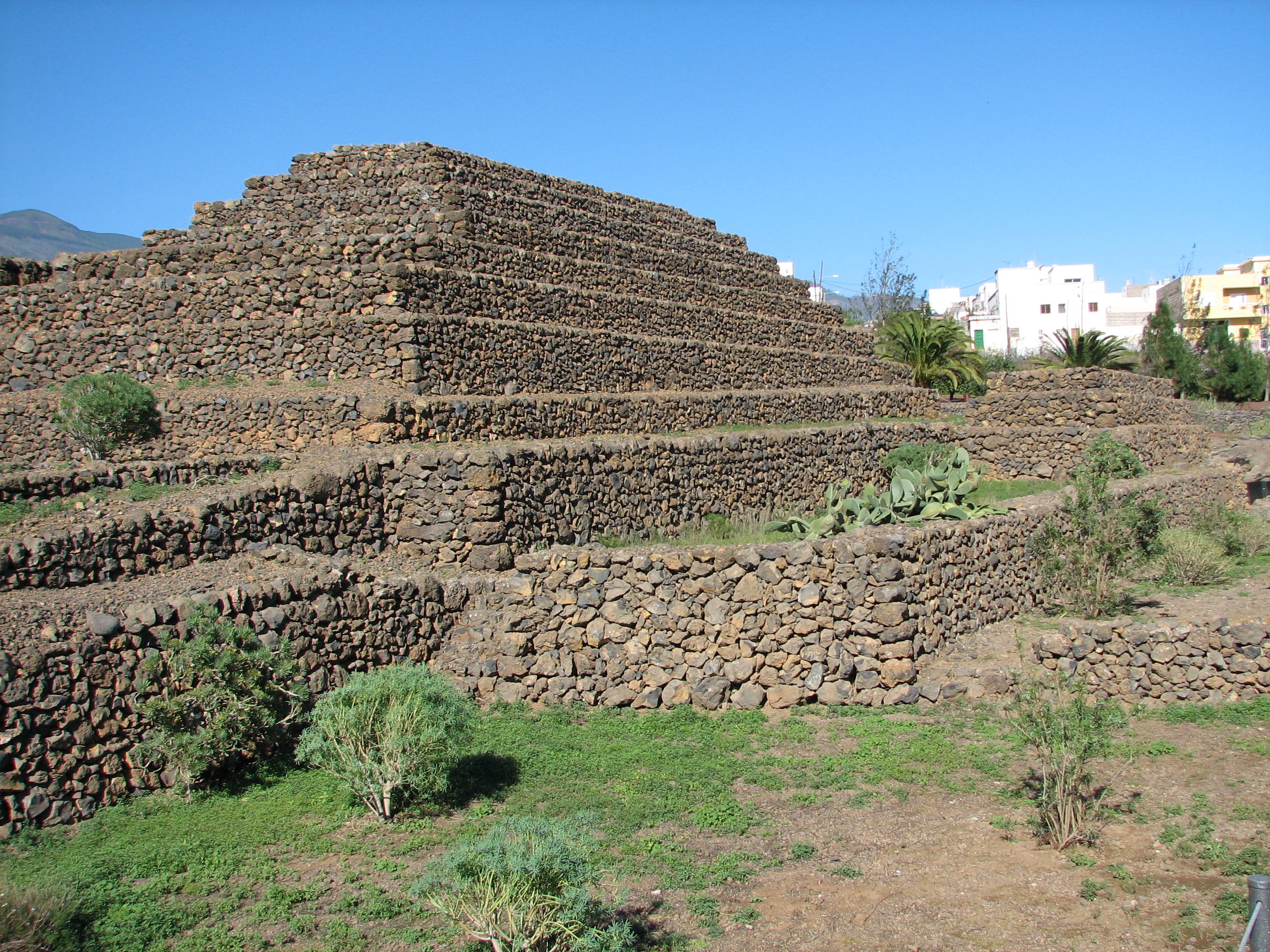 Pyramids of Güímar | |
 Flag  Coat of arms | |
 Municipal location in Tenerife | |
 Güímar Location in Tenerife  Güímar Güímar (Canary Islands)  Güímar Güímar (Spain, Canary Islands) | |
| Coordinates: 28°18′54″N 16°24′36″W | |
| Country | |
| Autonomous Community | |
| Province | Tenerife |
| Island | Tenerife |
| Government | |
| • Mayor | Carmen Luisa Castro Dorta (PP) |
| Area | |
| • Total | 102.9 km2 (39.7 sq mi) |
| Elevation (AMSL) | 289 m (948 ft) |
| Population (2018)[1] | |
| • Total | 19,739 |
| • Density | 190/km2 (500/sq mi) |
| Time zone | UTC+0 (CET) |
| • Summer (DST) | UTC+1 (CEST (GMT +1)) |
| Postal code | 38500 |
| Area code | +34 (Spain) + 922 (Tenerife) |
| Climate | BSh |
| Website | www.guimar.es |
The municipality is famous for its pyramids. It is also the location of the barranco de Badajoz. A portion of its volcanic landscape has been set aside as the Nature reserve of Malpaís of Güímar, its highest point being Montaña Grande.

Name
The name comes from Guanche and is thought to mean 'angle, corner, nook'.[2]
History
The first population centre of Güímar originated in the sixteenth century in the neighbourhood of San Juan - also called Güímar de Arriba - near the springs of the Agua and Chamoco ravines. The first buildings were linked to the sugar mill started up by the brothers Juan Felipe and Blasino Piombino or Romano.
Climate
| Climate data for Güímar (altitude: 289 metres (948 feet)) | |||||||||||||
|---|---|---|---|---|---|---|---|---|---|---|---|---|---|
| Month | Jan | Feb | Mar | Apr | May | Jun | Jul | Aug | Sep | Oct | Nov | Dec | Year |
| Average high °C (°F) | — | 18.7 (65.7) |
19.9 (67.8) |
20.7 (69.3) |
21.8 (71.2) |
23.8 (74.8) |
26.3 (79.3) |
27.5 (81.5) |
26.1 (79.0) |
24.5 (76.1) |
21.4 (70.5) |
19.5 (67.1) |
22.4 (72.3) |
| Daily mean °C (°F) | 15.4 (59.7) |
15.6 (60.1) |
16.5 (61.7) |
17.1 (62.8) |
18.1 (64.6) |
20.1 (68.2) |
22.3 (72.1) |
23.1 (73.6) |
22.5 (72.5) |
21.0 (69.8) |
18.4 (65.1) |
16.4 (61.5) |
18.9 (66.0) |
| Average low °C (°F) | 12.4 (54.3) |
12.5 (54.5) |
13.1 (55.6) |
13.5 (56.3) |
14.5 (58.1) |
16.5 (61.7) |
18.3 (64.9) |
18.8 (65.8) |
18.9 (66.0) |
17.5 (63.5) |
15.4 (59.7) |
13.4 (56.1) |
15.4 (59.7) |
| Average rainfall mm (inches) | 57 (2.2) |
45 (1.8) |
40 (1.6) |
20 (0.8) |
9 (0.4) |
4 (0.2) |
1 (0.0) |
1 (0.0) |
7 (0.3) |
37 (1.5) |
67 (2.6) |
73 (2.9) |
361 (14.3) |
| Source: Climate-Data.org[3] | |||||||||||||
References
- Municipal Register of Spain 2018. National Statistics Institute.
- Álvarez Delgado, Juan (1985). "La división de la isla de Tenerife en nueve reinos". Anuario de estudios atlánticos (31). ISSN 0570-4065.
- "Clima Güímar: Temperatura, Climograma y Tabla climática para Güímar - Climate-Data.org". es.climate-data.org.
External links
Municipalities in the province of Santa Cruz de Tenerife | ||
|---|---|---|
| Tenerife |
| |
| La Palma |
| |
| La Gomera |
| |
| El Hierro |
| |
Authority control | |
|---|---|
| General |
|
| National libraries | |
| Other |
|
На других языках
[de] Güímar
Güímar ist eine Gemeinde im Nordosten Teneriffas mit 20.190 Einwohnern (Stand 1. Januar 2019). Sie ist mit der Nachbargemeinde Santa Cruz de Tenerife über die Südautobahn TF-1 und über die alte Straße Santa Cruz de Tenerife – Adeje verbunden. Güímar liegt südwestlich von Santa Cruz de Tenerife. Nachbargemeinden sind Arafo im Norden, Fasnia im Süden und La Orotava im Westen.- [en] Güímar
[es] Güímar
Güímar es una localidad y municipio español perteneciente a la isla de Tenerife, en la provincia de Santa Cruz de Tenerife, comunidad autónoma de Canarias.[ru] Гуимар
Гуи́мар (исп. Güímar) — муниципалитет в Испании, входит в провинцию Санта-Крус-де-Тенерифе в составе автономного сообщества Канарские острова. Находится на острове Тенерифе. Занимает площадь 102,92 км². Население 17 852 человека (на 2010 год).Другой контент может иметь иную лицензию. Перед использованием материалов сайта WikiSort.org внимательно изучите правила лицензирования конкретных элементов наполнения сайта.
WikiSort.org - проект по пересортировке и дополнению контента Википедии