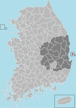
world.wikisort.org - South_Korea
Ulleung County (Korean: 울릉군, Ulleung-gun; Hanja: 鬱陵郡) is a county in North Gyeongsang Province, South Korea.
Ulleung
울릉군 | |
|---|---|
County | |
| Korean transcription(s) | |
| • Hangul | 울릉군 |
| • Hanja | 鬱陵郡 |
| • Revised Romanization | Ulleung-gun |
| • McCune-Reischauer | Ullŭng-gun |
 Flag Emblem of Ulleung | |
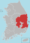
 Location in South Korea | |
| Country | South Korea |
| Region | Yeongnam |
| Administrative divisions | 1 eup, 2 myeon |
| Area | |
| • Total | 72.518 km2 (27.999 sq mi) |
| Population | |
| • Total | 10,426 |
| • Density | 143.8/km2 (372/sq mi) |
| • Dialect | Gyeongsang |
| Area code | +82-54-790~799 |
Ulleung County has a population of 10,426 making it the least populated county in South Korea. Ulleung County consists mainly of the island of Ulleungdo and 44 smaller islands located in the Sea of Japan, including the Liancourt Rocks (Dokdo) in effective governance by South Korea but claimed by Japan and North Korea). Ulleung County is administratively divided into one eup and two myeon: Ulleung-eup, Buk-myeon, and Seo-myeon, which are divided into 10 legal ri, those into 25 administrative ri, and at the most basic level the county is held to contain 56 "natural villages."[1]
History
At the year of 512, Jijeung of Silla conquered Usan-guk which was the original nation in Ulleung-do. After a downfall of Silla, Goryeo naturally took the title of Ulleung. In 930, 13th year of Taejo of Goryeo, he granted local people bringing a tribute.
Hyeonjong of Goryeo sent his ambassador to islands for recovering ruined farming land in 1012.
Location
It is located in the middle of the Sea of Japan between the Korean Peninsula and Japan. There are two main ports that provide ferries to Ulleung and Liancourt Rocks (Dokdo): Pohang Port and Mukho Port. These two ports offer regular shipping service.[2]
Administrative divisions

Ulleung-gun is divided into one eup and two myeon. Ulleung-eup is then divided into four legal ri, but six administrative ri. Buk-myeon is divided into three legal ri, eight administrative ri. Seo-myeon is divided into three legal ri, five administrative ri.
| eup and myeon | Hangeul | Hanja | ri | Hangeul | Hanja |
|---|---|---|---|---|---|
| Ulleung-eup | 울릉읍 | 鬱陵邑 | Dodong-ri
|
도동리
|
道洞里
|
| Jeodong-ri | 저동리 | 苧洞里 | |||
| Sadong-ri | 사동리 | 沙洞里 | |||
| Dokdo-ri | 독도리 | 獨島里 | |||
| Buk-myeon | 북면 | 北面 | Cheonbu-ri
|
천부리
|
天府里
|
Na-ri
|
나리
|
羅里
| |||
| Hyeonpo-ri | 현포리 | 玄圃里 | |||
| Seo-myeon | 서면 | 西面 | Namyang
|
남양리
|
南陽里
|
| Namseo-ri | 남서리 | 南西里 | |||
| Taeha-ri | 태하리 | 台霞里 |
Snowflower Festival
Ulleung County, which has one of the highest snowfalls in all of Korea, hosts the Snowflower Festival. In 2007, Ulleung had lot of snow, up to 42 cm (16.5 in) around coastlines and 105 cm (around 3 ft 5in) in the Nari Basin.[3] But the county did not host its festival before 2006 as there was not enough snow.[4]
Symbols
- Tree: Machilus thunbergii[5]
- Flower: camelliar flower
- Bird: wood pigeon
Climate
| Climate data for Ulleung (1991–2020 normals, extremes 1938–present) | |||||||||||||
|---|---|---|---|---|---|---|---|---|---|---|---|---|---|
| Month | Jan | Feb | Mar | Apr | May | Jun | Jul | Aug | Sep | Oct | Nov | Dec | Year |
| Record high °C (°F) | 14.9 (58.8) |
19.2 (66.6) |
21.8 (71.2) |
26.1 (79.0) |
30.8 (87.4) |
32.2 (90.0) |
34.6 (94.3) |
34.6 (94.3) |
32.4 (90.3) |
27.2 (81.0) |
23.2 (73.8) |
17.9 (64.2) |
34.6 (94.3) |
| Average high °C (°F) | 4.4 (39.9) |
5.6 (42.1) |
9.6 (49.3) |
15.1 (59.2) |
19.7 (67.5) |
22.5 (72.5) |
25.5 (77.9) |
26.9 (80.4) |
23.2 (73.8) |
18.8 (65.8) |
13.2 (55.8) |
7.2 (45.0) |
16.0 (60.8) |
| Daily mean °C (°F) | 1.7 (35.1) |
2.5 (36.5) |
5.8 (42.4) |
11.1 (52.0) |
15.8 (60.4) |
19.1 (66.4) |
22.7 (72.9) |
23.8 (74.8) |
20.0 (68.0) |
15.4 (59.7) |
9.9 (49.8) |
4.3 (39.7) |
12.7 (54.9) |
| Average low °C (°F) | −0.5 (31.1) |
0.0 (32.0) |
2.9 (37.2) |
7.8 (46.0) |
12.5 (54.5) |
16.5 (61.7) |
20.5 (68.9) |
21.7 (71.1) |
17.7 (63.9) |
13.0 (55.4) |
7.4 (45.3) |
1.9 (35.4) |
10.1 (50.2) |
| Record low °C (°F) | −11.6 (11.1) |
−13.6 (7.5) |
−9.9 (14.2) |
−2.7 (27.1) |
3.8 (38.8) |
7.0 (44.6) |
12.5 (54.5) |
14.7 (58.5) |
8.9 (48.0) |
0.7 (33.3) |
−5.9 (21.4) |
−9.6 (14.7) |
−13.6 (7.5) |
| Average precipitation mm (inches) | 117.4 (4.62) |
91.3 (3.59) |
76.4 (3.01) |
97.8 (3.85) |
108.5 (4.27) |
116.8 (4.60) |
175.0 (6.89) |
176.7 (6.96) |
173.6 (6.83) |
100.9 (3.97) |
116.9 (4.60) |
129.3 (5.09) |
1,480.6 (58.29) |
| Average precipitation days (≥ 0.1 mm) | 18.8 | 14.5 | 12.0 | 9.0 | 8.6 | 8.6 | 12.0 | 11.6 | 10.6 | 9.3 | 13.1 | 18.2 | 146.3 |
| Average snowy days | 17.7 | 13.2 | 7.4 | 1.0 | 0.0 | 0.0 | 0.0 | 0.0 | 0.0 | 0.1 | 3.4 | 13.1 | 55.9 |
| Average relative humidity (%) | 68.6 | 68.4 | 67.5 | 67.2 | 70.2 | 79.6 | 84.7 | 83.4 | 79.3 | 71.4 | 67.6 | 67.3 | 72.9 |
| Mean monthly sunshine hours | 102.0 | 118.1 | 180.5 | 216.5 | 238.5 | 185.5 | 165.1 | 176.6 | 163.7 | 178.8 | 132.0 | 104.1 | 1,961.4 |
| Percent possible sunshine | 29.5 | 34.2 | 45.1 | 53.7 | 51.7 | 39.7 | 33.6 | 38.8 | 42.5 | 50.7 | 42.6 | 33.7 | 41.7 |
| Source: Korea Meteorological Administration (percent sunshine 1981–2010)[6][7][8][9][10] | |||||||||||||
Tourism
Tourist spots
Places recommended by Gyeongsangbuk-do Culture & Tourism Organization
| Gwaneumdo |
| Dokdo Island |
| Dokdo mit haedojigwangwang cablecar |
| Bongnae Falls |
| Jukdo Island |
| Taehahyangmok Tourist Monorail |
Twin towns and sister cities
This section does not cite any sources. (September 2018) |
Ulleung is twinned with:
References
- "Ulleung County Administrative District". ulleung.go.kr (in Korean). Retrieved 2018-05-19.
- "Mysterious island Ulleung do". Archived from the original on 2007-11-17. Retrieved 2008-01-26.
- Nice to see you, Snow! 눈꽃축제 울릉 반갑다! 폭설 http://www.imaeil.com/sub_news/sub_news_view.php?news_id=2674&yy=2008
- Ulleung county worries 2-year long lack of snowfall <설국(雪國) 울릉도 2년째 눈 부족 '속타네'> 연합뉴스 2008-01-14 http://news.naver.com/main/read.nhn?mode=LSD&mid=sec&sid1=103&oid=001&aid=0001892877
- "울릉군 상징물" [Ulleung Symbol]. ulleung.go.kr (in Korean). Retrieved 2018-05-19.
- "Climatological Normals of Korea (1991 ~ 2020)" (PDF) (in Korean). Korea Meteorological Administration. Archived from the original (PDF) on 29 January 2022. Retrieved 4 April 2022.
- 우리나라 기후평년값 - 파일셋 (in Korean). Korea Meteorological Administration. Retrieved 4 April 2022.
- 우리나라 기후평년값 - 그래프 (in Korean). Korea Meteorological Administration. Retrieved 4 April 2022.
- 순위값 - 구역별조회 (in Korean). Korea Meteorological Administration. Retrieved 4 April 2022.
- "Climatological Normals of Korea" (PDF). Korea Meteorological Administration. 2011. Archived from the original (PDF) on 7 December 2016. Retrieved 8 December 2016.
External links
На других языках
- [en] Ulleung County
[ru] Уллын
Уллы́н (кор. 울릉군?, 鬱陵郡?, Ulleung-gun) — уезд в провинции Кёнсан-Пукто, Южная Корея. Большая часть территории уезда находится на острове Уллындо, также в территорию входит 42 более мелких острова, включая острова Лианкур (Такэсима/Токто), являющиеся предметом территориальных споров Южной Кореи и Японии. Все острова находятся в акватории Японского моря. Уезд является одним из главных туристических направлений в стране.Другой контент может иметь иную лицензию. Перед использованием материалов сайта WikiSort.org внимательно изучите правила лицензирования конкретных элементов наполнения сайта.
WikiSort.org - проект по пересортировке и дополнению контента Википедии