world.wikisort.org - South_Korea
Chilgok County (Chilgok-gun) is located at south-west part of North Gyeongsang Province. It is close by Gunwi County, Daegu Metropolitan city on the east while adjoins with Gimchon-si, Seongju County on the west. It is also a transportation hub where the Nakdong river flows through and an Urban-Farming complex that adjoins with Gumi City and Daegu Metropolitan city.
This article relies largely or entirely on a single source. (May 2018) |
Chilgok
칠곡군 | |
|---|---|
County | |
| Korean transcription(s) | |
| • Hangul | 칠곡군 |
| • Hanja | 漆谷郡 |
| • Revised Romanization | Chilgok-gun |
| • McCune-Reischauer | Ch'ilgok-kun |
 Flag Emblem of Chilgok | |
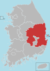
 Location in South Korea | |
| Country | |
| Region | Yeongnam |
| Administrative divisions | 3 eup, 5 myeon |
| Area | |
| • Total | 451 km2 (174 sq mi) |
| Population | |
| • Total | 107,158 |
| • Density | 237.6/km2 (615/sq mi) |
| • Dialect | Gyeongsang |
It is home to the famous Cheonsaengsanseong Fortress, a battle field where general Gwak Jae-woo fought during the Japanese Invasion of Korea in 1592, as well as the Gasansanseong Fortress, which was built to prevent a Japanese invasion after the second Manchu invasions in 1636. It is also a battle field of the Nakdong River and Dabudong battles during the Korean war.
History
Silla Period
It was Palgeorihyeon or Bukchijangnihyeon, Illihyeon and King Gyeongdeok of Silla (the 35th ruler who reigned from 742 to 765 over the kingdom of Silla) revised it to Pal-ri of which become affiliated to Suchang-guen.
Goryeo Period
It was revised to Palgeo in the early part of Goryeo period and during King Hyeonjong of Goryeo (the 8th ruler who reigned from 1010-1031), it become affiliation of Gyonsanbu which is the present lord of the castle.
Joseon Period
In 1640 when King Injo of Joseon (the 16th ruler who reigned from 1623-1649) reign for 18th year, it was called Chilgok by installing regional military command and Gasansanseong Fortress. In 1895 King Gojong's (the 26th ruler who reigned from 1863-1907) 32nd year of reign, Chilgok was re-entitled to Chilgok-guen which led to become a part of Daegu. In accordance with rearrangement of Buguen-myeon in 1914, it incorporated with 9 myeon of Indong-guen , Yakmok-myeon which used to be Daemok or ChilchonㆍGonsanhyeon during Silla dynasty and transferred the location of the county to Waegwan.
Geography
Its geographical coordinate is 128°18'-128°38'to the east longitude and the north latitude 35°52' - 36°38' with average temperature of 14.8°C and 948mm amount of rainfall.
Administrative divisions

Chilgok County is divided into 3 eup and 5 myeon.
| Name | Hangeul | Hanja |
|---|---|---|
| Waegwan-eup | 왜관읍 | 倭館邑 |
| Buksam-eup | 북삼읍 | 北三邑 |
| Seokjeok-eup | 석적읍 | 石積邑 |
| Jicheon-myeon | 지천면 | 枝川面 |
| Dongmyeong-myeon | 동명면 | 東明面 |
| Gasan-myeon | 가산면 | 架山面 |
| Yakmok-myeon | 약목면 | 若木面 |
| Gisan-myeon | 기산면 | 岐山面 |
Tourism
Gasansanseong Fortress
Gasansanseong Camping Site
Dabudong War Memorial Museum
Songjeong Recreational Forest
Chilgokbo Auto-camping Site
Chilgok Patriots & Peace Memorial
Chilgok Patriots & Peace Memorial is a memorial museum dedicated to the soldiers who seized victory by holding up a fierce battle at Nakdong River's line of defense for 55 days in Chilgok during the Korean War. The museum consists of a spacious four-story high building with two basement floors and an outdoor exhibition with a variety of artifacts. The museum also has battle miniatures and experience facilities to help foster patriotism and appreciation for the soldiers who gave their lives to protect the country.[1] 3.
References
- "Chilgok Patriots & Peace Memorial (칠곡호국평화기념관) - Culture - Korea travel and tourism information". www.koreatriptips.com. Retrieved 2020-09-01.
External links
Andong (capital) | ||||
 | Specific city |
| ||
| Cities | ||||
| Counties |
| |||
Authority control | |
|---|---|
| General | |
| National libraries | |
На других языках
- [en] Chilgok County
[ru] Чхильгок
Чхильго́к (кор. 칠곡군?, 漆谷郡?, Chilgok-gun) — уезд в провинции Кёнсан-Пукто, Южная Корея.Другой контент может иметь иную лицензию. Перед использованием материалов сайта WikiSort.org внимательно изучите правила лицензирования конкретных элементов наполнения сайта.
WikiSort.org - проект по пересортировке и дополнению контента Википедии