world.wikisort.org - South_Africa
uMkhanyakude is the northernmost of the 11 districts of the KwaZulu-Natal province of South Africa. Its seat is Mkuze. It is a very rural district, the largest town being Mtubatuba in the south, with Hluhluwe, Mkuze, Jozini, Kwangwanase and Ingwavuma further to the north. The majority of its 573,353 people speak IsiZulu (2001 Census). The district code is DC27.
uMkhanyakude
North Uthungulu | |
|---|---|
District municipality | |
|
Seal | |
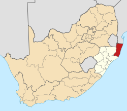 Location in South Africa | |
| Country | South Africa |
| Province | KwaZulu-Natal |
| Seat | Mkuze[1] |
| Local municipalities | List
|
| Government | |
| • Type | Municipal council |
| • Mayor | Cllr.Solomon Mkhombo |
| Area | |
| • Total | 12,821 km2 (4,950 sq mi) |
| Population (2011)[3] | |
| • Total | 625,846 |
| • Density | 49/km2 (130/sq mi) |
| Racial makeup (2011) | |
| • Black African | 98.8% |
| • Coloured | 0.2% |
| • Indian/Asian | 0.2% |
| • White | 0.7% |
| First languages (2011) | |
| • Zulu | 94.6% |
| • English | 1.7% |
| • Southern Ndebele | 1.2% |
| • Other | 2.5% |
| Time zone | UTC+2 (SAST) |
| Municipal code | DC27 |
uMkhanyakude is named after the yellow-barked fever tree, literally meaning “seen from afar”. It contains many areas of outstanding natural beauty such as the St Lucia greater wetland park, Sodwana Bay and Kosi Bay. Game parks include Hluhluwe-Umfolozi, Ndumu and Tembe Elephant Park.
It is one of the two most deprived districts in South Africa according to the District Health Barometer. “Deprivation” is defined as a combination of indicators including unemployment rates, access to piped water and electricity, female-headed households with high numbers of children and low education levels, according to the Health Systems Trust which produces the Barometer.
Geography
Neighbours
uMkhanyakude is surrounded by:
- The republic of Mozambique to the north
- The Indian Ocean to the east
- uThungulu to the south (DC28)
- Zululand to the west (DC26)
- the kingdom of Eswatini to the north-west
Local municipalities
The district contains the following local municipalities:
| Local municipality | Population | % | Dominant language |
|---|---|---|---|
| Jozini | 184 093 | 32.11% | Zulu |
| Hlabisa | 176 899 | 30.85% | Zulu |
| Umhlabuyalingana | 140 962 | 24.59% | Zulu |
| Mtubatuba | 35 216 | 6.14% | Zulu |
| The Big 5 False Bay | 31 102 | 5.42% | Zulu |
| St Lucia Park | 5 080 | 0.89% |
Demographics
The following statistics are from the 2001 census.
| Language | Population | % |
|---|---|---|
| IsiZulu | 559 949 | 97.66% |
| SiSwati | 3 748 | 0.65% |
| English | 3 182 | 0.55% |
| Afrikaans | 2 304 | 0.40% |
| IsiNdebele | 1 378 | 0.24% |
| Sesotho | 903 | 0.16% |
| Sepedi | 582 | 0.10% |
| IsiXhosa | 561 | 0.10% |
| Setswana | 259 | 0.05% |
| Xitsonga | 230 | 0.04% |
| Other | 208 | 0.04% |
| Tshivenda | 48 | 0.01% |
Gender
| Gender | Population | % |
|---|---|---|
| Female | 313 954 | 54.76% |
| Male | 259 399 | 45.24% |
Ethnic group
| Ethnic group | Population | % |
|---|---|---|
| Black African | 568 853 | 99.22% |
| White | 3 235 | 0.56% |
| Coloured | 898 | 0.16% |
| Indian/Asian | 367 | 0.06% |
Age
| Age | Population | % |
|---|---|---|
| 000 - 004 | 76 956 | 13.42% |
| 005 - 009 | 85 375 | 14.89% |
| 010 - 014 | 86 948 | 15.16% |
| 015 - 019 | 78 248 | 13.65% |
| 020 - 024 | 50 006 | 8.72% |
| 025 - 029 | 36 983 | 6.45% |
| 030 - 034 | 30 883 | 5.39% |
| 035 - 039 | 27 382 | 4.78% |
| 040 - 044 | 23 084 | 4.03% |
| 045 - 049 | 16 695 | 2.91% |
| 050 - 054 | 13 481 | 2.35% |
| 055 - 059 | 9 654 | 1.68% |
| 060 - 064 | 11 199 | 1.95% |
| 065 - 069 | 8 543 | 1.49% |
| 070 - 074 | 8 869 | 1.55% |
| 075 - 079 | 4 049 | 0.71% |
| 080 - 084 | 3 017 | 0.53% |
| 085 - 089 | 1 004 | 0.18% |
| 090 - 094 | 579 | 0.10% |
| 095 - 099 | 292 | 0.05% |
| 100 plus | 106 | 0.02% |
Politics
Election results
Election results for Umkhanyakude in the South African general election, 2004.
- Population 18 and over: 274 753 [47.92% of total population]
- Total votes: 150 543 [26.26% of total population]
- Voting % estimate: 54.79% votes as a % of population 18 and over
| Party | Votes | % |
|---|---|---|
| Inkhata Freedom Party | 104 721 | 69.56% |
| African National Congress | 36 893 | 24.51% |
| Democratic Alliance | 3 357 | 2.23% |
| African Christian Democratic Party | 1 381 | 0.92% |
| United Democratic Movement | 1 038 | 0.69% |
| Azanian People's Organisation | 423 | 0.28% |
| New National Party | 374 | 0.25% |
| Freedom Front Plus | 343 | 0.23% |
| Independent Democrats | 308 | 0.20% |
| Pan African Congress | 234 | 0.16% |
| PJC | 204 | 0.14% |
| SOPA | 177 | 0.12% |
| KISS | 176 | 0.12% |
| CDP | 163 | 0.11% |
| United Christian Democratic Party | 139 | 0.09% |
| EMSA | 135 | 0.09% |
| UF | 113 | 0.08% |
| Minority Front | 112 | 0.07% |
| TOP | 106 | 0.07% |
| NA | 91 | 0.06% |
| NLP | 55 | 0.04% |
| Total | 150 543 | 100.00% |
References
- KwaZulu-Natal Top Business | uMkhanyakude District Municipality
- "Contact list: Executive Mayors". Government Communication & Information System. Archived from the original on 14 July 2010. Retrieved 22 February 2012.
- "Statistics by place". Statistics South Africa. Retrieved 27 September 2015.
External links
![]() Elephant Coast travel guide from Wikivoyage
Elephant Coast travel guide from Wikivoyage
Municipalities of KwaZulu-Natal | |||||||||||||||||||||
|---|---|---|---|---|---|---|---|---|---|---|---|---|---|---|---|---|---|---|---|---|---|
| Metropolitan |
|  | |||||||||||||||||||
| District and local |
| ||||||||||||||||||||
List of municipalities in KwaZulu-Natal | |||||||||||||||||||||
This KwaZulu-Natal location article is a stub. You can help Wikipedia by expanding it. |
На других языках
- [en] Umkhanyakude District Municipality
[ru] Умкханьякуде
Умкханьякуде (зулу Umkhanyakude) — район провинции Квазулу-Натал (ЮАР). Название района в переводе с языка зулу означает «видимый издалека», и происходит от зулусского названия растения, которое европейцы прозвали «дерево лихорадки»: это хорошо заметные издали деревья с жёлтой корой. Административный центр — Мкузе. По данным переписи 2001 года большинство населения района говорит на языке зулу.Другой контент может иметь иную лицензию. Перед использованием материалов сайта WikiSort.org внимательно изучите правила лицензирования конкретных элементов наполнения сайта.
WikiSort.org - проект по пересортировке и дополнению контента Википедии