world.wikisort.org - South_Africa
Nama Khoi Municipality is a local municipality in the Northern Cape Province of South Africa. It is administered from the town of Springbok.
Nama Khoi | |
|---|---|
Local municipality | |
 Seal | |
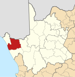 Location in the Northern Cape | |
| Coordinates: 29°30′S 18°00′E | |
| Country | South Africa |
| Province | Northern Cape |
| District | Namakwa |
| Seat | Springbok |
| Wards | 9 |
| Government | |
| • Type | Municipal council |
| • Mayor | Gustav Bock |
| Area | |
| • Total | 17,989 km2 (6,946 sq mi) |
| Population (2011)[2] | |
| • Total | 47,041 |
| • Density | 2.6/km2 (6.8/sq mi) |
| Racial makeup (2011) | |
| • Black African | 4.2% |
| • Coloured | 88.1% |
| • Indian/Asian | 0.5% |
| • White | 6.6% |
| First languages (2011) | |
| • Afrikaans | 95.9% |
| • Xhosa | 1.0% |
| • Other | 3.1% |
| Time zone | UTC+2 (SAST) |
| Municipal code | NC062 |
Main places
The 2011 census divided the municipality into the following main places:[3]
| Place | Code | Area (km2) | Population |
|---|---|---|---|
| Bulletrap | 364006 | 1.8 | 415 |
| Carolusberg | 364013 | 123.6 | 1,336 |
| Concordia | 364007 | 4.8 | 4,988 |
| Goodhouse | 364004 | 0.3 | 171 |
| Kleinzee | 364009 | 9.1 | 728 |
| Kleinzee Mine | 364008 | 160.2 | 3 |
| Komaggas | 364014 | 2.6 | 3,116 |
| Kotzehoop | 364001 | 9.3 | 467 |
| Nababeep | 364010 | 123.1 | 5,374 |
| Okiep | 364011 | 38.6 | 6,304 |
| Springbok | 364012 | 37.6 | 12,790 |
| Steinkopf | 364005 | 7.6 | 7,842 |
| Vioolsdrif | 364003 | 2.0 | 599 |
| Remainder | 364002 | 17,468.1 | 2,909 |
| Total | 17,988.6 | 47,041 | |
Politics
The municipal council consists of seventeen members elected by mixed-member proportional representation. Nine councillors are elected by first-past-the-post voting in nine wards, while the remaining eight are chosen from party lists so that the total number of party representatives is proportional to the number of votes received. In the election of 1 November 2021 no party obtained a majority on the council.[4][5]
| Nama Khoi local election, 1 November 2021 | ||||||||
|---|---|---|---|---|---|---|---|---|
| Party | Votes | Seats | ||||||
| Ward | List | Total | % | Ward | List | Total | ||
| African National Congress | 6,625 | 6,513 | 13,138 | 42.0% | 7 | 0 | 7 | |
| Democratic Alliance | 4,665 | 4,739 | 9,404 | 30.1% | 1 | 4 | 5 | |
| Namakwa Civic Movement | 3,229 | 3,290 | 6,519 | 20.8% | 1 | 3 | 4 | |
| Freedom Front Plus | 223 | 234 | 457 | 1.5% | 0 | 1 | 1 | |
| Khoisan Revolution | 213 | 225 | 438 | 1.4% | 0 | 0 | 0 | |
| Good | 145 | 147 | 292 | 0.9% | 0 | 0 | 0 | |
| Patriotic Alliance | 123 | 168 | 291 | 0.9% | 0 | 0 | 0 | |
| Congress of the People | 131 | 143 | 274 | 0.9% | 0 | 0 | 0 | |
| Economic Freedom Fighters | 115 | 120 | 235 | 0.8% | 0 | 0 | 0 | |
| National Economic Fighters | 132 | – | 132 | 0.4% | 0 | – | 0 | |
| Independent Civic Organisation of South Africa | 34 | 31 | 65 | 0.2% | 0 | 0 | 0 | |
| African Transformation Movement | 1 | 19 | 20 | 0.1% | 0 | 0 | 0 | |
| South African Royal Kingdoms Organization | 4 | 6 | 10 | 0.0% | 0 | 0 | 0 | |
| Total | 15,640 | 15,635 | 31,275 | 9 | 8 | 17 | ||
| Valid votes | 15,640 | 15,635 | 31,275 | 98.9% | ||||
| Spoilt votes | 174 | 179 | 353 | 1.1% | ||||
| Total votes cast | 15,814 | 15,814 | 31,628 | |||||
| Voter turnout | 15,814 | |||||||
| Registered voters | 29,072 | |||||||
| Turnout percentage | 54.4% | |||||||
References
- "Contact list: Executive Mayors". Government Communication & Information System. Archived from the original on 14 July 2010. Retrieved 22 February 2012.
- "Statistics by place". Statistics South Africa. Retrieved 27 September 2015.
- "Nama Khoi Local Municipality". Census 2011.
- "Results Summary - All Ballots" (PDF). Electoral Commission of South Africa. 8 November 2021. Retrieved 12 November 2021.
{{cite web}}: CS1 maint: url-status (link) - "Seat Calculation Detail" (PDF). Electoral Commission of South Africa. 8 November 2021. Retrieved 12 November 2021.
{{cite web}}: CS1 maint: url-status (link)
External links
Municipalities and communities of Namakwa District Municipality, Northern Cape | ||
|---|---|---|
District seat: Springbok | ||
| Hantam |  | |
| Kamiesberg |
| |
| Karoo Hoogland |
| |
| Khâi-Ma | ||
| Nama Khoi | ||
| Richtersveld |
| |
Municipalities of the Northern Cape | ||
|---|---|---|
| Namakwa District |
|  |
| Pixley ka Seme District |
| |
| ZF Mgcawu District | ||
| Frances Baard District | ||
| John Taolo Gaetsewe District | ||
List of municipalities in the Northern Cape | ||
This Northern Cape location article is a stub. You can help Wikipedia by expanding it. |
На других языках
[de] Nama Khoi
Nama Khoi (englisch Nama Khoi Local Municipality) ist eine Lokalgemeinde im Distrikt Namakwa in der südafrikanischen Provinz Nordkap. Der Sitz der Gemeindeverwaltung befindet sich in Springbok. Bürgermeister ist Lorenzo Faber.[1]- [en] Nama Khoi Local Municipality
Текст в блоке "Читать" взят с сайта "Википедия" и доступен по лицензии Creative Commons Attribution-ShareAlike; в отдельных случаях могут действовать дополнительные условия.
Другой контент может иметь иную лицензию. Перед использованием материалов сайта WikiSort.org внимательно изучите правила лицензирования конкретных элементов наполнения сайта.
Другой контент может иметь иную лицензию. Перед использованием материалов сайта WikiSort.org внимательно изучите правила лицензирования конкретных элементов наполнения сайта.
2019-2025
WikiSort.org - проект по пересортировке и дополнению контента Википедии
WikiSort.org - проект по пересортировке и дополнению контента Википедии