world.wikisort.org - South_Africa
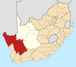
Soebatsfontein is a settlement in Namakwa District Municipality in the Northern Cape province of South Africa.
Soebatsfontein | |
|---|---|
 Soebatsfontein  Soebatsfontein | |
| Coordinates: 30.117°S 17.583°E | |
| Country | South Africa |
| Province | Northern Cape |
| District | Namakwa |
| Municipality | Kamiesberg |
| Area | |
| • Total | 0.42 km2 (0.16 sq mi) |
| Population (2011)[1] | |
| • Total | 276 |
| • Density | 660/km2 (1,700/sq mi) |
| Racial makeup (2011) | |
| • Coloured | 97.8% |
| • Indian/Asian | 0.4% |
| • White | 1.8% |
| First languages (2011) | |
| • Afrikaans | 96.4% |
| • Tswana | 1.8% |
| • Other | 1.8% |
| Time zone | UTC+2 (SAST) |
| PO box | 8257 |
Settlement 80 km south-west of Springbok and 48 km north-west of Kamieskroon. The name, Afrikaans for ‘begging or pleading fountain’, dates from an incident about 1898 in which Hendrik S(t)ievert, a farmhand, was murdered by San in spite of his begging for mercy.[2]
References
- "Main Place Soebatsfontein". Census 2011.
- "Dictionary of Southern African Place Names (Public Domain)". Human Science Research Council. p. 409.
Текст в блоке "Читать" взят с сайта "Википедия" и доступен по лицензии Creative Commons Attribution-ShareAlike; в отдельных случаях могут действовать дополнительные условия.
Другой контент может иметь иную лицензию. Перед использованием материалов сайта WikiSort.org внимательно изучите правила лицензирования конкретных элементов наполнения сайта.
Другой контент может иметь иную лицензию. Перед использованием материалов сайта WikiSort.org внимательно изучите правила лицензирования конкретных элементов наполнения сайта.
2019-2025
WikiSort.org - проект по пересортировке и дополнению контента Википедии
WikiSort.org - проект по пересортировке и дополнению контента Википедии
