world.wikisort.org - Slovenia
Zajasovnik (pronounced [zaˈjaːsɔu̯nik]) is a dispersed settlement that is divided between the municipalities of Kamnik and Vransko in Slovenia.
Zajasovnik | |
|---|---|
 | |
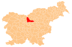
 Zajasovnik Location in Slovenia | |
| Coordinates: 46°12′31″N 14°54′8.23″E | |
| Country | |
| Traditional region | Upper Carniola, Styria |
| Statistical region | Central Slovenia |
| Municipality | Kamnik, Vransko |
| Area | |
| • Total | 3.08 km2 (1.19 sq mi) |
| Elevation | 541.4 m (1,776.2 ft) |
| Population (2002) | |
| • Total | 77 |
| [1] | |
Cultural heritage

An Austro-Hungarian boundary stone marking the border between Carniola and Styria stands at the border between the two parts of Zajasovnik.[2]
References
- Statistical Office of the Republic of Slovenia Archived November 18, 2008, at the Wayback Machine
- "Zajasovnik - Mejni deželni kamen". Register kulturne dediščine. Ministrstvo za kulturo. Retrieved June 29, 2021.
External links
 Media related to Zajasovnik at Wikimedia Commons
- Zajasovnik (Kamnik) on Geopedia
- Zajasovnik (Vransko) on Geopedia
Municipality of Vransko | ||
|---|---|---|
| Settlements | Administrative seat: Vransko
|  |
| Landmarks |
| |
This article about the Municipality of Kamnik in Slovenia is a stub. You can help Wikipedia by expanding it. |
This article about the Municipality of Vransko in Slovenia is a stub. You can help Wikipedia by expanding it. |
Текст в блоке "Читать" взят с сайта "Википедия" и доступен по лицензии Creative Commons Attribution-ShareAlike; в отдельных случаях могут действовать дополнительные условия.
Другой контент может иметь иную лицензию. Перед использованием материалов сайта WikiSort.org внимательно изучите правила лицензирования конкретных элементов наполнения сайта.
Другой контент может иметь иную лицензию. Перед использованием материалов сайта WikiSort.org внимательно изучите правила лицензирования конкретных элементов наполнения сайта.
2019-2025
WikiSort.org - проект по пересортировке и дополнению контента Википедии
WikiSort.org - проект по пересортировке и дополнению контента Википедии