world.wikisort.org - Slovenia
Vrhpolje pri Kamniku (pronounced [ˈʋəɾxpɔljɛ pɾi ˈkaːmniku]; German: Oberfeld[2]) is a settlement in the Municipality of Kamnik in the Upper Carniola region of Slovenia. Urban expansion has turned it into a single continuous settlement with the neighbouring settlement of Nevlje. The main road from Kamnik into the Tuhinj Valley runs through Vrhpolje.
Vrhpolje pri Kamniku | |
|---|---|
 | |
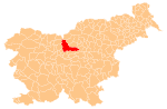
 Vrhpolje pri Kamniku Location in Slovenia | |
| Coordinates: 46°13′48.06″N 14°37′53.11″E | |
| Country | |
| Traditional region | Upper Carniola |
| Statistical region | Central Slovenia |
| Municipality | Kamnik |
| Area | |
| • Total | 0.94 km2 (0.36 sq mi) |
| Elevation | 392.9 m (1,289.0 ft) |
| Population (2002) | |
| • Total | 664 |
| [1] | |
Name
The name of the settlement was changed from Vrhpolje to Vrhpolje pri Kamniku in 1955.[3] In the past the German name was Oberfeld.[2]
Gallery
 Historical postcard of Vrhpolje pri Kamniku

References
- Statistical Office of the Republic of Slovenia
- Leksikon občin kraljestev in dežel zastopanih v državnem zboru, vol. 6: Kranjsko. 1906. Vienna: C. Kr. Dvorna in Državna Tiskarna, p. 28.
- Spremembe naselij 1948–95. 1996. Database. Ljubljana: Geografski inštitut ZRC SAZU, DZS.
External links
 Media related to Vrhpolje pri Kamniku at Wikimedia Commons
- Vrhpolje pri Kamniku on Geopedia
This article about the Municipality of Kamnik in Slovenia is a stub. You can help Wikipedia by expanding it. |
Текст в блоке "Читать" взят с сайта "Википедия" и доступен по лицензии Creative Commons Attribution-ShareAlike; в отдельных случаях могут действовать дополнительные условия.
Другой контент может иметь иную лицензию. Перед использованием материалов сайта WikiSort.org внимательно изучите правила лицензирования конкретных элементов наполнения сайта.
Другой контент может иметь иную лицензию. Перед использованием материалов сайта WikiSort.org внимательно изучите правила лицензирования конкретных элементов наполнения сайта.
2019-2025
WikiSort.org - проект по пересортировке и дополнению контента Википедии
WikiSort.org - проект по пересортировке и дополнению контента Википедии