world.wikisort.org - Slovenia
Stahovica (pronounced [staˈxoːʋitsa]) is a settlement that stretches along the road leading into the upper Kamnik Bistrica Valley in the Municipality of Kamnik in the Upper Carniola region of Slovenia.
Stahovica | |
|---|---|
 | |
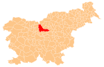
 Stahovica Location in Slovenia | |
| Coordinates: 46°16′16.76″N 14°36′24.31″E | |
| Country | |
| Traditional region | Upper Carniola |
| Statistical region | Central Slovenia |
| Municipality | Kamnik |
| Area | |
| • Total | 1.89 km2 (0.73 sq mi) |
| Elevation | 442.9 m (1,453.1 ft) |
| Population (2002) | |
| • Total | 187 |
| [1] | |
References
External links
This article about the Municipality of Kamnik in Slovenia is a stub. You can help Wikipedia by expanding it. |
Текст в блоке "Читать" взят с сайта "Википедия" и доступен по лицензии Creative Commons Attribution-ShareAlike; в отдельных случаях могут действовать дополнительные условия.
Другой контент может иметь иную лицензию. Перед использованием материалов сайта WikiSort.org внимательно изучите правила лицензирования конкретных элементов наполнения сайта.
Другой контент может иметь иную лицензию. Перед использованием материалов сайта WikiSort.org внимательно изучите правила лицензирования конкретных элементов наполнения сайта.
2019-2025
WikiSort.org - проект по пересортировке и дополнению контента Википедии
WikiSort.org - проект по пересортировке и дополнению контента Википедии