world.wikisort.org - Slovenia
Mali Konec (pronounced [ˈmaːli ˈkɔːnəts]) is a small settlement in the hills north of Polica in the Municipality of Grosuplje in central Slovenia. The area is part of the historical region of Lower Carniola. The municipality is now included in the Central Slovenia Statistical Region.[2]
Mali Konec | |
|---|---|
 Mali Konec | |
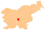
 Mali Konec Location in Slovenia | |
| Coordinates: 46°0′1.19″N 14°42′5.38″E | |
| Country | |
| Traditional region | Lower Carniola |
| Statistical region | Central Slovenia |
| Municipality | Grosuplje |
| Area | |
| • Total | 1.4 km2 (0.5 sq mi) |
| Elevation | 465.4 m (1,526.9 ft) |
| Population (2002) | |
| • Total | 25 |
| [1] | |
Evidence of an Iron Age hillfort has been found on Križatec Hill north of the settlement.[3] The fortification had a rectangular layout and its embankments are still partially preserved.[4]
References
- Statistical Office of the Republic of Slovenia
- Grosuplje municipal site
- "EŠD 11872". Registry of Immovable Cultural Heritage (in Slovenian). Ministry of Culture of the Republic of Slovenia. Retrieved 1 July 2011.
- Savnik, Roman (1971). Krajevni leksikon Slovenije, vol. 2. Ljubljana: Državna založba Slovenije. p. 138.
External links
 Media related to Mali Konec at Wikimedia Commons
- Mali Konec on Geopedia
This article about the Municipality of Grosuplje in Slovenia is a stub. You can help Wikipedia by expanding it. |
Текст в блоке "Читать" взят с сайта "Википедия" и доступен по лицензии Creative Commons Attribution-ShareAlike; в отдельных случаях могут действовать дополнительные условия.
Другой контент может иметь иную лицензию. Перед использованием материалов сайта WikiSort.org внимательно изучите правила лицензирования конкретных элементов наполнения сайта.
Другой контент может иметь иную лицензию. Перед использованием материалов сайта WikiSort.org внимательно изучите правила лицензирования конкретных элементов наполнения сайта.
2019-2026
WikiSort.org - проект по пересортировке и дополнению контента Википедии
WikiSort.org - проект по пересортировке и дополнению контента Википедии