world.wikisort.org - Slovenia
Gajniče (pronounced [ɡai̯ˈniːtʃɛ]; in older sources also Goniče[2] or Gojniče;[3] German: Ganitsche[2]) is a small settlement just southwest of Šmarje–Sap in the Municipality of Grosuplje in central Slovenia. The entire municipality is included in the Central Slovenia Statistical Region. The area is part of the historical region of Lower Carniola.[4]
Gajniče | |
|---|---|
 | |
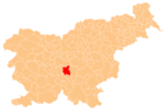
 Gajniče Location in Slovenia | |
| Coordinates: 45°58′29.34″N 14°35′48.64″E | |
| Country | |
| Traditional region | Lower Carniola |
| Statistical region | Central Slovenia |
| Municipality | Grosuplje |
| Area | |
| • Total | 1.06 km2 (0.41 sq mi) |
| Elevation | 316.7 m (1,039.0 ft) |
| Population (2002) | |
| • Total | 36 |
| [1] | |
Geography
Gajniče is a clustered village on the southern slope of Roj Hill (330 m), which also has a railroad tunnel. A wet, marshy valley lies below the village, through which Tlake Creek (Slovene: Tlaški potok) flows, with its source at Vir Spring below the hamlet of Razdrto. The creek flows through the low-lying Snožeti Meadows.[5] Klobušter Hill (396 m) and Mačka Hill (397 m) rise above the settlement to the south.[6][7]
References
- Statistical Office of the Republic of Slovenia
- Intelligenzblatt zur Laibacher Zeitung, no. 141. 24 November 1849, p. 21.
- Krajevni leksikon Dravske Banovine. 1937. Ljubljana: Zveza za tujski promet za Slovenijo, p. 356.
- Grosuplje municipal site
- Savnik, Roman, ed. 1971. Krajevni leksikon Slovenije, vol. 2. Ljubljana: Državna založba Slovenije, p. 129.
- Klobušter Hill at pespoti.si (in Slovene)
- Mačka Hill at pespoti.si (in Slovene)
External links
 Media related to Gajniče at Wikimedia Commons
- Gajniče on Geopedia
This article about the Municipality of Grosuplje in Slovenia is a stub. You can help Wikipedia by expanding it. |
Другой контент может иметь иную лицензию. Перед использованием материалов сайта WikiSort.org внимательно изучите правила лицензирования конкретных элементов наполнения сайта.
WikiSort.org - проект по пересортировке и дополнению контента Википедии