world.wikisort.org - Russia
Untsukulsky District (Russian: Унцукульский райо́н; Avar: Унсоколо мухъ) is an administrative[1] and municipal[7] district (raion), one of the forty-one in the Republic of Dagestan, Russia. It is located in the center of the republic. The area of the district is 560 square kilometers (220 sq mi).[2] Its administrative center is the rural locality (a selo) of Untsukul.[1] As of the 2010 Census, the total population of the district was 29,547, with the population of Untsukul accounting for 21.2% of that number.[3]
Untsukulsky District
Унцукульский район | |
|---|---|
District | |
| Other transcription(s) | |
| • Avar | Унсоколо мухъ |
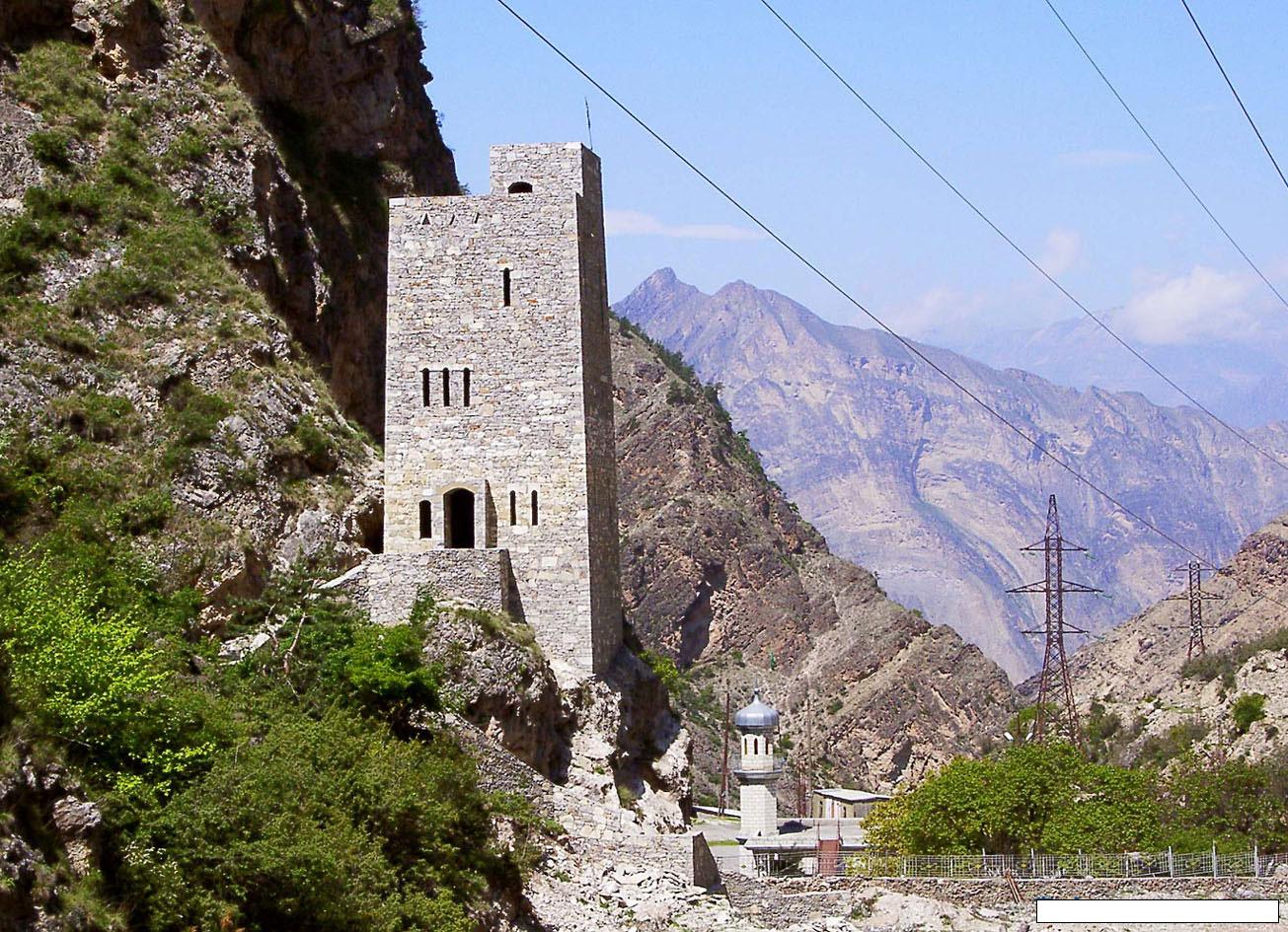 Gimry Tower, a cultural heritage object in Untsukulsky District | |
 Flag  Coat of arms | |
 Location of Untsukulsky District in the Republic of Dagestan | |
| Coordinates: 42°53′N 47°12′E | |
| Country | Russia |
| Federal subject | Republic of Dagestan[1] |
| Established | 1935 |
| Administrative center | Untsukul[1] |
| Area | |
| • Total | 560 km2 (220 sq mi) |
| Population (2010 Census)[3] | |
| • Total | 29,547 |
| • Estimate (2018)[4] | 31,080 (+5.2%) |
| • Density | 53/km2 (140/sq mi) |
| • Urban | 16.5% |
| • Rural | 83.5% |
| Administrative structure | |
| • Administrative divisions | 1 Settlements, 6 Selsoviets |
| • Inhabited localities[5] | 1 Urban-type settlements[6], 20 Rural localities |
| Municipal structure | |
| • Municipally incorporated as | Untsukulsky Municipal District[7] |
| • Municipal divisions[7] | 1 Urban settlements, 11 Rural settlements |
| Time zone | UTC+3 (MSK |
| OKTMO ID | 82653000 |
| Website | http://uncukul.ru |
| 2010 Census | 29,547[3] |
|---|---|
| 2002 Census | 27,460[9] |
| 1989 Census | 16,105[10] |
| 1979 Census | 11,786[11] |
Administrative and municipal status
Within the framework of administrative divisions, Untsukulsky District is one of the forty-one in the Republic of Dagestan.[1] It is divided into one settlement (an administrative division with the administrative center in the urban-type settlement (an inhabited locality) of Shamilkala) and six selsoviets, which comprise twenty rural localities.[5] As a municipal division, the district is incorporated as Untsukulsky Municipal District.[7] The settlement is incorporated as an urban settlement, and the six selsoviets are incorporated as eleven rural settlements within the municipal district.[7] The selo of Untsukul serves as the administrative center of both the administrative[1] and municipal[12] district.
References
Notes
- Law #16
- "General Information" (in Russian). Untsukulsky District. Retrieved January 20, 2017.
- Russian Federal State Statistics Service (2011). Всероссийская перепись населения 2010 года. Том 1 [2010 All-Russian Population Census, vol. 1]. Всероссийская перепись населения 2010 года [2010 All-Russia Population Census] (in Russian). Federal State Statistics Service.
- "26. Численность постоянного населения Российской Федерации по муниципальным образованиям на 1 января 2018 года". Federal State Statistics Service. Retrieved January 23, 2019.
- Государственный комитет Российской Федерации по статистике. Комитет Российской Федерации по стандартизации, метрологии и сертификации. №ОК 019-95 1 января 1997 г. «Общероссийский классификатор объектов административно-территориального деления. Код 82 253», в ред. изменения №278/2015 от 1 января 2016 г.. (State Statistics Committee of the Russian Federation. Committee of the Russian Federation on Standardization, Metrology, and Certification. #OK 019-95 January 1, 1997 Russian Classification of Objects of Administrative Division (OKATO). Code 82 253, as amended by the Amendment #278/2015 of January 1, 2016. ).
- The count of urban-type settlements may include the work settlements, the resort settlements, the suburban (dacha) settlements, as well as urban-type settlements proper.
- Law #6
- "Об исчислении времени". Официальный интернет-портал правовой информации (in Russian). June 3, 2011. Retrieved January 19, 2019.
- Russian Federal State Statistics Service (May 21, 2004). Численность населения России, субъектов Российской Федерации в составе федеральных округов, районов, городских поселений, сельских населённых пунктов – районных центров и сельских населённых пунктов с населением 3 тысячи и более человек [Population of Russia, Its Federal Districts, Federal Subjects, Districts, Urban Localities, Rural Localities—Administrative Centers, and Rural Localities with Population of Over 3,000] (XLS). Всероссийская перепись населения 2002 года [All-Russia Population Census of 2002] (in Russian).
- Всесоюзная перепись населения 1989 г. Численность наличного населения союзных и автономных республик, автономных областей и округов, краёв, областей, районов, городских поселений и сёл-райцентров [All Union Population Census of 1989: Present Population of Union and Autonomous Republics, Autonomous Oblasts and Okrugs, Krais, Oblasts, Districts, Urban Settlements, and Villages Serving as District Administrative Centers]. Всесоюзная перепись населения 1989 года [All-Union Population Census of 1989] (in Russian). Институт демографии Национального исследовательского университета: Высшая школа экономики [Institute of Demography at the National Research University: Higher School of Economics]. 1989 – via Demoscope Weekly.
- Всесоюзная перепись населения 1979 г. Национальный состав населения по регионам России [All Union Population Census of 1979. Ethnic composition of the population by regions of Russia] (XLS). Всесоюзная перепись населения 1979 года [All-Union Population Census of 1979] (in Russian). 1979 – via Demoscope Weekly (website of the Institute of Demographics of the State University—Higher School of Economics.
- Федеральная служба государственной статистики. Федеральное агентство по технологическому регулированию и метрологии. №ОК 033-2013 1 января 2014 г. «Общероссийский классификатор территорий муниципальных образований. Код 82 653». (Federal State Statistics Service. Federal Agency on Technological Regulation and Metrology. #OK 033-2013 January 1, 2014 Russian Classification of Territories of Municipal Formations. Code 82 653. ).
Sources
- Народное Собрание Республики Дагестан. Закон №16 от 10 апреля 2002 г. «Об административно-территориальном устройстве Республики Дагестан», в ред. Закона №106 от 30 декабря 2013 г. «О внесении изменений в некоторые законодательные акты Республики Дагестан». Вступил в силу со дня официального опубликования. Опубликован: "Дагестанская правда", №81, 12 апреля 2002 г. (People's Assembly of the Republic of Dagestan. Law #16 of April 10, 2002 On the Administrative-Territorial Structure of the Republic of Dagestan, as amended by the Law #106 of December 30, 2013 On Amending Various Legislative Acts of the Republic of Dagestan. Effective as of the day of the official publication.).
- Народное Собрание Республики Дагестан. Закон №6 от 13 января 2005 г. «О статусе и границах муниципальных образований Республики Дагестан», в ред. Закона №43 от 30 апреля 2015 г. «О статусе городского округа с внутригородским делением "Город Махачкала", статусе и границах внутригородских районов в составе городского округа с внутригородским делением "Город Махачкала" и о внесении изменений в отдельные законодательные акты Республики Дагестан». Вступил в силу со дня официального опубликования. Опубликован: "Дагестанская правда", №8, 15 февраля 2005 г. (People's Assembly of the Republic of Dagestan. Law #6 of January 13, 2005 On the Status and Borders of the Municipal Formations of the Republic of Dagestan, as amended by the Law #43 of April 30, 2015 On the Status of the "City of Makhachkala" Urban Okrug with Intra-Urban Divisions, the Status and the Borders of the Intra-City Districts Comprising the "City of Makhachkala" Urban Okrug with Intra-Urban Divisions, and on Amending Various Legislative Acts of the Republic of Dagestan. Effective as of the day of the official publication.).
Administrative divisions of Dagestan | |||
|---|---|---|---|
Capital: Makhachkala • Rural localities | |||
| Districts |
| ||
| Cities and towns | |||
| Urban-type settlements | |||
Rural localities in Untsukulsky District | ||
|---|---|---|
На других языках
- [en] Untsukulsky District
[ru] Унцукульский район
Унцуку́льский район (авар. Унсоколо мухъ) — административно-территориальная единица и муниципальное образование (муниципальный район) в составе Дагестана Российской Федерации.Другой контент может иметь иную лицензию. Перед использованием материалов сайта WikiSort.org внимательно изучите правила лицензирования конкретных элементов наполнения сайта.
WikiSort.org - проект по пересортировке и дополнению контента Википедии