world.wikisort.org - Russia
Severo-Kurilsk (Russian: Се́веро-Кури́льск; Japanese: 柏原, Kashiwabara) is a town and the administrative center of Severo-Kurilsky District of Sakhalin Oblast, Russia, located in the northern part of the Kuril Islands, on the island of Paramushir. Population: 2,536 (2010 Census);[2] 2,592 (2002 Census);[8] 5,180 (1989 Census).[9]
Severo-Kurilsk
Северо-Курильск | |
|---|---|
Town[1] | |
 Main street of Severo-Kurilsk | |
 Flag  Coat of arms | |
Location of Severo-Kurilsk  | |
 Severo-Kurilsk Location of Severo-Kurilsk 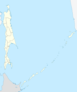 Severo-Kurilsk Severo-Kurilsk (Sakhalin Oblast) | |
| Coordinates: 50°40′N 156°07′E | |
| Country | Russia |
| Federal subject | Sakhalin Oblast[1] |
| Administrative district | Severo-Kurilsky District[1] |
| Elevation | 30 m (100 ft) |
| Population | |
| • Total | 2,536 |
| • Estimate (2018)[3] | 2,507 (−1.1%) |
Administrative status | |
| • Capital of | Severo-Kurilsky District[1] |
Municipal status | |
| • Urban okrug | Severo-Kurilsky Urban Okrug[4] |
| • Capital of | Severo-Kurilsky Urban Okrug[4] |
| Time zone | UTC+11 (MSK+8 |
| Postal code(s)[6] | 694550 |
| Dialing code(s) | +7 42453[7] |
| OKTMO ID | 64743000001 |
History
The Ainu are the original inhabitants of Paramushir, which came under the control of the Russian Empire in the mid-18th century. Russian sovereignty was initially confirmed under the terms of the Treaty of Shimoda in 1855, but the island was transferred to the Empire of Japan per the Treaty of Saint Petersburg in 1875. The Japanese established a settlement, Kashiwabara, on the site of the largest Ainu village (Ottomai), which became the major port on the island, and a center for the commercial fishing industry, particularly for herring. The village was named for the captain of the survey vessel Iwaki, which charted the coasts of the island in 1875. The village had the northernmost post office in Japan. During World War II Kashiwabara was strongly garrisoned by the Imperial Japanese Army and served as the headquarters of the IJA 91st Infantry Division. Kashiwabara Airfield was established in the outskirts of the village, and numerous fortifications and gun emplacements were built. The area was subject to sporadic air raids from the US Army Air Force and US Navy based in the Aleutian Islands from 1943 until the end of the war.
During the Invasion of the Kuril Islands, Soviet forces landed on Paramushir on August 18, 1945, and combat operations continued through August 23, ending with the surrender of the surviving members of the Japanese garrison. The Soviets forcibly deported the remaining Japanese civilian inhabitants and sent the prisoners of war to labor camps. Kashiwabara was renamed Severo-Kurilsk (Northern Kuril Town) and the island annexed by the Soviet Union in 1946.
On November 5, 1952 the town was completely destroyed by the 1952 Severo-Kurilsk tsunami, with at least 2,336 of the town's 6,000 inhabitants killed. Severo-Kurilsk was rebuilt on higher ground, and the population soon rose above its original level, however in the years since the dissolution of the Soviet Union and the associated economic crisis of the 1990s, the town's population has again declined.
The surrounding area has some remaining Japanese fortifications visible. On 25 March 2020, an earthquake of magnitude 7.5 struck near the town of Severo-Kurilsk.[10]
Gallery
 View of the original site of Severo-Kurilsk

Administrative and municipal status
Within the framework of administrative divisions, Severo-Kurilsk serves as the administrative center of Severo-Kurilsky District and is subordinated to it.[1] As a municipal division, the town of Severo-Kurilsk and one rural locality of Severo-Kurilsky District are incorporated as Severo-Kurilsky Urban Okrug.[4]
Economy
Commercial fishing is virtually the only industry in the town.
Climate
Severo-Kurilsk has a subarctic climate (Köppen Dfc). The monthly average temperature is greater than 10 degrees Celsius only in August and September. Due to the influence of the cold current of the Oyashio current , it is cold and humid all year round. The annual precipitation is more than five times that of Siberia. Winter lasts from December through April, the months where temperatures average below freezing.
| Climate data for Severo-Kurilsk (1991–2020, extremes 1948–present) | |||||||||||||
|---|---|---|---|---|---|---|---|---|---|---|---|---|---|
| Month | Jan | Feb | Mar | Apr | May | Jun | Jul | Aug | Sep | Oct | Nov | Dec | Year |
| Record high °C (°F) | 6.0 (42.8) |
6.0 (42.8) |
9.2 (48.6) |
14.6 (58.3) |
19.7 (67.5) |
24.3 (75.7) |
26.5 (79.7) |
25.1 (77.2) |
23.1 (73.6) |
17.8 (64.0) |
12.2 (54.0) |
7.0 (44.6) |
26.4 (79.5) |
| Average high °C (°F) | −1.8 (28.8) |
−2.4 (27.7) |
−0.8 (30.6) |
1.9 (35.4) |
5.7 (42.3) |
10.6 (51.1) |
13.5 (56.3) |
15.2 (59.4) |
13.8 (56.8) |
8.9 (48.0) |
3.4 (38.1) |
−0.5 (31.1) |
5.6 (42.1) |
| Daily mean °C (°F) | −3.7 (25.3) |
−4.4 (24.1) |
−3.0 (26.6) |
−0.3 (31.5) |
2.9 (37.2) |
6.9 (44.4) |
10.0 (50.0) |
11.7 (53.1) |
10.6 (51.1) |
6.3 (43.3) |
1.3 (34.3) |
−2.4 (27.7) |
3.0 (37.4) |
| Average low °C (°F) | −5.6 (21.9) |
−6.4 (20.5) |
−5.0 (23.0) |
−2.1 (28.2) |
0.8 (33.4) |
4.2 (39.6) |
7.5 (45.5) |
9.1 (48.4) |
7.8 (46.0) |
3.8 (38.8) |
−0.8 (30.6) |
−4.5 (23.9) |
0.7 (33.3) |
| Record low °C (°F) | −22.0 (−7.6) |
−18.9 (−2.0) |
−17.6 (0.3) |
−10.7 (12.7) |
−6.0 (21.2) |
−1.9 (28.6) |
1.6 (34.9) |
2.0 (35.6) |
−1.0 (30.2) |
−4.0 (24.8) |
−12.2 (10.0) |
−16.1 (3.0) |
−22.0 (−7.6) |
| Average precipitation mm (inches) | 126 (5.0) |
137 (5.4) |
152 (6.0) |
116 (4.6) |
113 (4.4) |
143 (5.6) |
160 (6.3) |
163 (6.4) |
183 (7.2) |
246 (9.7) |
253 (10.0) |
185 (7.3) |
1,977 (77.8) |
| Average extreme snow depth cm (inches) | 64 (25) |
86 (34) |
103 (41) |
98 (39) |
27 (11) |
0 (0) |
0 (0) |
0 (0) |
0 (0) |
0 (0) |
10 (3.9) |
35 (14) |
103 (41) |
| Average rainy days | 1 | 0.3 | 1 | 7 | 16 | 17 | 18 | 20 | 22 | 25 | 12 | 4 | 143 |
| Average snowy days | 30 | 30 | 29 | 24 | 11 | 1 | 0.2 | 0.1 | 0.2 | 6 | 24 | 30 | 186 |
| Average relative humidity (%) | 75 | 77 | 77 | 79 | 82 | 85 | 89 | 87 | 80 | 76 | 74 | 74 | 79 |
| Source: Pogoda.ru.net[11] | |||||||||||||
Sister city
 Nemuro, Hokkaido, Japan[12]
References
Notes
- Law #25-ZO
- Russian Federal State Statistics Service (2011). Всероссийская перепись населения 2010 года. Том 1 [2010 All-Russian Population Census, vol. 1]. Всероссийская перепись населения 2010 года [2010 All-Russia Population Census] (in Russian). Federal State Statistics Service.
- http://www.gks.ru/free_doc/doc_2018/bul_dr/mun_obr2018.rar; archive date: 26 July 2018; retrieved: 25 July 2018; archive URL: https://web.archive.org/web/20180726010024/http://www.gks.ru/free_doc/doc_2018/bul_dr/mun_obr2018.rar.
- Law #524
- "Об исчислении времени". Официальный интернет-портал правовой информации (in Russian). June 3, 2011. Retrieved January 19, 2019.
- Почта России. Информационно-вычислительный центр ОАСУ РПО. (Russian Post). Поиск объектов почтовой связи (Postal Objects Search) (in Russian)
- Телефонные коды Сахалина - Dialing codes of Sakhalin (in Russian)
- Russian Federal State Statistics Service (May 21, 2004). Численность населения России, субъектов Российской Федерации в составе федеральных округов, районов, городских поселений, сельских населённых пунктов – районных центров и сельских населённых пунктов с населением 3 тысячи и более человек [Population of Russia, Its Federal Districts, Federal Subjects, Districts, Urban Localities, Rural Localities—Administrative Centers, and Rural Localities with Population of Over 3,000] (XLS). Всероссийская перепись населения 2002 года [All-Russia Population Census of 2002] (in Russian).
- Всесоюзная перепись населения 1989 г. Численность наличного населения союзных и автономных республик, автономных областей и округов, краёв, областей, районов, городских поселений и сёл-райцентров [All Union Population Census of 1989: Present Population of Union and Autonomous Republics, Autonomous Oblasts and Okrugs, Krais, Oblasts, Districts, Urban Settlements, and Villages Serving as District Administrative Centers]. Всесоюзная перепись населения 1989 года [All-Union Population Census of 1989] (in Russian). Институт демографии Национального исследовательского университета: Высшая школа экономики [Institute of Demography at the National Research University: Higher School of Economics]. 1989 – via Demoscope Weekly.
- "Magnitude 7.5 earthquake strikes near Severo-Kuril'sk, Russia". SFGate. March 25, 2020. Retrieved March 25, 2020.
- "Pogoda.ru.net" (in Russian). Retrieved November 8, 2021.
- Sister relations with Hokkaido
Sources
- Сахалинская областная Дума. Закон №25-ЗО от 23 марта 2011 г. «Об административно-территориальном устройстве Сахалинской области», в ред. Закона №62-ЗО от 27 июня 2013 г. «О внесении изменения в статью 10 Закона Сахалинской области "Об административно-территориальном устройстве Сахалинской области"». Вступил в силу 9 апреля 2011 г.. Опубликован: "Губернские ведомости", №55(3742), 29 марта 2011 г. (Sakhalin Oblast Duma. Law #25-ZO of March 23, 2011 On the Administrative-Territorial Structure of Sakhalin Oblast, as amended by the Law #62-ZO of June 27, 2013 On Amending Article 10 of the Law of Sakhalin Oblast "On the Administrative-Territorial Structure of Sakhalin Oblast". Effective as of April 9, 2011.).
- Сахалинская областная Дума. Закон №524 от 21 июля 2004 г. «О границах и статусе муниципальных образований в Сахалинской области», в ред. Закона №45-ЗО от 27 мая 2013 г. «О внесении изменения в Закон Сахалинской области "О границах и статусе муниципальных образований в Сахалинской области"». Вступил в силу 1 января 2005 г. Опубликован: "Губернские ведомости", №175–176(2111–2112), 31 июля 2004 г. (Sakhalin Oblast Duma. Law #524 of July 21, 2004 On the Borders and Status of the Municipal Formations in Sakhalin Oblast, as amended by the Law #45-ZO of May 27, 2013 On Amending the Law of Sakhalin Oblast "On the Borders and Status of the Municipal Formations in Sakhalin Oblast". Effective as of January 1, 2005.).
Further reading
- Krasheninnikov, Stepan Petrovich, and James Greive. The History of Kamtschatka and the Kurilski Islands, with the Countries Adjacent. Chicago: Quadrangle Books, 1963.
- Rees, David. The Soviet Seizure of the Kuriles. New York: Praeger, 1985. ISBN 0-03-002552-4
External links
- Unofficial website of Severo-Kurilsk (in Russian)
Authority control | |
|---|---|
| General |
|
| National libraries | |
На других языках
- [en] Severo-Kurilsk
[es] Sévero-Kurilsk
Sévero-Kurilsk (en ruso: Се́веро-Кури́льск) (se lee "Sévera Kurillsk") es una ciudad en el óblast de Sajalín de la Federación Rusa. Es el centro administrativo del raión de Severo-Kurilsk.[ru] Северо-Курильск
Се́веро-Кури́льск — город в России, административный центр Северо-Курильского городского округа Сахалинской области.Другой контент может иметь иную лицензию. Перед использованием материалов сайта WikiSort.org внимательно изучите правила лицензирования конкретных элементов наполнения сайта.
WikiSort.org - проект по пересортировке и дополнению контента Википедии