world.wikisort.org - Russia
Salekhard (Russian: Салеха́рд; Khanty: Пуӆңават, Pułñawat; Nenets: Саляʼ харад, Saljaꜧ harad) is a town in Yamalo-Nenets Autonomous Okrug, Russia, serving as the okrug's administrative centre. It crosses the Arctic Circle, the main parts being about 1 kilometer (0.62 mi) south and suburbs stretching to the north of the circle.
This article may be a rough translation from Russian. It may have been generated, in whole or in part, by a computer or by a translator without dual proficiency. (April 2020) |
Salekhard
Салехард | |
|---|---|
Town[1] | |
 Polar circle monument in Salekhard | |
 Flag  Coat of arms | |
Location of Salekhard  | |
 Salekhard Location of Salekhard  Salekhard Salekhard (Yamalo-Nenets Autonomous Okrug) | |
| Coordinates: 66°32′N 66°36′E | |
| Country | Russia |
| Federal subject | Yamalo-Nenets Autonomous Okrug[1] |
| Founded | 1595 |
| Town status since | 1938 |
| Government | |
| • Mayor | Alexey Titovsky |
| Area | |
| • Total | 84.50 km2 (32.63 sq mi) |
| Elevation | 15 m (49 ft) |
| Population | |
| • Total | 42,544 |
| • Estimate (2018) | 49 214 |
| • Density | 500/km2 (1,300/sq mi) |
Administrative status | |
| • Subordinated to | town of okrug significance of Salekhard[1] |
| • Capital of | Yamalo-Nenets Autonomous Okrug[1], town of okrug significance of Salekhard[1] |
Municipal status | |
| • Urban okrug | Salekhard Urban Okrug[3] |
| • Capital of | Salekhard Urban Okrug[3] |
| Time zone | UTC+5 (MSK+2 |
| Postal code(s)[5] | 629000 |
| Dialing code(s) | +7 34922[6] |
| OKTMO ID | 71951000001 |
| Website | www |
History
The settlement of Obdorsk (Обдорск) was founded in 1595, in the place of a Khanty settlement called Polnovat-Vozh (Полноват-вож), by Russian settlers after the conquest of Siberia.[citation needed] It was situated on the Ob River, and its name supposedly derives from that. The land around Obdorsk was referred to as Obdorsky krai, or Obdoriya.
The town was often used as a place of exile during the Tsarist and Soviet periods. Among notable people who spent time here were the Doukhobor spiritual leader Pyotr Verigin and Leon Trotsky. The town and nearby area contained three Soviet camps where approximately 6,500 prisoners were held, arrested for their belief in God.[7] At the port of Salekhard, approximately 1,500 prisoners loaded and unloaded goods at the dock, or mined metal ores. About 5,000 prisoners in two camps near Salekhard were assigned to polish diamonds mined from Mir mine.[citation needed]
The nearest railway station is at Labytnangi on the opposite side of the river Ob. From 1949 to 1953, the Salekhard-Igarka Railway project made an unsuccessful attempt to extend the line to Igarka, claiming the lives of thousands of Gulag prisoners.[8] The section of railway from Salekhard to Nadym was completed and remained in use for some time in the Soviet era, although it was later abandoned. It is currently[when?] being rebuilt, along with a long-awaited bridge across the Ob between Labytnangi and Salekhard.
Salekhard was the host city for the 2006 Arctic Council Ministerial Meeting in October 2006.[9]
In April 2014, Rostelecom, a Russian Internet service provider, completed the final stretch of the Nadym-Salekhard optical Internet line. That same line stretches for almost 3,500 kilometres (2,200 mi).[10]
In summer 2016, after temperatures as high as 95 °F (35 °C) thawed anthrax infected corpses frozen since 1941 near Salekhard, anthrax spores infected reindeer herds and herders.[11]
Administrative and municipal status

Within the framework of administrative divisions, it is, together with one rural locality, incorporated as the town of okrug significance of Salekhard—an administrative unit with the status equal to that of the districts.[1] As a municipal division, the town of okrug significance of Salekhard is incorporated as Salekhard Urban Okrug.[3]
Demographics
Ethnic composition (2010):[12]
- Russians – 65%
- Tatars – 9%
- Ukrainians – 6.2%
- Khanty – 3.3%
- Nenets – 3%
- Komi – 2.7%
- Kyrgyz – 1%
- Others – 9.8%
Economy
 Sterh Supermarket
 Building of the representative office of Gazprom
 Gifts of Yamal Supermarket
 Headquarters of Yamalneftegaz
 Sezam Shopping center
 Yamal Airlines Headquarters
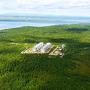 Oil depot
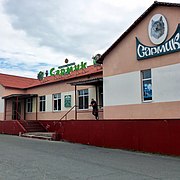 Sarmik Fishing and hunting shop


Yamal Airlines has its head office in Salekhard.[13] Most of residents are employed in reindeer herding, fishing and the services sector.[14]
By 2015, about 3 kilometres (1.9 miles) from the airport, near the Arctic circle, authorities plan to build a large polar resort "Center of the Arctic tourism."
Transportation
Salekhard is located in the Ob river valley and is an important river port of the Russian Far North. The unfinished Salekhard–Igarka Railway was set to provide a rail connection between the Ob river port of Salekhard and the Yenisei river port of Igarka. Currently, the nearest railway is at Labytnangi (on the Salekhard–Igarka Railway), 20 kilometres (12 mi) northwest on the opposite side of the river Ob. The project Northern Latitudinal Railway will provide Salekhard access to Russian railway and will further connect Salekhard to the Konosha-Vorkuta railway and other parts of European Russia.[15] the Salekhard Bridge project, the combined railway-road bridge over Ob river, is the main component of Northern Latitudinal Railway that connect Labytnangi and Salekhard is to be constructed with cost of 60 billion rubles.[16] Nadym-Salekhard road, a 344 km long road, has been inaugurated since December 2020 to the 90th anniversary of the Yamalo-Nenets Autonomous Okrug[17],which facilate the construction and railway between two cities and Connects East & West part of Yamal.[18][19] For 9–10 months each year, the Ob river is frozen and cars and trucks can cross via the river ice. In the summer a ferry operates, however during the floating of ice, generally shortly before the start and shortly after the end of summer, Salekhard is effectively isolated from the outside world, regarding freight. During these periods, only helicopters are able to reach Salekhard in case of emergency. Native people, mainly the Nenets and Khanty people, always build up stocks of food at home, in the shops, and in the markets during this period, but they still suffer from seasonal inflation.[20] The city is also served by the Salekhard Airport, which is 7 kilometres (4.3 mi) north of the main city.
 Ferry across the Ob river
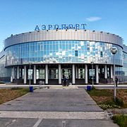
 Salekhard port on Ob river
 Bus transport
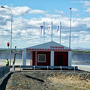 Ferry service station
 Fakel(Torch) Bridge over Poluy river


Climate
Salekhard has a subarctic climate (Köppen climate classification Dfc) with short, mild summers and severely cold winters. Precipitation is moderate, and is significantly greater in summer than in winter.
| Climate data for Salekhard (1991–2020, extremes 1882–present) | |||||||||||||
|---|---|---|---|---|---|---|---|---|---|---|---|---|---|
| Month | Jan | Feb | Mar | Apr | May | Jun | Jul | Aug | Sep | Oct | Nov | Dec | Year |
| Record high °C (°F) | 3.5 (38.3) |
3.3 (37.9) |
7.3 (45.1) |
15.5 (59.9) |
28.4 (83.1) |
31.6 (88.9) |
32.9 (91.2) |
30.4 (86.7) |
24.8 (76.6) |
18.2 (64.8) |
7.0 (44.6) |
4.1 (39.4) |
32.9 (91.2) |
| Average high °C (°F) | −18.8 (−1.8) |
−17.7 (0.1) |
−9.2 (15.4) |
−2.3 (27.9) |
4.7 (40.5) |
15.2 (59.4) |
20.0 (68.0) |
15.9 (60.6) |
9.3 (48.7) |
0.2 (32.4) |
−10.5 (13.1) |
−15.6 (3.9) |
−0.7 (30.7) |
| Daily mean °C (°F) | −23.1 (−9.6) |
−22 (−8) |
−14.2 (6.4) |
−7.3 (18.9) |
0.4 (32.7) |
10.3 (50.5) |
15.0 (59.0) |
11.6 (52.9) |
5.7 (42.3) |
−2.7 (27.1) |
−14.5 (5.9) |
−19.9 (−3.8) |
−5.1 (22.8) |
| Average low °C (°F) | −27.7 (−17.9) |
−26.6 (−15.9) |
−19.3 (−2.7) |
−12.1 (10.2) |
−3.5 (25.7) |
5.8 (42.4) |
9.9 (49.8) |
7.3 (45.1) |
2.4 (36.3) |
−5.8 (21.6) |
−18.9 (−2.0) |
−24.3 (−11.7) |
−9.4 (15.1) |
| Record low °C (°F) | −51.9 (−61.4) |
−53.7 (−64.7) |
−47.4 (−53.3) |
−38.7 (−37.7) |
−30.8 (−23.4) |
−11 (12) |
−1 (30) |
−5.5 (22.1) |
−10 (14) |
−35.7 (−32.3) |
−47.1 (−52.8) |
−51.5 (−60.7) |
−53.7 (−64.7) |
| Average precipitation mm (inches) | 24 (0.9) |
21 (0.8) |
23 (0.9) |
28 (1.1) |
44 (1.7) |
57 (2.2) |
61 (2.4) |
67 (2.6) |
46 (1.8) |
48 (1.9) |
31 (1.2) |
26 (1.0) |
476 (18.7) |
| Average extreme snow depth cm (inches) | 36 (14) |
40 (16) |
45 (18) |
36 (14) |
17 (6.7) |
0 (0) |
0 (0) |
0 (0) |
0 (0) |
5 (2.0) |
20 (7.9) |
30 (12) |
45 (18) |
| Average rainy days | 0 | 0 | 1 | 3 | 10 | 17 | 18 | 20 | 20 | 9 | 1 | 0 | 99 |
| Average snowy days | 26 | 25 | 23 | 18 | 17 | 4 | 0.03 | 0.2 | 5 | 21 | 25 | 27 | 191 |
| Average relative humidity (%) | 83 | 82 | 81 | 78 | 77 | 70 | 72 | 79 | 82 | 86 | 85 | 83 | 80 |
| Mean monthly sunshine hours | 4 | 48 | 135 | 209 | 233 | 270 | 307 | 185 | 96 | 57 | 18 | 0 | 1,562 |
| Source 1: Pogoda.ru.net[21] | |||||||||||||
| Source 2: NOAA (sun only, 1961-1990)[22] | |||||||||||||
Gallery
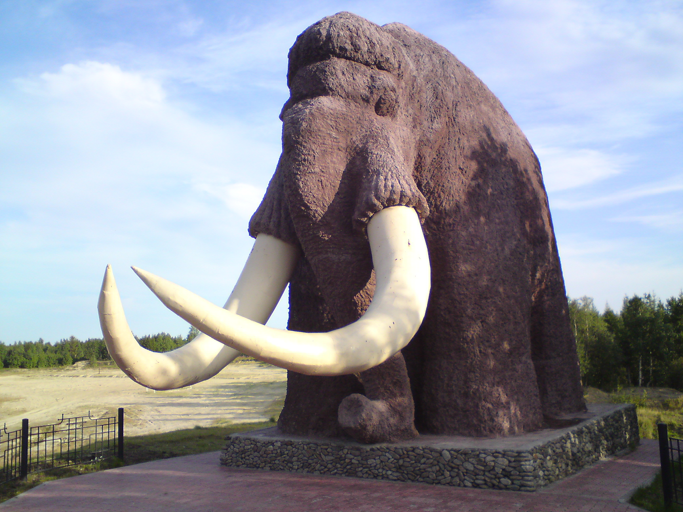
 Mammoth monument in Salekhard
 Mammoth monument in Salekhard
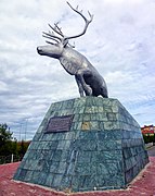 reindeer monument in Salekhard
 Mosque in Salekhard
 Ice Palace of Salekhard
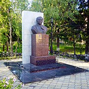 Monument to K.I. Mironov
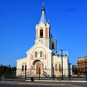 Church of Saints Peter and Paul
 "Polyaris" Entertainment center
 Wedding Palace
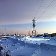 North Outskirts of Salekhard
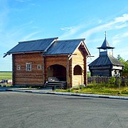 City Masters
 Arctic Hotel
 Student Sports complex .


International relations
Twin towns and sister cities
Salekhard is twinned with:
- Azov, Rostov Oblast, Russia
See also
 Siberia portal
References
Notes
- Law #42-ZAO
- Russian Federal State Statistics Service (2011). Всероссийская перепись населения 2010 года. Том 1 [2010 All-Russian Population Census, vol. 1]. Всероссийская перепись населения 2010 года [2010 All-Russia Population Census] (in Russian). Federal State Statistics Service.
- Law #26-ZAO
- "Об исчислении времени". Официальный интернет-портал правовой информации (in Russian). June 3, 2011. Retrieved January 19, 2019.
- Почта России. Информационно-вычислительный центр ОАСУ РПО. (Russian Post). Поиск объектов почтовой связи (Postal Objects Search) (in Russian)
- Телефонные коды городов (in Russian). Retrieved 2010-09-24.
- Thomas, George. "Stalin's 'Railroad of Death' Witnesses Revival". CBN News. Retrieved May 27, 2013.
- Gonzales, Daria (June 7, 2012). "A living city among dead roads". RBTH. Retrieved July 9, 2015.
- "Arctic Council Salekhard Ministerial Declaration". October 2006.
- "Rostelecom to expand network in Yamal". www.telecompaper.com. Retrieved February 23, 2018.
- Alec Luhn (August 1, 2016). "Anthrax outbreak triggered by climate change kills boy in Arctic Circle Seventy-two nomadic herders, including 41 children, were hospitalised in far north Russia after the region began experiencing abnormally high temperatures". The Guardian. Retrieved August 4, 2016.
- "ВПН том 4. Таблица 4. Население по национальности и владению русским языком по муниципальным образованиям Ямало-Ненецкого автономного округа" (PDF). Yamalstat. Archived from the original (PDF) on December 13, 2016. Retrieved September 20, 2020.
- Yamal Airlines. Retrieved on February 27, 2012.
- "What is life like in the world's only city built on the Arctic Circle?". February 2, 2021.
- Ямальская дорога в зеркале мнений — Парламентская газета «Тюменские известия». old.t-i.ru. Проверено 5 марта 2016.
- "С крымского моста – на Ямал: строительство Северного широтного хода".
- "Дорогу Надым – Салехард официально откроют 9 декабря".
- "На Ямале открылся круглогодичный проезд по дороге Надым — Салехард".
- "New Arctic Road Connects East & West Yamal in Asian Russia". December 18, 2020.
- 2010/2011 visitor Любовь
- "Pogoda.ru.net - Climate Data for Salekhard" (in Russian). Retrieved November 8, 2021.
- "Salekhard Climate Normals 1961-1990". National Oceanic and Atmospheric Administration. Retrieved November 7, 2021.
Sources
- Государственная Дума Ямало-Ненецкого автономного округа. Закон №42-ЗАО от 6 октября 2006 г. «Об административно-территориальном устройстве Ямало-Ненецкого автономного округа», в ред. Закона №123-ЗАО от 6 декабря 2012 г. «О внесении изменений в некоторые Законы Ямало-Ненецкого автономного округа в части изменения вида населённого пункт Тазовский путём отнесения его к сельским пунктам и наделении муниципального образования посёлок Тазовский статусом сельского поселения». Вступил в силу по истечении десяти дней со дня официального опубликования. Опубликован: "Красный Север", №119, 13 октября 2006 г. (State Duma of Yamalo-Nenets Autonomous Okrug. Law #42-ZAO of October 6, 2006 On the Administrative-Territorial Structure of Yamalo-Nenets Autonomous Okrug, as amended by the Law #123-ZAO of December 6, 2012 On Amending Various Laws of Yamalo-Nenets Autonomous Okrug Due to Changing the Status of the Inhabited Locality of Tazovsky to a Rural Locality and on Granting the Municipal Formation of the Settlement of Tazovsky the Status of a Rural Settlement. Effective as of the day upon expiration of ten days from the official publication date.).
- Государственная Дума Ямало-Ненецкого автономного округа. Закон №26-ЗАО от 22 июня 2004 г. «О наделении статусом, определении административного центра и установлении границ муниципального образования город Салехард», в ред. Закона №100-ЗАО от 31 октября 2012 г. «О внесении изменения в Закон Ямало-Ненецкого автономного округа "О наделении статусом, определении административного центра и установлении границ муниципального образования город Салехард"». Вступил в силу со дня официального опубликования. Опубликован: "Красный Север", №50, 23 июня 2004 г. (State Duma of Yamalo-Nenets Autonomous Okrug. Law #26-ZAO of June 22, 2004 On Granting the Status, Determining the Administrative Center, and Establishing the Borders of the Municipal Formation of the Town of Salkhard, as amended by the Law #100-ZAO of October 31, 2012 On Amending the Law of Yamalo-Nenets Autonomous Okrug "On Granting the Status, Determining the Administrative Center, and Establishing the Borders of the Municipal Formation of the Town of Salkhard". Effective as of the day of the official publication.).
External links
- (in Russian) Official website of Salekhard
- Official website of Yamalo-Nenets Autonomous Okrug. Information about Salekhard
Administrative divisions of Yamalo-Nenets Autonomous Okrug | |||
|---|---|---|---|
Administrative center: Salekhard • Rural localities | |||
| Districts |
| ||
| Cities and towns | |||
| Urban-type settlements |
| ||
Authority control | |
|---|---|
| General |
|
| National libraries | |
На других языках
[de] Salechard
Salechard (russisch Салехард; nenzisch Саля'харад, Haus auf Halbinsel) ist eine russische Stadt mit 42.544 Einwohnern (Stand 14. Oktober 2010)[1] in Nordsibirien. Sie ist der Hauptort des Autonomen Kreises der Jamal-Nenzen.- [en] Salekhard
[ru] Салехард
Салеха́рд[2] (от нен. Саля' хард «поселение на мысу», хант. Пуӆңават, до 1933 года — Обдорск) — город в России, административный центр Ямало-Ненецкого автономного округа.Другой контент может иметь иную лицензию. Перед использованием материалов сайта WikiSort.org внимательно изучите правила лицензирования конкретных элементов наполнения сайта.
WikiSort.org - проект по пересортировке и дополнению контента Википедии