world.wikisort.org - Philippines
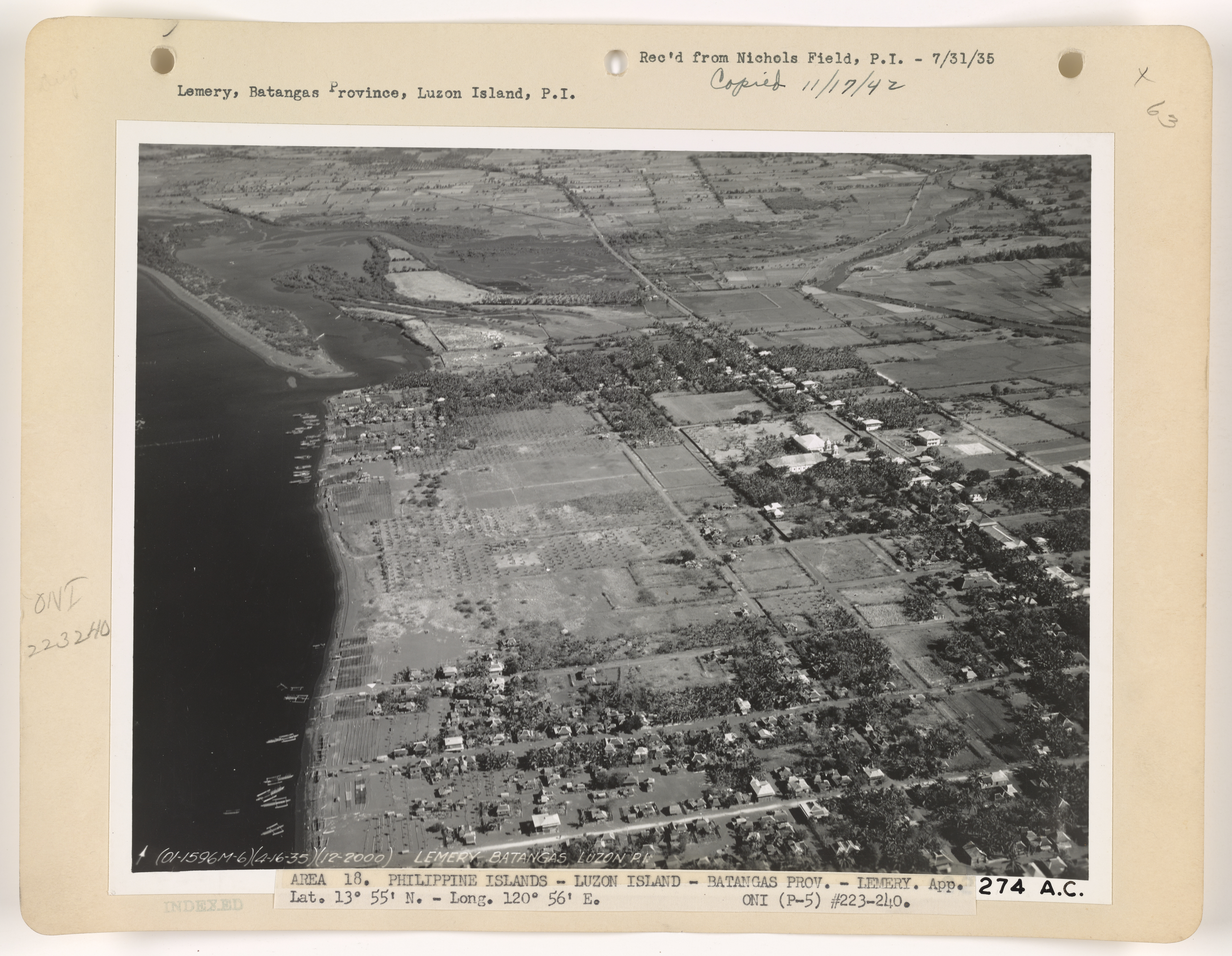
Lemery, officially the Municipality of Lemery (Tagalog: Bayan ng Lemery), is a 1st class municipality in the province of Batangas, Philippines. According to the 2020 census, it has a population of 93,186 people. [3]
Lemery | |
|---|---|
Municipality | |
| Municipality of Lemery | |
 Welcome Arch of Lemery | |
 Seal | |
 Map of Batangas with Lemery highlighted | |
OpenStreetMap  | |
 Lemery Location within the Philippines | |
| Coordinates: 13°55′N 120°53′E | |
| Country | Philippines |
| Region | Calabarzon |
| Province | Batangas |
| District | 1st district |
| Founded | May 26, 1862 |
| Chartered | October 25, 1906 |
| Barangays | 46 (see Barangays) |
| Government | |
| • Type | Sangguniang Bayan |
| • Mayor | Ian Kenneth M. Alilio |
| • Vice Mayor | Geraldine C. Ornales |
| • Representative | Joseph Eric R. Buhain |
| • Municipal Council | Members |
| • Electorate | 55,827 voters (2022) |
| Area | |
| • Total | 109.80 km2 (42.39 sq mi) |
| Elevation | 123 m (404 ft) |
| Highest elevation | 779 m (2,556 ft) |
| Lowest elevation | 0 m (0 ft) |
| Population | |
| • Total | 93,186 |
| • Density | 850/km2 (2,200/sq mi) |
| • Households | 21,122 |
| Economy | |
| • Income class | 1st municipal income class |
| • Poverty incidence | 10.67% (2018)[4] |
| • Revenue | ₱239,978,168.49 (2020) |
| • Assets | ₱601,592,463.02 (2020) |
| • Expenditure | ₱230,591,898.92 (2020) |
| • Liabilities | ₱62,806,146.38 (2020) |
| Service provider | |
| • Electricity | Batangas 1 Electric Cooperative (BATELEC 1) |
| Time zone | UTC+8 (PST) |
| ZIP code | 4209 |
| PSGC | |
| IDD : area code | +63 (0)43 |
| Native languages | Tagalog |
| Website | www |
Lemery is a growing urban center in western Batangas. The municipality was named after Captain Roberto Lemery, a commanding officer of the local garrison. He took command of the local military outpost until his death in 1856.
History
This article needs additional citations for verification. (June 2020) |

During the early part of the 18th century, adventurous settlers from Taal, northern Mindoro and southern Cavite were attracted to the vast plain near the shores of Balayan Bay because of its abundance in fish and other marine life. Salting and drying fish became their major occupation due to the great demand of salted and dried fish by the people of Cavite, Mindoro, Laguna and Batangas. People came in great numbers to join the settlers, and the village became populous. The place was first called Punta, meaning "point". In 1818, the village of Punta was converted into one of the barrios of the Municipality of Taal. It was later renamed San Geronimo.
In 1858, the barrio of San Geronimo became officially known as Lemery, after Captain Roberto Lemery, a commanding officer of the local military garrison. Captain Lemery was known for his deep ties with the community. Although he was tasked with instructing the military personnel assigned to the garrison, he went out of his way to immerse himself with the locals. He formed relationships with heads of the local church to learn the local language and cultivate harmony among the populace. When he died in 1856, the locals wished for the town to be renamed in honor of Captain Lemery.
In 1862, Lemery and its surrounding barrios were separated from the Municipality of Taal. It became a district municipality through the efforts of Candida Cesario Valenzuela, Manuel Cabrera, Policarpio Mariño and Domingo Agoncillo. Jose Cabrera became the First Gobernadorcillo of the newly created town.
The local military garrison was officially incorporated into the Guardia Civil upon the latter's creation in 1868. This newly formed organization was a gendarmerie tasked with law enforcement in the Philippines. It operated under the Spanish Army and Spanish colonial government and remained the de facto police force in the entire Philippines until its independence from Spain in 1898.
For economic considerations, Lemery was again annexed to Taal in 1904. Finally by virtue of Executive Order 1549 of the Philippine Civil Commission, it became an independent municipality in 1907.
Geography
According to the Philippine Statistics Authority, the municipality has a land area of 109.80 square kilometres (42.39 sq mi) [5] constituting 3.52% of the 3,119.75-square-kilometre- (1,204.54 sq mi) total area of Batangas.
Lemery is 25 kilometres (16 mi) from Batangas City and 130 kilometres (81 mi) from Manila.
Barangays
Lemery is politically subdivided into 46 barangays.[6] In 1957, the sitio of Bagong Pook was separated from the barrio of Arumahan and constituted into an independent barrio,[7] while sitio of Masalisi was separated from Payapa.[8]
| PSGC | Barangay | Population | ±% p.a. | |||
|---|---|---|---|---|---|---|
| 2020 [3] | 2010 [9] | |||||
| 041012001 | Anak‑Dagat | 1.9% | 1,803 | 1,715 | 0.48% | |
| 041012002 | Arumahan | 2.6% | 2,403 | 2,273 | 0.53% | |
| 041012003 | Ayao‑iyao | 4.0% | 3,683 | 2,690 | 3.02% | |
| 041012004 | Bagong Pook | 1.4% | 1,336 | 1,173 | 1.24% | |
| 041012005 | Bagong Sikat | 1.5% | 1,375 | 1,375 | 0.00% | |
| 041012006 | Balanga | 1.1% | 1,050 | 955 | 0.90% | |
| 041012007 | Bukal | 2.3% | 2,159 | 1,814 | 1.66% | |
| 041012009 | Cahilan I | 2.3% | 2,189 | 2,021 | 0.76% | |
| 041012010 | Cahilan II | 1.8% | 1,631 | 1,519 | 0.68% | |
| 041012011 | Dayapan | 2.9% | 2,674 | 2,599 | 0.27% | |
| 041012012 | Dita | 1.4% | 1,281 | 1,167 | 0.89% | |
| 041012013 | Gulod | 1.9% | 1,791 | 1,598 | 1.09% | |
| 041012014 | Lucky | 1.0% | 909 | 622 | 3.66% | |
| 041012015 | Maguihan | 2.6% | 2,450 | 1,933 | 2.27% | |
| 041012016 | Mahabang Dahilig | 2.0% | 1,873 | 1,584 | 1.60% | |
| 041012017 | Mahayahay | 1.6% | 1,505 | 1,466 | 0.25% | |
| 041012018 | Maigsing Dahilig | 1.3% | 1,168 | 901 | 2.49% | |
| 041012020 | Maligaya | 1.4% | 1,281 | 1,199 | 0.63% | |
| 041012021 | Malinis | 2.2% | 2,030 | 1,657 | 1.94% | |
| 041012022 | Masalisi | 1.1% | 1,054 | 997 | 0.53% | |
| 041012023 | Mataas na Bayan | 3.3% | 3,035 | 2,764 | 0.89% | |
| 041012024 | Matingain I | 3.8% | 3,543 | 3,098 | 1.28% | |
| 041012025 | Matingain II | 1.6% | 1,449 | 1,285 | 1.15% | |
| 041012026 | Mayasang | 2.6% | 2,439 | 2,439 | 0.00% | |
| 041012027 | Niogan | 1.6% | 1,537 | 1,443 | 0.60% | |
| 041012028 | Nonong Casto | 3.4% | 3,130 | 2,653 | 1.58% | |
| 041012029 | Palanas | 3.3% | 3,103 | 2,638 | 1.55% | |
| 041012030 | Payapa Ibaba | 2.2% | 2,089 | 1,859 | 1.11% | |
| 041012031 | Payapa Ilaya | 3.7% | 3,457 | 3,127 | 0.96% | |
| 041012032 | District I (Poblacion) | 1.5% | 1,413 | 1,164 | 1.86% | |
| 041012033 | District II (Poblacion) | 1.0% | 917 | 1,071 | −1.46% | |
| 041012034 | District III (Poblacion) | 0.5% | 442 | 268 | 4.86% | |
| 041012035 | District IV (Poblacion) | 2.4% | 2,223 | 1,762 | 2.23% | |
| 041012036 | Rizal | 0.9% | 794 | 721 | 0.92% | |
| 041012037 | Sambal Ibaba | 2.2% | 2,050 | 1,737 | 1.58% | |
| 041012038 | Sambal Ilaya | 4.6% | 4,265 | 3,745 | 1.24% | |
| 041012039 | San Isidro Ibaba | 1.6% | 1,484 | 1,368 | 0.77% | |
| 041012040 | San Isidro Itaas | 3.8% | 3,507 | 2,777 | 2.24% | |
| 041012041 | Sangalang | 2.3% | 2,101 | 1,937 | 0.77% | |
| 041012043 | Talaga | 3.5% | 3,291 | 2,784 | 1.60% | |
| 041012044 | Tubigan | 1.5% | 1,390 | 1,016 | 3.02% | |
| 041012045 | Tubuan | 1.2% | 1,151 | 1,109 | 0.35% | |
| 041012046 | Wawa Ibaba | 3.1% | 2,934 | 2,593 | 1.18% | |
| 041012047 | Wawa Ilaya | 1.9% | 1,779 | 1,523 | 1.48% | |
| 041012048 | Sinisian East | 2.1% | 1,977 | 1,890 | 0.43% | |
| 041012049 | Sinisian West | 2.2% | 2,012 | 1,796 | 1.08% | |
| Total | 93,186 | 81,825 | 1.24% | |||
Climate
| Climate data for Lemery, Batangas | |||||||||||||
|---|---|---|---|---|---|---|---|---|---|---|---|---|---|
| Month | Jan | Feb | Mar | Apr | May | Jun | Jul | Aug | Sep | Oct | Nov | Dec | Year |
| Average high °C (°F) | 29 (84) |
30 (86) |
31 (88) |
33 (91) |
32 (90) |
30 (86) |
29 (84) |
29 (84) |
29 (84) |
29 (84) |
29 (84) |
29 (84) |
30 (86) |
| Average low °C (°F) | 20 (68) |
20 (68) |
21 (70) |
22 (72) |
24 (75) |
24 (75) |
24 (75) |
24 (75) |
24 (75) |
23 (73) |
22 (72) |
21 (70) |
22 (72) |
| Average precipitation mm (inches) | 11 (0.4) |
13 (0.5) |
14 (0.6) |
32 (1.3) |
101 (4.0) |
142 (5.6) |
208 (8.2) |
187 (7.4) |
175 (6.9) |
131 (5.2) |
68 (2.7) |
39 (1.5) |
1,121 (44.3) |
| Average rainy days | 5.2 | 5.0 | 7.4 | 11.5 | 19.8 | 23.5 | 27.0 | 25.9 | 25.2 | 23.2 | 15.5 | 8.3 | 197.5 |
| Source: Meteoblue[10] | |||||||||||||
Demographics
|
| |||||||||||||||||||||||||||||||||||||||||||||||||||
| Source: Philippine Statistics Authority [11] [9] [12][13] | ||||||||||||||||||||||||||||||||||||||||||||||||||||
In the 2020 census, Lemery had a population of 93,186. [3] The population density was 850 inhabitants per square kilometre (2,200/sq mi).
Most of the people in Lemery are Tagalogs. In recent years, there has been a noticeable increase of Visayans in some barrios or barangays. The main language spoken is Tagalog, and a significant number now speaks Cebuano. Most of the residents can also understand and speak English.
Economy

In the Rankings of Cities and Municipalities that are based on the sum of their scores on 3 Pillars: Economic Dynamism, Government Efficiency, and Infrastructure. In 2016, Lemery ranked 75th out of 479 municipalities, with total score of 28.252921.
Lemery is a first class municipality by income classification. The primary source of income is agricultural activities, including crop production, livestock and poultry, with 30 out of 46 barangays involved in it.[21] As a coastal municipality with 13 barangays located along the shore, fishing activities are also significant contributor to the local economy.
The municipality also serves as a provincial urban center for its surrounding rural municipalities including Taal, San Nicolas, Agoncillo and San Luis. It hosts the largest public high school in the first legislative district of Batangas, a private college (Lemery Colleges), a campus of a public university (Batangas State University)and the Batangas Provincial Hospital. Furthermore, bus lines from Manila serving the Southern Tagalog Region reach Central Batangas by way of Lemery. Vans also connect the town to and from other urban centers in the region such as Dasmariñas, Calamba and Lucena.
In February 2014, Xentro Mall Lemery, a community mall, opened in the Diversion Road, further cementing Lemery's position as a growing commercial center. In December 2017, SM Center Lemery opened.
Transportation
Lemery is accessible by bus from Manila via the South Luzon Expressway (SLEX). The Lipa-Lemery Road connects the STAR Tollway in Lipa to Lemery, passing a number of municipalities along the southern shores of Taal Lake. Lemery can also be reached from Tagaytay via the Diokno Highway. Furthermore, there are vans connecting Manila to Lemery.
Government

Elected officials:
- Mayor: Ian Kenneth M. Alilio
- Vice Mayor: Geraldine C. Ornales
- Councilors:
- Maria Hanalee V. Bustos
- Hannah Beatriz C. Cabral
- Aris Kenneth C. Punzalan
- Christopher Jones M. Bello
- Rosendo R. Eguia
- Rodolfo De Castro
- Napoleon M. Piol
- Susan B. Vidal
Health

Some of the health institutions in Lemery include:
- Batangas Provincial Hospital
- Metro Lemery Medical Center
- Our Lady of Caysasay Medical Center
- Lemery Doctors Medical Center
- Little Angels Medical Hospital
Education
Schools in Lemery include:
Elementary schools
- Lemery Pilot Elementary School
- R. Venturanza Central School
- V. Ornales Memorial Elementary School
Private schools

- Christian Knights Academy
- Escuela De Shalom
- Glorious Faith Christian School
- Maranatha Shekinah Christian School
- Philadelphia Montessorian Academy
- Saint Mary's Educational Institute
- Swiss Montessori School
- Universal Scholastica Academe
National high schools
- Ananias Hernandez Memorial National High School
- Dionisio P. Vito National High School
- Gov. Feliciano Leviste Memorial National High School (formerly Batangas West High School)
- Payapa National High School
- Lemery Senior High School - since 2016
Colleges
- Batangas State University-Lemery campus[22]
- Lemery Colleges
References
- Municipality of Lemery | (DILG)
- "2015 Census of Population, Report No. 3 – Population, Land Area, and Population Density" (PDF). Philippine Statistics Authority. Quezon City, Philippines. August 2016. ISSN 0117-1453. Archived (PDF) from the original on May 25, 2021. Retrieved July 16, 2021.
- Census of Population (2020). "Region IV-A (Calabarzon)". Total Population by Province, City, Municipality and Barangay. PSA. Retrieved 8 July 2021.
- "PSA Releases the 2018 Municipal and City Level Poverty Estimates". Philippine Statistics Authority. 15 December 2021. Retrieved 22 January 2022.
- "Province: Batangas". PSGC Interactive. Quezon City, Philippines: Philippine Statistics Authority. Retrieved 12 November 2016.
- "Municipal: Lemery, Batangas". PSGC Interactive. Quezon City, Philippines: Philippine Statistics Authority. Retrieved 8 January 2016.
- "An Act Creating the Barrio of Bagong Pook in the Municipality of Lemery, Province of Batangas". LawPH.com. Retrieved 2011-04-12.
- "An Act Creating the Barrio of Masalisi in the Municipality of Lemery, Province of Batangas". LawPH.com. Retrieved 2011-04-12.
- Census of Population and Housing (2010). "Region IV-A (Calabarzon)". Total Population by Province, City, Municipality and Barangay. NSO. Retrieved 29 June 2016.
- "Lemery: Average Temperatures and Rainfall". Meteoblue. Retrieved 5 May 2020.
- Census of Population (2015). "Region IV-A (Calabarzon)". Total Population by Province, City, Municipality and Barangay. PSA. Retrieved 20 June 2016.
- Censuses of Population (1903–2007). "Region IV-A (Calabarzon)". Table 1. Population Enumerated in Various Censuses by Province/Highly Urbanized City: 1903 to 2007. NSO.
- "Province of Batangas". Municipality Population Data. Local Water Utilities Administration Research Division. Retrieved 17 December 2016.
- "Poverty incidence (PI):". Philippine Statistics Authority. Retrieved 28 December 2020.
- https://psa.gov.ph/sites/default/files/NSCB_LocalPovertyPhilippines_0.pdf; publication date: 29 November 2005; publisher: Philippine Statistics Authority.
- https://psa.gov.ph/sites/default/files/2003%20SAE%20of%20poverty%20%28Full%20Report%29_1.pdf; publication date: 23 March 2009; publisher: Philippine Statistics Authority.
- https://psa.gov.ph/sites/default/files/2006%20and%202009%20City%20and%20Municipal%20Level%20Poverty%20Estimates_0_1.pdf; publication date: 3 August 2012; publisher: Philippine Statistics Authority.
- https://psa.gov.ph/sites/default/files/2012%20Municipal%20and%20City%20Level%20Poverty%20Estima7tes%20Publication%20%281%29.pdf; publication date: 31 May 2016; publisher: Philippine Statistics Authority.
- https://psa.gov.ph/sites/default/files/City%20and%20Municipal-level%20Small%20Area%20Poverty%20Estimates_%202009%2C%202012%20and%202015_0.xlsx; publication date: 10 July 2019; publisher: Philippine Statistics Authority.
- "PSA Releases the 2018 Municipal and City Level Poverty Estimates". Philippine Statistics Authority. 15 December 2021. Retrieved 22 January 2022.
- "Annual Audit Report". Commission on Audit. Retrieved 18 August 2017.
- "History – Batangas State University- Lemery Campus". Batstateulemerycampus.weebly.com. 2003-05-23. Retrieved 2016-11-29.
External links
Places adjacent to Lemery, Batangas | ||||||||||||||||
|---|---|---|---|---|---|---|---|---|---|---|---|---|---|---|---|---|
| ||||||||||||||||
Batangas City (capital) | |
| Component cities | |
| Municipalities | |
Authority control | |
|---|---|
| General |
|
| National libraries | |
На других языках
[de] Lemery (Batangas)
Lemery ist eine philippinische Stadtgemeinde in der Provinz Batangas. Sie hat 93.157 Einwohner (Zensus 1. August 2015). Die Gemeinde liegt an der Balayan-Bucht.- [en] Lemery, Batangas
Другой контент может иметь иную лицензию. Перед использованием материалов сайта WikiSort.org внимательно изучите правила лицензирования конкретных элементов наполнения сайта.
WikiSort.org - проект по пересортировке и дополнению контента Википедии