world.wikisort.org - New_Zealand
West Auckland (Māori: Te Uru o Tāmaki Makaurau) is one of the major geographical areas of Auckland, the largest city in New Zealand. Much of the area is dominated by the Waitākere Ranges, the eastern slopes of the Miocene era Waitākere volcano which was upraised from the ocean floor, and one of the largest regional parks in New Zealand. The metropolitan area of West Auckland developed on the lands between the Waitākere Ranges to the west and the upper reaches of the Waitematā Harbour to the east, in areas such as Massey, Henderson, New Lynn and Glen Eden.
West Auckland | |
|---|---|
 Metropolitan West Auckland captured by a Planet Labs satellite in 2016 | |
 West Auckland Location in the Auckland Region | |
| Coordinates: 36°48′S 174°36′E | |
| Country | New Zealand |
| Island | North Island |
| Region | Auckland Region |
The area is within the rohe of Te Kawerau ā Maki, whose traditional names for the area were Hikurangi, Waitākere, and Te Wao Nui a Tiriwa, the latter of which refers to the forest of the greater Waitākere Ranges area. Most settlements and pā were centred around the west coast beaches and the Waitākere River valley. Two of the major waka portages are found in the area: the Te Tōanga Waka (the Whau River portage), and Te Tōangaroa (the Kumeū portage), connecting the Waitematā, Manukau and Kaipara harbours.
European settlement of the region began in the 1840s, centred around the kauri logging trade. Later industries developed around kauri gum digging, orchards, vineyards and the clay brickworks of the upper Waitematā Harbour estuaries, most notably at New Lynn on the Whau River. Originally isolated from the developing city of Auckland on the Auckland isthmus, West Auckland developed after being connected to the North Auckland railway line in 1880 and the Northwestern Motorway in the 1950s.
Definition and etymologies

West Auckland is not a strictly defined area. It includes the former Waitakere City, which existed between 1989 and 2010 between the Whau River and Hobsonville.[1][2] The Whau River and Te Tōanga Waka (the Whau portage), which marked the border between the former Waitakere and Auckland cities had divided Eden County from Waitemata County since 1876,[3] and originally dating back much earlier, as the rohe marker between Te Kawerau ā Maki and Tāmaki isthmus iwi.[4] West Auckland typically also includes Avondale,[5] and Blockhouse Bay,[6][7] two suburbs to the east of the Whau border on the Auckland isthmus, due to their strong historical ties.[8] Towns in southwestern Rodney, such as Helensville, Riverhead, Waimauku, Kumeū and Huapai are also often described as West Auckland.[9][10][11] Occasionally a stricter definition is used, including just the Henderson-Massey, Waitākere Ranges and Whau local board areas.[12][13][14]
The traditional Tāmaki Māori names for the area include Hikurangi, Waitākere, Whakatū and Te Wao Nui a Tiriwa. Hikurangi referred to the central and western Waitākere Ranges south of the Waitākere River,[15] and was originally a name given by Rakatāura, the tohunga of the Tainui migratory canoe to a location south of Piha, likely referring to meaning the area where the last light of day reaches. This is a name commonly used as a placename across Polynesia.[16][15] The name Wai-tākere ("cascading water") originated as a name for a rock at Te Henga / Bethells Beach found at the former mouth of the Waitākere River,[17][18] which was later applied to the river, Ranges, and West Auckland in general.[15] The name refers to the action of the water striking the rock as the waves came into shore, and became popularised in the early 18th century during Te Raupatu Tihore ("The Stripping Conquest"), when a Te Kawerau ā Maki chief's body was lain on this rock.[19]
The name Whakatū is the traditional name for the Tasman Sea and west coast beaches of West Auckland south of Te Henga / Bethells Beach. It is a shortening of the name Nga Tai Whakatū a Kupe ("The Upraised Seas of Kupe"), referring to Kupe's visit to the west coast and his attempts to evade people pursuing him, by chanting a karakia to make the west coast seas rough.[20][21] Te Wao Nui a Tiriwa, the Great Forest of Tiriwa, references the name of Tiriwa, a chief of the supernatural Tūrehu people.[22] The name refers to all of the forested areas of the Waitākere Ranges south from Muriwai and the Kaipara Harbour portage to the Manukau Harbour.[15]
The modern use of West Auckland to refer to areas such as New Lynn and Henderson was popularised in the 1960s and 1970s.[23][24][25] Prior to this, West Auckland or Western Auckland mostly referred to the western portions of the old Auckland City, such as Ponsonby and Kingsland.[26][27][28][29] The township of Auckland was named in 1840 by William Hobson, after patron George Eden, 1st Earl of Auckland.[30]
Natural history
22 million years ago, due to subduction of the Pacific Plate, most of the Auckland Region was pushed 2,000–3,000 metres down to the sea floor, forming a sedimentary basin.[31] Approximately 20 million years ago, this subduction led to the formation of the Waitākere volcano, a partially submerged volcano located to the west of the modern Auckland Region.[32] The volcano is the largest stratovolcano in the geologic history of New Zealand, over 50 kilometres in diameter and reaching an estimated height of 4,000 metres above the sea floor.[33] Between 3 and 5 million years ago, tectonic forces uplifted the Waitākere Ranges and central Auckland, while subsiding the Manukau and upper Waitematā Harbours.[34] The Waitākere Ranges are the remnants of the eastern slopes of the Waitākere volcano, while the lowlands of suburban West Auckland are formed of Waitemata Group sandstone from the ancient sedimentary basin.[31] Many of the areas directly adjacent to the Waitematā Harbour, such as New Lynn, Te Atatū and Hobsonville are formed from rhyolitic clays and peat, formed from eroding soil and interactions with the harbour.[31]
The modern shape of West Auckland began to form approximately 8,000 years ago, after sea level rises at the end of the Last Glacial Maximum.[35] Prior to this, the Manukau Harbour and Waitematā Harbour were forested river valleys,[35] and the Tasman Sea shoreline was over 20-kilometres west of its current location.[36] The mouths of the rivers of West Auckland flooded, forming into large estuaries. Tidal mudflats formed at the Manukau Harbour river mouths, such as Huia, Big Muddy Creek and Little Muddy Creek.[35] Sand dunes formed along the estuaries of the west coast, creating west coast beaches such as Piha and Te Henga / Bethells Beach.[35] The black ironsand of these beaches is volcanic material from Mount Taranaki (including the Pouakai Range and Sugar Loaf Islands volcanoes) which had drifted northwards, and potentially material from the Taupō Volcano and other central North Island volcanoes which travelled down the Waikato River as sediment.[31]
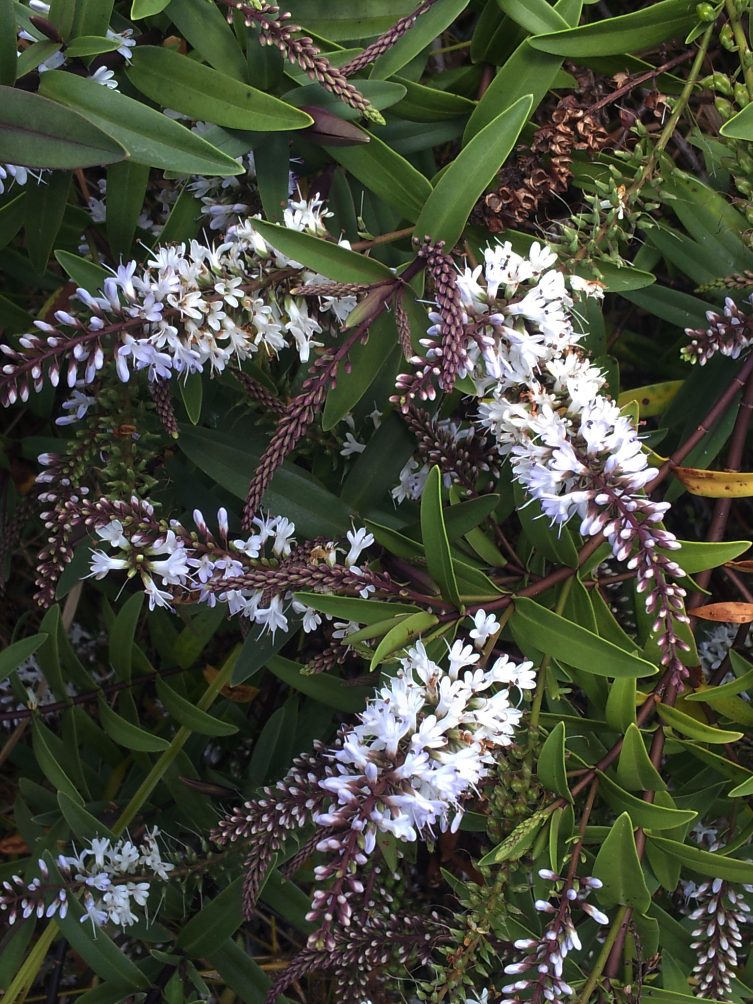
While much of West Auckland, especially the Waitākere Ranges, were historically dominated by kauri, northern rata, rimu most of the kauri trees were felled as a part of the kauri logging industry.[37][38] One plant species is native to West Auckland, Veronica bishopiana, the Waitākere rock koromiko. A number of other plant species are primarily found in coastal West Auckland, including Sophora fulvida, the west coast kōwhai and Veronica obtusata, the coastal hebe.[39][40] Sophora fulvida is a common sight in West Auckland; other species of kōwhai are not allowed to be planted west of Scenic Drive.[41] The Waitākere Ranges are known for the wide variety of ern species (over 110),[41] as well as native orchid species, many of which self-naturalised by seeds being carried by winds from the east coast of Australia.[42]
The areas of West Auckland close to the Waitematā Harbour such as Henderson, Te Atatū Peninsula and Whenuapai were formerly covered in broadleaf forest, predominantly kahikatea, pukatea trees, and a thick growth of nīkau palm trees.[41] As the soils around Titirangi and Laingholm are more sedimentary than the Waitākere Ranges volcanic soil, tōtara was widespread, alongside kohekohe, pūriri, karaka and nīkau palm trees.[41]
Human context
Māori history
Early settlement

The area was settled early in Māori history, by people arriving on Māori migration canoes such as the Moekākara and Tainui. Early tribal identities of Tāmaki Māori who settled in West Auckland include Tini o Maruiwi, Ngā Oho and Ngā Iwi.[43] One of the earliest individuals associated with the area is Tiriwa, a chief of the supernatural Tūrehu people, who is involved with the traditional story of the creation of Rangitoto Island, by uplifting it from Karekare on the west coast.[44] Early Polynesian navigator Kupe visited the west coast. The Tasman Sea alongside the coast was named for Kupe,[20] and traditional stories tell of Kupe leaving paddle marks on the side of Paratutae Island to commemorate his visit.[18] The Tainui tohunga Rakatāura (also known as Hape) was known to visit the region after arriving in New Zealand, naming many locations along the west coast,[15] and is the namesake of the Karangahape Peninsula at Cornwallis, and the name of the ancient walking track linking the peninsula to the central Tāmaki isthmus.[45][46]
Most Māori settlements in West Auckland centred around the west coast beaches and the Waitākere River valley, especially at Te Henga / Bethells Beach.[47][48] Instead of living in permanent settlements, Te Kawerau ā Maki and other earlier Tāmaki Māori groups seasonally migrated across the region.[49] The west coast was well known for their abundant seafood and productive soil for growing crops such as kūmara, taro, hue (calabash/bottle gourd), aruhe, and for the diversity of birds, eels, crayfish and berries found in the ranges.[50] Archaeological investigations of middens show evidence of regional trade between different early Māori people, due to the existence of pipi, cockle and mud-snail shells not native to the area.[48] Unlike most defensive pā found on the Auckland isthmus, not many Waitākere pā used defensive ditchwork, instead preferring natural barriers.[51]
Few settlements were found in the central Waitākere Ranges or in modern urban centres of West Auckland.[48] Some notable exceptions were near the portages where waka could be hauled between the three harbours of West Auckland: Te Tōangaroa, the portage linking the Kaipara Harbour in the north to the Waitematā Harbour via the Kaipara River and Kumeū River, and Te Tōanga Waka, the Whau River portage linking the Waitematā Harbour to the Manukau Harbour in the south.[48][18] Defensive pā and kāinga (villages) were found close to the portages and the major walking tracks across the area, including at the Opanuku Stream and the Huruhuru Creek.[48][52] A number of settlements also existed on the Te Atatū Peninsula, including Ōrukuwai and Ōrangihina.[18][52]
Te Kawerau ā Maki
In the early 1600s, members of Ngāti Awa from the Kawhia Harbour, most notably the rangatira Maki and his brother Matāhu, migrated north to the Tāmaki Makaurau region, where they had ancestral ties.[53] Maki conquered and united Tāmaki Māori people of the west coast and northern Auckland Region. Within a few generations, the name Te Kawerau ā Maki developed to refer to this collective. Those living on the west coast retained the name Te Kawerau ā Maki, while those living at Mahurangi (modern-day Warkworth) adopted the name Ngāti Manuhiri, and Ngāti Kahu for the people who settled on the North Shore.[54]
In the early 1700s, Ngāti Whātua migrated south into the Kaipara area (modern-day Helensville). While initially relations between the iwi were friendly and many important marriages were made between the peoples (some of which formed the Ngāti Whātua hapū Ngāti Rongo), hostilities broke out and Ngāti Whātua asked for assistance from Kawharu, a famed Tainui warrior from Kawhia. Kawharu's repeated attacks of the Waitākere Ranges settlements became known as Te Raupatu Tīhore, or the stripping conquest.[55][56] Lasting peace between Te Kawerau ā Maki and Ngāti Whātua was forged by Maki's grandson Te Au o Te Whenua, who fixed the border of the rohe as between Muriwai Beach and Rangitōpuni (Riverhead).[57]
In the 1740s, war broke out between Ngāti Whātua and Waiohua, the confederation of Tāmaki Māori tribes centred to the east on the Tāmaki isthmus.[58] While Te Kawerau ā Maki remained a neutral party, the battle of Te-Rangi-hinganga-tahi, where Waiohua paramount chief Kiwi Tāmaki was killed, was held at Paruroa (Big Muddy Creek) on Te Kawerau ā Maki lands.[59][60]
During early European contact in the late 18th and early 19th centuries, Te Kawerau ā Maki were only rarely directly contacted by Europeans, instead primarily receiving European products such as potatoes and pigs through neighbouring Tāmaki Māori tribes.[61] Significant numbers of Te Kawerau ā Maki lost their lives due to influenza and the Musket Wars of the 1820s.[61] After a period of exile from the region, Te Kawerau ā Maki returned to their lands, primarily settling at a musket pā at Te Henga / Bethells Beach.[62]
European history
The Cornwallis settlement and the establishment of Auckland

The earliest permanent European settlement in the Auckland Region was the Cornwallis, which was settled in 1835 by Australian timber merchant Thomas Mitchell, who, helped by William White of the English Wesleyan Mission, negotiated with the chief Apihai Te Kawau of Ngāti Whātua for the purchase of 40,000 acres of land in West Auckland, on the shores of the Manukau Harbour.[63] After settling here in 1836 and establishing a timber mill, Mitchell drowned only months later, and the land was sold to Captain William Cornwallis Symonds.[63] Symonds formed a company to create a large-scale settlement at Cornwallis as a logging, trading and shipping settlement, subdividing 220 plots of land in the area.[64][63] Cornwallis was advertised as an idyllic and fertile to Scottish settlers, and after 88 plots of land had been sold, the settler ship Brilliant left Glasgow in 1840.[63] The settlement collapsed by 1843, due to its remoteness, land rights issues and the death of Symonds,[63] with many residents moving to Onehunga.[65]
In 1840 after the signing of the Treaty of Waitangi, paramount chief Apihai Te Kawau made a tuku (strategic gift) of land on the Waitematā Harbour to William Hobson, the first Governor of New Zealand, as a location for the capital of the colony of New Zealand to develop. This location became the modern city of Auckland.[66] Many further tuku and land purchases were made; the earliest in West Auckland were organised by Ngāti Whātua, without the knowledge or consent of the senior rangatira of Te Kawerau ā Maki, however some purchases in the 1850s involved Te Kawerau ā Maki.[52]
Early settlements

In 1844, 18,000 acres of land at Te Atatū and Henderson were sold to Thomas Henderson and John Macfarlane,[52] who established a kauri logging sawmill on Te Wai-o-Pareira / Henderson Creek.[67] Communities developed around the kauri logging business at Riverhead and Helensville, which were later important trade centres for the kauri gum industry that developed in the Waitākere Ranges foothills.[1][68] Between 1840 and 1940, 23 timber mills worked the Waitākere Ranges, felling about 120,000 trees. By the 1920s there was little kauri forest left in the Waitākeres,[1] and the area continued to be used to search for kauri gum until the early 20th century.[68]
The first brick kiln in West Auckland was built by Daniel Pollen in 1852, on the Rosebank Peninsula along the shores of the Whau River.[1][69] Brickworks and the pottery industry became a major industry in the area, with 39 brick works active along the shores of the upper Waitematā Harbour, primarily on the shores of the Whau River.[69] From 1853, rural West Auckland around Glen Eden and Oratia was developed into orchards.[70] New Lynn developed as a trade centre after 1865 due to the port along the estuarial Whau River, which could only be used at high tide.[71] The North Auckland Line began operating in March 1880, connecting central Auckland to stations at Avondale, New Lynn and Glen Eden.[72] The line was extended to Henderson by December, and to Helensville by July 1881.[72] The railway encouraged growth along the corridor between Auckland and Henderson.[1]
The West Auckland orchards prospered in the early 1900s, after immigrants from Dalmatia (modern-day Croatia) settled in the area.[1] In 1907, Lebanese New Zealander Assid Abraham Corban developed a vineyard at Henderson.[73] By the 1920s, the Lincoln Road, Swanson Road and Sturgess Road areas had developed into orchards run primarily by Dalmatian families,[74] and in the 1940s these families began establishing vineyards at Kumeū and Huapai.[1]
In the 1920s and 1930s, airfields were developed on flat land at Hobsonville and Whenuapai for the New Zealand Air Force. Whenuapai became the main airport for civilian aviation between 1945 and 1965.[1] The Northwestern Motorway was first developed as a way for passengers to more efficiently drive to the airport at Whenuapai.[75]
Waitākere Ranges dams and regional park

By the late 19th century, Auckland City was plagued with seasonal water droughts. A number of options were considered to counter this, including the construction of water reservoirs in the Waitākere Ranges. The first of these projects was the Waitākere Dam in the north-eastern Waitākere Ranges, which finished construction in 1910.[76][22] Further reservoirs were constructed along the different river catchments in the Waitākere Ranges: the Upper Nihotupu Reservoir in 1923,[76] the Huia Reservoir in 1929[77] and the Lower Nihotupu Reservoir in 1948.[76]
The construction of the Waitākere Dam permanently reduced the flow of the Waitākere River, greatly impacting the Te Kawerau ā Maki community at Te Henga / Bethells Beach.[52] Between the 1910s and 1950s, most members of Te Kawerau ā Maki moved away from their traditional rohe, in search of employment or community with other Māori.[52] After the construction of the dams, the Nihotupu and Huia reforested in native bush. The native forest left a strong impression on residents who lived in these communities, and was one of the major factors which sparked the movement for the Waitākere Ranges to become a nature reserve.[78]
The Auckland Centennial Memorial Park opened in 1940,[78] formed from various pockets of lands which had been reserved by the Auckland City Council starting in 1895.[79] Titirangi resident Arthur Mead, the principal engineer who created the Waitākere Ranges dams, lobbied the city council and negotiated with landowners to expand the park. Due to the efforts of Mead, the park had tripled in size by 1964, when it became the Waitākere Ranges Regional Park.[79]
Urban development

By the early 1950s, four major centres had developed to the west of Auckland: New Lynn, Henderson, Helensville and Glen Eden. These areas had developed large enough populations to become boroughs with their own local government, splitting from the rural Waitemata County.[80] The area saw an explosion in population over the next 20 years, Northwestern Motorway and the development of low cost housing at Te Atatū, Rānui and Massey.[1] By this time, the area was no longer seen as scattered rural communities, and had developed into satellite suburbs of Auckland.[81] The post-war years saw widespread migration of Urban Māori from rural areas to West Auckland. This happened a second time in the 1970s, as Māori communities moved to areas such as Te Atatū away from the inner suburbs of Auckland.[82] In 1980, the Hoani Waititi Marae opened in West Auckland, established as a marae to serve the urban Māori population of West Auckland.[83] By the mid-2000s, West Auckland had the largest Ngāpuhi population in the country outside of Northland.[82] Similarly, areas such as Rānui and Massey developed as centres for Pasifika New Zealander communities.[1][84]
During World War II, the New Zealand Brick Tile and Pottery Company diversified into china production to supply local markets and American troops. Under the name Crown Lynn, the company developed into the pottery supplier in the Southern Hemisphere.[1] In 1963, LynnMall opened, becoming the first American-style shopping mall in New Zealand.[85] It quickly became a major centre for retail in Auckland. The Henderson Borough Council wanted to replicate this success, and in 1968 opened the Henderson Square,[85] now known as WestCity Waitakere.
In 1975, West Auckland was connected to the North Shore when the Upper Harbour Bridge was constructed.[86] In the late 1980s, the Crown Lynn factory closed due to competition from overseas imports.[1]
Local government

Road boards were the first local government in West Auckland in the 1860s, which were established across the Auckland Province due to a lack of central government funding for road improvements.[87] In West Auckland, some of these bodies included the Whau Highway Board, the Titirangi Road Board, Waikumete Road Board, Waipareira Road Board and the Waitakere East, South and West Road Boards.[88] In 1876, the Waitemata County was established as the local government of West Auckland, the North Shore and Rodney, becoming one of the largest counties ever created in New Zealand.[89] In 1881, the Town District Act allowed communities of more than 50 households to amalgamate into a town district. Large town districts were able to form boroughs, which had their own councils and a greater lending power.[89] Between 1886 and 1954, nine boroughs split from the county as Auckland began to develop, primarily on the North Shore.[80] In West Auckland, the first borough to form was New Lynn in 1929, followed by Henderson in 1946, Helensville in 1947 and Glen Eden in 1953.[80]
On 1 August 1974, the western area of Waitemata County amalgamated to form the Waitemata City, which included Titirangi, Te Atatū, Lincoln and Waitākere, without the boroughs of New Lynn, Henderson and Glen Eden.[90] Henderson Borough refused to amalgamate into the city, preferring to retain its unique identity, while the New Lynn and Glen Eden borough councils were interested but were unable to meet the deadline for the merger.[90] Tim Shadbolt, later known as the mayor of Invercargill, was the longest serving mayor of Waitemata City (1983–1989).[91]
With the 1989 local government reforms, the Waitemata City merged with the New Lynn, Glen Eden and Henderson boroughs to form the Waitakere City.[92] In the early years of the city's existence, the Rosebank Peninsula was proposed to be added to the city, however this was opposed by mayor Assid Corban.[92] From 1992 to 2010, Bob Harvey served as the mayor of Waitakere City.[93]
On 1 November 2010, Waitakere City was merged with the surrounding metropolitan and rural areas of Auckland to form a single Auckland Council unitary authority.[94] Within the new system, West Auckland was primarily split into three areas which elect a local board: Henderson-Massey, the Waitākere Ranges and Whau. The Whau local board area includes the suburbs of Avondale, New Windsor and Rosebank; areas to the east of the Whau River formerly administered as a part of Auckland City.[95] Northern West Auckland suburbs such as Whenuapai and Hobsonville, formerly administered by the Waitakere City, became a part of the Upper Harbour local board area, which also covers Albany and much of the North Shore. North-western towns such as Riverhead, Kumeū and Huapai became a part of the Rodney local board area.
In addition to local boards, a number of councillors represent West Auckland on the Auckland Council. Voters in the Henderson-Massey and Waitākere Ranges areas vote for two councillors as a part of the Waitākere ward, while people in the Whau local board area vote for a single Whau ward councillor. Upper Harbour residents vote for two Albany ward councillors, while Rodney residents vote for one councillor to represent the Rodney ward.
Westies
Westie is a term used to describe a stereotypical person from West Auckland. Similar to the word bogan, the stereotype usually involves a macho, working class Pākehā with poor taste, and the mullet haircut.[1] Over time, the word became a societal identifier and not exclusively a pejorative term. Westies were famously depicted in the New Zealand television series Outrageous Fortune (2005–2010).[96]
References
- McClure, Margaret (1 August 2016). "West Auckland". Te Ara: The Encyclopedia of New Zealand. Retrieved 4 November 2021.
- "Historic District Schemes and Plans of the Auckland Region". Auckland Council. Retrieved 26 July 2022.
- Bloomfield 1973, pp. 55.
- Stone 2001, pp. 48.
- Earley, Melanie (30 June 2022). "More than 500 homes planned for West Auckland's Avondale". Stuff. Retrieved 26 July 2022.
- "School Directory". Waitakere Area Principals' Association. Retrieved 26 July 2022.
- "Covid 19 Delta outbreak: Outdoor gym classes identified as new locations of interest". The New Zealand Herald. 18 October 2021. Retrieved 26 July 2022.
- Luxton 2006, pp. 271.
- "West Auckland AT HOP retailers". Auckland Transport. Retrieved 26 July 2022.
- "Proposed changes to West Auckland bus services Consultation Brochure" (PDF). Auckland Transport. 2022. Retrieved 26 July 2022.
- Wade, Pamela (17 January 2022). "How to spend a perfect weekend in West Auckland". Stuff. Retrieved 26 July 2022.
- Huakau, John (July 2016). Locality Population Snapshot West Auckland (PDF) (Report). Te Pou Matakana. ISBN 978-0-473-31576-4. Retrieved 26 July 2022.
- Martin, Sam; Zhou, Lifeng (October 2012). West Auckland Integrated Care Project: Locality and Cluster Level Analysis (PDF) (Report). Waitematā District Health Board. Retrieved 26 July 2022.
- Moore, Charlie; Bridgman, Geoff; Moore, Charlotte; Grey, Jeff (March 2017). Perceptions of Community Safety in West Auckland (PDF) (Report). Community Waitakere. ISBN 978-0-473-39286-4. Retrieved 26 July 2022.
- Murdoch 1990, pp. 18.
- Diamond & Hayward 1979, pp. 41.
- Taua 2009, pp. 23.
- "Te Kawerau ā Maki Deed of Settlement Schedule" (PDF). New Zealand Government. 22 February 2014. Retrieved 29 January 2021.
- Murdoch 1990, pp. 20.
- Murdoch 1990, pp. 12.
- Tatton, Kim (June 2019). "The Historic Māori Settlements oF Waiti Village and Parawai Pā, Te Henga: Research Report" (PDF). Clough & Associated Ltd. Auckland Council. ISBN 978-0-908320-17-2. Retrieved 15 May 2022.
- Waitākere Ranges Local Board (October 2015). "Local Area Plan: Te Henga (Bethells Beach) and the Waitākere River Valley. Waitākere Ranges Heritage Area" (PDF). Auckland Council. ISBN 978-0-908320-17-2. Retrieved 15 May 2022.
- "City Plan Rejected". Press. Vol. CIII, no. 30623. 14 December 1964. p. 14. Retrieved 28 July 2022 – via Papers Past.
- "Control by trusts". Press. Vol. CXI, no. 32752. 1 November 1971. p. 16. Retrieved 28 July 2022 – via Papers Past.
- "Changes in Auckland". Press. Vol. CXIV, no. 33664. 14 October 1974. p. 1. Retrieved 28 July 2022 – via Papers Past.
- "The Territorials". The New Zealand Herald. Vol. XLVIII, no. 14730. 12 July 1911. p. 4. Retrieved 28 July 2022 – via Papers Past.
- "Liberal and Labour Federation". Auckland Star. Vol. XXXVII, no. 51. 28 February 1906. p. 6. Retrieved 28 July 2022 – via Papers Past.
- "Power Supply Fails". The New Zealand Herald. Vol. LXV, no. 19845. 16 January 1928. p. 8. Retrieved 28 July 2022 – via Papers Past.
- "Western Auckland". The New Zealand Herald. Vol. XLIV, no. 13474. 26 June 1907. p. 4. Retrieved 28 July 2022 – via Papers Past.
- Simpson, K. A. "Hobson, William". Dictionary of New Zealand Biography. Ministry for Culture and Heritage. Retrieved 12 July 2015.
- Hayward 2009, pp. 10–11.
- Hayward 2009, pp. 8.
- Hayward 2017, pp. 109.
- Hayward 2009, pp. 13–14.
- Hayward 2009, pp. 13–14, 17–18.
- "Estuary origins". National Institute of Water and Atmospheric Research. Retrieved 3 November 2021.
- Cranwell-Smith 2006, pp. 49.
- Esler 2006, pp. 67–69.
- Jones 2006, pp. 97.
- Grant 2009, pp. 315–318.
- "Native to the West: A Guide for Planting and Restoring the Nature of Waitakere City" (PDF). Waitakere City Council. April 2005. Retrieved 16 June 2022.
- Hatch 2006, pp. 99.
- Taua 2009, pp. 27–31.
- Taonui, Rāwiri (10 February 2015). "Tāmaki tribes". Te Ara: The Encyclopedia of New Zealand. Ministry for Culture and Heritage. Retrieved 15 September 2016.
- "The Muddy Creeks Plan – a Local Area Plan for Parau, Laingholm, Woodlands Park and Waimā" (PDF). Auckland Council. 13 February 2014. Retrieved 28 June 2021.
- "Karangahape Peninsula". New Zealand Gazetteer. Land Information New Zealand. Retrieved 7 September 2021.
- Murdoch 1990, pp. 9.
- Diamond & Hayward 1990, pp. 38–39.
- Diamond & Hayward 1990, pp. 23, 38–39.
- Diamond & Hayward 1990, pp. 33.
- Diamond & Hayward 1990, pp. 36.
- Taua 2009, pp. 40–41.
- Taua 2009, pp. 31–32.
- Taua 2009, pp. 33–34.
- Taua 2009, pp. 34–35.
- Paterson 2009, pp. 50–51.
- Diamond & Hayward 1979, pp. 14.
- Te Ākitai Waiohua (2015). "Cultural impact assessment by Te Ākitai Waiohua for Bremner Road Drury Special Housing Area" (PDF). Retrieved 29 June 2021 – via Auckland Council.
- Stone 2001, pp. 42.
- Taua 2009, pp. 37.
- Taua 2009, pp. 39.
- Taua 2009, pp. 40.
- Redman, Julie (2007). "Auckland's first settlement at Cornwallis 1835–1860". New Zealand Legacy. 19 (2): 15–18.
- "The Corn Wallis Settlement". The New Zealand Herald. Papers Past. 4 November 1892. Retrieved 7 September 2021.
- Mogford, Janice C. "A summary of Onehunga's European settlement". The Onehunga Business Association. Retrieved 7 September 2021.
- Stone 2001, pp. 180.
- Thomas, Carolyn (8 June 2009). "Mill artefacts go on display". Stuff. Retrieved 26 April 2022.
- Hayward 1989, pp. 5.
- Diamond 1992, p. 39.
- Vela 1989, pp. 90–91.
- Mackay, Jo (2001). The Whau: Our Streams, Our River, Our Backyards (PDF). Waitakere City Council. Retrieved 21 March 2009.
- Scoble, Juliet (2010). "Names & Opening & Closing Dates of Railway Stations" (PDF). Rail Heritage Trust of New Zealand. Retrieved 11 November 2018.
- Flude 2008, pp. 66.
- Flude 2008, pp. 77, 79–80.
- Lancaster & La Roche 2011, pp. 110–116.
- La Roche 2011, pp. 27–50.
- "Huia Dam Township Now Being Removed". Vol. III, no. 788. Auckland Sun. 8 October 1929. p. 7. Retrieved 5 July 2022 – via Papers Past.
- Harvey & Harvey 2009, pp. 97.
- Grant 2009, pp. 313–315.
- Reidy 2009, pp. 239.
- Vela 1989, pp. 85–87.
- Stewart 2009, p. 112.
- Stewart 2009, p. 113.
- Stewart 2009, p. 115.
- Moon 2009, pp. 136.
- Reidy 2009, pp. 245.
- "Previous Local Government Agencies". Auckland Council. Retrieved 4 November 2021.
- "Road Boards: Auckland Council's Ancestors" (PDF). Auckland Council. Retrieved 19 July 2022.
- Reidy 2009, pp. 238.
- Reidy 2009, pp. 242.
- Reidy 2009, pp. 245–248.
- Reidy 2009, pp. 249.
- Harvey, Bob (29 September 2010). "Report of the Mayor" (PDF). Waitakere City Council. p. 4 (5). Archived from the original (PDF) on 19 July 2011. Retrieved 9 October 2010.
- Blakeley, Roger (2015). "The planning framework for Auckland 'super city': an insider's view". Policy Quarterly. 11 (4). doi:10.26686/pq.v11i4.4572. ISSN 2324-1101.
- "Council profile". aucklandcouncil.govt.nz. Auckland Council.
- Walker, Zoe (16 December 2010). "Ways of the Wests: Outrageous Fortune the exhibition". The New Zealand Herald. Retrieved 28 July 2022.
Bibliography
- Bloomfield, G.T. (1973). The Evolution of Local Government Areas in Metropolitan Auckland, 1840–1971. Auckland University Press, Oxford University Press. ISBN 0 19 647714 X.
- Cranwell-Smith, Lucy (2006). "Rain Forest of the Waitakeres". In Harvey, Bruce; Harvey, Trixie (eds.). Waitakere Ranges: Ranges of Inspiration, Nature, History, Culture. Waitakere Ranges Protection Society. ISBN 978-0-476-00520-4.
- Diamond, John T. (1992). "The Brick and Pottery Industry in the Western Districts". In Northcote-Bade, James (ed.). West Auckland Remembers, Volume 2. West Auckland Historical Society. ISBN 0-473-01587-0.
- Diamond, John T.; Hayward, Bruce W. (1979). The Māori history and legends of the Waitākere Ranges. The Lodestar Press. ISBN 9781877431210.
- Diamond, John T.; Hayward, Bruce W. (1990). "Prehistoric Sites in West Auckland". In Northcote-Bade, James (ed.). West Auckland Remembers, Volume 1. West Auckland Historical Society. pp. 33–41. ISBN 0-473-00983-8.
- Esler, Alan (2006). "Forest Zones". In Harvey, Bruce; Harvey, Trixie (eds.). Waitakere Ranges: Ranges of Inspiration, Nature, History, Culture. Waitakere Ranges Protection Society. ISBN 978-0-476-00520-4.
- Flude, Anthony G. (2008). Henderson's Mill: a history of Henderson 1849-1939. West Auckland Historical Society. ISBN 9781877431210.
- Grant, Simon (2009). "Call of the Wild". In Macdonald, Finlay; Kerr, Ruth (eds.). West: The History of Waitakere. Random House. pp. 305–322. ISBN 9781869790080.
- Harvey, Bruce; Harvey, Trixie (2009). "That Noble Sheet of Water". In Macdonald, Finlay; Kerr, Ruth (eds.). West: The History of Waitakere. Random House. pp. 87–104. ISBN 9781869790080.
- Hatch, J. D. (2006). "Native Orchids". In Harvey, Bruce; Harvey, Trixie (eds.). Waitakere Ranges: Ranges of Inspiration, Nature, History, Culture. Waitakere Ranges Protection Society. ISBN 978-0-476-00520-4.
- Hayward, Bruce W. (1989). Kauri Gum and the Gumdiggers. The Bush Press. ISBN 0-908608-39-X.
- Hayward, Bruce W. (2009). "Land, Sea and Sky". In Macdonald, Finlay; Kerr, Ruth (eds.). West: The History of Waitakere. Random House. pp. 7–22. ISBN 9781869790080.
- Hayward, Bruce W. (2017). Out of the Ocean, Into the Fire. Geoscience Society of New Zealand. ISBN 978-0-473-39596-4.
- Jones, Sandra (2006). "Uncommon Trees and Shrubs of the Waitakeres". In Harvey, Bruce; Harvey, Trixie (eds.). Waitakere Ranges: Ranges of Inspiration, Nature, History, Culture. Waitakere Ranges Protection Society. ISBN 978-0-476-00520-4.
- Lancaster, Mike; La Roche, John (2011). "Auckland Motorways". In La Roche, John (ed.). Evolving Auckland: The City's Engineering Heritage. Wily Publications. ISBN 9781927167038.
- La Roche, John (2011). "Auckland's Water Supply". In La Roche, John (ed.). Evolving Auckland: The City's Engineering Heritage. Wily Publications. ISBN 9781927167038.
- Luxton, David (2006). "Timber, Clay and Gum". In Harvey, Bruce; Harvey, Trixie (eds.). Waitakere Ranges: Ranges of Inspiration, Nature, History, Culture. Waitakere Ranges Protection Society. pp. 270–282. ISBN 978-0-476-00520-4.
- Moon, Paul (2009). "Taking Care of Business". In Macdonald, Finlay; Kerr, Ruth (eds.). West: The History of Waitakere. Random House. pp. 119–140. ISBN 9781869790080.
- Murdoch, Graeme (1990). "Nga Tohu o Waitakere: the Maori Place Names of the Waitakere River Valley and its Environs; their Background History and an Explanation of their Meaning". In Northcote-Bade, James (ed.). West Auckland Remembers, Volume 1. West Auckland Historical Society. pp. 9–32. ISBN 0-473-00983-8.
- Paterson, Malcolm (2009). "Ko Ngā Kurī Purepure o Tāmaki, e Kore e Ngari i te Pō". In Macdonald, Finlay; Kerr, Ruth (eds.). West: The History of Waitakere. Random House. pp. 49–62. ISBN 9781869790080.
- Reidy, Jade (2009). "How the West Was Run". In Macdonald, Finlay; Kerr, Ruth (eds.). West: The History of Waitakere. Random House. pp. 237–256. ISBN 9781869790080.
- Stewart, Keith (2009). "Into the West". In Macdonald, Finlay; Kerr, Ruth (eds.). West: The History of Waitakere. Random House. pp. 105–118. ISBN 9781869790080.
- Stone, R. C. J. (2001). From Tamaki-makau-rau to Auckland. Auckland University Press. ISBN 1869402596.
- Taua, Te Warena (2009). "He Kohikohinga Kōrero mō Hikurangi". In Macdonald, Finlay; Kerr, Ruth (eds.). West: The History of Waitakere. Random House. pp. 23–48. ISBN 9781869790080.
- Vela, Pauline, ed. (1989). In Those Days: An Oral History of Glen Eden. Glen Eden Borough Council. ISBN 0-473-00862-9.
| |
| Major areas |
|
| Local board areas | |
| |
Другой контент может иметь иную лицензию. Перед использованием материалов сайта WikiSort.org внимательно изучите правила лицензирования конкретных элементов наполнения сайта.
WikiSort.org - проект по пересортировке и дополнению контента Википедии