world.wikisort.org - New_Zealand
Lincoln is a suburb in West Auckland, New Zealand. It is also the filming location of Shortland Street.[citation needed] The suburb is sometimes called Lincoln North or treated as part of Henderson North to avoid confusion with Lincoln in Canterbury.
Lincoln | |
|---|---|
Suburb of Auckland | |
 Central Park Drive | |
 | |
| Coordinates: 36°51′26″S 174°37′48″E | |
| Country | New Zealand |
| City | Auckland |
| Local authority | Auckland Council |
| Electoral ward | Waitākere ward |
| Local board | Henderson-Massey |
| Area | |
| • Land | 517 ha (1,278 acres) |
| Population (June 2021)[2] | |
| • Total | 11,030 |
| Postcode(s) | 0619 |
| Massey West | (Henderson Creek) | Te Atatū Peninsula |
| Rānui |
|
Te Atatū South |
| Henderson North | Henderson North | Glendene |
Demographics
Lincoln comprises four statistical areas. Henderson Larnoch, Henderson Lincoln West and Henderson Lincoln South are primarily residential. Henderson Lincoln East is primarily commercial.
Residential area
The residential area of Lincoln covers 3.23 km2 (1.25 sq mi)[1] and had an estimated population of 10,850 as of June 2021,[2] with a population density of 3,359 people per km2.
| Year | Pop. | ±% p.a. |
|---|---|---|
| 2006 | 8,445 | — |
| 2013 | 9,063 | +1.01% |
| 2018 | 9,951 | +1.89% |
| Source: [3] | ||
The residential areas had a population of 9,951 at the 2018 New Zealand census, an increase of 888 people (9.8%) since the 2013 census, and an increase of 1,506 people (17.8%) since the 2006 census. There were 2,859 households, comprising 4,965 males and 4,986 females, giving a sex ratio of 1.0 males per female, with 2,331 people (23.4%) aged under 15 years, 2,247 (22.6%) aged 15 to 29, 4,404 (44.3%) aged 30 to 64, and 972 (9.8%) aged 65 or older.
Ethnicities were 35.5% European/Pākehā, 18.7% Māori, 24.7% Pacific peoples, 34.5% Asian, and 4.0% other ethnicities. People may identify with more than one ethnicity.
The percentage of people born overseas was 43.5, compared with 27.1% nationally.
Although some people chose not to answer the census's question about religious affiliation, 35.4% had no religion, 44.7% were Christian, 1.5% had Māori religious beliefs, 5.7% were Hindu, 2.5% were Muslim, 2.6% were Buddhist and 2.3% had other religions.
Of those at least 15 years old, 1,509 (19.8%) people had a bachelor's or higher degree, and 1,503 (19.7%) people had no formal qualifications. 702 people (9.2%) earned over $70,000 compared to 17.2% nationally. The employment status of those at least 15 was that 3,783 (49.6%) people were employed full-time, 912 (12.0%) were part-time, and 468 (6.1%) were unemployed.[3]
Commercial area
The commercial area covers 1.94 km2 (0.75 sq mi)[1] and had an estimated population of 180 as of June 2021,[2] with a population density of 93 people per km2.
| Year | Pop. | ±% p.a. |
|---|---|---|
| 2006 | 306 | — |
| 2013 | 309 | +0.14% |
| 2018 | 138 | −14.89% |
| Source: [4] | ||
The commercial area had a population of 138 at the 2018 New Zealand census, a decrease of 171 people (−55.3%) since the 2013 census, and a decrease of 168 people (−54.9%) since the 2006 census. There were 24 households, comprising 75 males and 63 females, giving a sex ratio of 1.19 males per female. The median age was 35.2 years (compared with 37.4 years nationally), with 21 people (15.2%) aged under 15 years, 33 (23.9%) aged 15 to 29, 78 (56.5%) aged 30 to 64, and 9 (6.5%) aged 65 or older.
Ethnicities were 60.9% European/Pākehā, 10.9% Māori, 8.7% Pacific peoples, 30.4% Asian, and 4.3% other ethnicities. People may identify with more than one ethnicity.
The percentage of people born overseas was 34.8, compared with 27.1% nationally.
Although some people chose not to answer the census's question about religious affiliation, 30.4% had no religion, 56.5% were Christian, 4.3% were Hindu and 4.3% were Buddhist.
Of those at least 15 years old, 27 (23.1%) people had a bachelor's or higher degree, and 12 (10.3%) people had no formal qualifications. The median income was $24,500, compared with $31,800 nationally. 21 people (17.9%) earned over $70,000 compared to 17.2% nationally. The employment status of those at least 15 was that 60 (51.3%) people were employed full-time, 24 (20.5%) were part-time, and 6 (5.1%) were unemployed.[4]
Individual statistical areas
| Name | Area (km2) | Population | Density (per km2) | Households | Median age | Median income |
|---|---|---|---|---|---|---|
| Henderson Larnoch | 0.97 | 4,188 | 4,318 | 1,173 | 31.8 years | $27,200[5] |
| Henderson Lincoln West | 0.90 | 3,213 | 3,570 | 936 | 31.8 years | $26,100[6] |
| Henderson Lincoln South | 1.36 | 2,550 | 1,875 | 750 | 35.2 years | $28,400[7] |
| Henderson Lincoln East | 1.94 | 138 | 71 | 24 | 35.2 years | $24,500[8] |
| New Zealand | 37.4 years | $31,800 |
Main Roads
The Northwestern Motorway passes through the northern part of the suburb, with the "Lincoln Road" junction providing access.[9]
Lincoln Road runs through the suburb and is the main road for the suburb with Universal Drive and Central Park Drive the main support routes in and out of the suburbs.
Main centres
Lincoln North mall is a small shopping centre on the corner of Lincoln Road and Universal Drive, and across Universal Drive are a Pak'n Save supermarket and Mitre 10 megastore.
Schools
Pomaria Road School is a contributing primary (years 1-6) school with a roll of 460 students.[10] The school opened about 1960. It has operated a Kohanga Reo (Māori language immersion kindergarten) since 1992.[11]
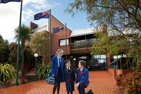
ACG Sunderland School and College is a private school with a roll of 624 students.[12] They opened at the beginning of 2007.[13]
Both schools are coeducational. Rolls are as of July 2022.[14]
Henderson High School, Liston College and St Dominic's College are in Henderson North to the south of Lincoln.
Notes
- "ArcGIS Web Application". statsnz.maps.arcgis.com. Retrieved 24 June 2022.
- "Population estimate tables - NZ.Stat". Statistics New Zealand. Retrieved 22 October 2021.
- "Statistical area 1 dataset for 2018 Census". Statistics New Zealand. March 2020. Henderson Larnoch (124300), Henderson Lincoln West (124900) and Henderson Lincoln South (125700).
- "Statistical area 1 dataset for 2018 Census". Statistics New Zealand. March 2020. Henderson Lincoln East (125100). 2018 Census place summary: Henderson Lincoln East
- 2018 Census place summary: Henderson Larnoch
- 2018 Census place summary: Henderson Lincoln West
- 2018 Census place summary: Henderson Lincoln South
- 2018 Census place summary: Henderson Lincoln East
- Gregory's Auckland & Surrounds Street Directory (3rd ed.). 2008. p. map 75. ISBN 978-0-7319-2048-8.
- Education Counts: Pomaria Road School
- "History - Pomaria Te Kohanga Reo". Retrieved 10 July 2009.
- Education Counts: Sunderland College
- "History of Sunderland". Archived from the original on 25 June 2009. Retrieved 10 July 2009.
- "New Zealand Schools Directory". New Zealand Ministry of Education. Retrieved 19 August 2022.
Другой контент может иметь иную лицензию. Перед использованием материалов сайта WikiSort.org внимательно изучите правила лицензирования конкретных элементов наполнения сайта.
WikiSort.org - проект по пересортировке и дополнению контента Википедии