world.wikisort.org - Netherlands
Ugchelen is part of the municipality of Apeldoorn in the Gelderland province of the Netherlands, and is today seen as a neighbourhood of Apeldoorn.
Ugchelen | |
|---|---|
Village and neighbourhood | |
 Church at Ugchelen | |
 Ugchelen Location in the province of Gelderland  Ugchelen Ugchelen (Netherlands) | |
| Coordinates: 52°11′7″N 5°56′27″E | |
| Country | Netherlands |
| Province | Gelderland |
| Municipality | Apeldoorn |
| Area | |
| • Total | 23.32 km2 (9.00 sq mi) |
| Elevation | 26 m (85 ft) |
| Population (2021)[1] | |
| • Total | 3,860 |
| • Density | 170/km2 (430/sq mi) |
| Time zone | UTC+1 (CET) |
| • Summer (DST) | UTC+2 (CEST) |
| Postal code | 7339[1] |
| Dialing code | 055 |
Ugchelen is located South West of Apeldoorn and has about 7000 inhabitants. Like Apeldoorn, the old village thanked its growth to the paper industry, it had a total of 11 watermills. In 2006 it received a new water mill called The Bouwhof Mill.[3]
The most important hospital in the region, Gelre hospital, is located next to Ugchelen.
Notable people
- Robin Linschoten, politician (VVD) (born 17 April 1956 in Ugchelen)
- Peter Bosz, manager with Olympique Lyonnais and ex-trainer of AGOVV Apeldoorn and ex-professional soccer player with Feyenoord (born 21 November 1963 in Apeldoorn)
- Medy van der Laan, politician (D66) (born 14 August 1968 in Spijkenisse)
- Jan Kromkamp, professional soccer player with PSV (born 17 August 1980 in Makkinga)
- Jaime Bruinier, professional soccer player with AGOVV (born 28 June 1987 in Ugchelen)
Gallery
 Caesarea chapel
 Altena factory
 Forest office
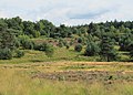 Leesterheide


References
- "Kerncijfers wijken en buurten 2021". Central Bureau of Statistics. Retrieved 19 March 2022.
Three entries
- "Postcodetool for 7339AA". Actueel Hoogtebestand Nederland (in Dutch). Het Waterschapshuis. 24 July 2019. Retrieved 19 March 2022.
- Gert Woutersen (2021-03-13). "Ugchelen, Nieuws en informatie uit Ugchelen en Ugchelense Organisaties en Verenigingen". Ugchelen.org. Retrieved 2022-08-01.
External links
 Media related to Ugchelen at Wikimedia Commons
- Official site (in Dutch)
Текст в блоке "Читать" взят с сайта "Википедия" и доступен по лицензии Creative Commons Attribution-ShareAlike; в отдельных случаях могут действовать дополнительные условия.
Другой контент может иметь иную лицензию. Перед использованием материалов сайта WikiSort.org внимательно изучите правила лицензирования конкретных элементов наполнения сайта.
Другой контент может иметь иную лицензию. Перед использованием материалов сайта WikiSort.org внимательно изучите правила лицензирования конкретных элементов наполнения сайта.
2019-2026
WikiSort.org - проект по пересортировке и дополнению контента Википедии
WikiSort.org - проект по пересортировке и дополнению контента Википедии