world.wikisort.org - Netherlands
Klarenbeek is a village in the eastern Netherlands. The village belongs to two municipalities, Apeldoorn and Voorst, with the municipality border situated in the middle of the village.
Klarenbeek | |
|---|---|
Village | |
 Bethlehem Church (2022) | |
 Klarenbeek Location in the province of Gelderland  Klarenbeek Klarenbeek (Netherlands) | |
| Coordinates: 52°9′56″N 6°3′32″E | |
| Country | Netherlands |
| Province | Gelderland |
| Municipality | Apeldoorn Voorst |
| Area | |
| • Total | 24.84 km2 (9.59 sq mi) |
| Elevation | 92 m (302 ft) |
| Population (2021)[1] | |
| • Total | 2,885 |
| • Density | 120/km2 (300/sq mi) |
| Time zone | UTC+1 (CET) |
| • Summer (DST) | UTC+2 (CEST) |
| Postal code | 7325, 7381 & 7382[1] |
| Dialing code | 055 |
Klarenbeek is named after an estate situated next to the Klaarbeek. This estate was later also named Klarenbeek. Both Klaarbeek and Klarenbeek translate to "Clear Stream" in English.
Klarenbeek has its own railway station, Klarenbeek railway station, 2 km northeast of the village on the railway line between Apeldoorn and Zutphen. The station can be reached by Buurtbus service. This service connects with the station hourly, from 7am to 6pm. The railway station lies within the borders of the municipality of Voorst.
The village is located along the European hiking route E11, locally known as the Marskramerpad or Handelsweg.
History
The village of Klarenbeek was founded in 1732 when a copper mill was established next to the Beekbergse Beek. In 1764, this copper mill was bought by the family of Krepel.[3] To increase the capacity of the mill, the Beekbergse Beek was enlarged and heightened, causing the water to fall down faster. Later, a water reservoir called "De Wiert" was added to this. The Wiert still exists, and when the winters are cold enough, it is a common location for ice skating. The Krepel family built homes for their employees, creating the first non-farm houses in Klarenbeek.
Gallery
 Carriage house of Huize Klarenbeek
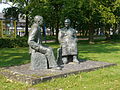 Statue of granddad and grandma by Maïté Duval
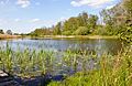 Beekbergerwoud
 Former railway station building (demolished)


References
- "Kerncijfers wijken en buurten 2021". Central Bureau of Statistics. Retrieved 19 March 2022.
Two entries
- "Postcodetool for 7346AA". Actueel Hoogtebestand Nederland (in Dutch). Het Waterschapshuis. Retrieved 19 March 2022.
- Ontstaangeschiedenis van Klarenbeek
На других языках
[de] Klarenbeek
Klarenbeek ist ein Dorf in den Niederlanden, in der Provinz Gelderland. Es gehört zu den zwei Gemeinden Apeldoorn und Voorst. Klarenbeek hat 3.470 Einwohner.[1] Es besitzt einen Kleinbahnhof an der Bahnstrecke Amsterdam–Zutphen und liegt am Europäischen Fernwanderweg E11.- [en] Klarenbeek
Другой контент может иметь иную лицензию. Перед использованием материалов сайта WikiSort.org внимательно изучите правила лицензирования конкретных элементов наполнения сайта.
WikiSort.org - проект по пересортировке и дополнению контента Википедии