world.wikisort.org - Netherlands
Spijkenisse (Dutch pronunciation: [spɛikəˈnɪsə] (![]() listen)) is a city in the province of South Holland, Netherlands. Following an administrative reform in 2015, it is part of the municipality of Nissewaard, and has a population of 72,500. It covers an area of 30.27 km2 (11.69 sq mi) of which 4.15 km2 (1.60 sq mi) is water. It is part of the Greater Rotterdam area.
listen)) is a city in the province of South Holland, Netherlands. Following an administrative reform in 2015, it is part of the municipality of Nissewaard, and has a population of 72,500. It covers an area of 30.27 km2 (11.69 sq mi) of which 4.15 km2 (1.60 sq mi) is water. It is part of the Greater Rotterdam area.
Spijkenisse | |
|---|---|
City | |
 City centre of Spijkenisse | |
 Flag Coat of arms | |
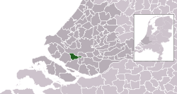 Location in South Holland | |
| Coordinates: 51°51′N 4°20′E | |
| Country | Netherlands |
| Province | South Holland |
| Municipality | Nissewaard |
| Area | |
| • Total | 30.27 km2 (11.69 sq mi) |
| • Land | 26.12 km2 (10.08 sq mi) |
| • Water | 4.15 km2 (1.60 sq mi) |
| Elevation | −1 m (−3 ft) |
| Population | |
| • Total | 72,500 |
| Demonym(s) | Spijkenissenaar |
| Time zone | UTC+1 (CET) |
| • Summer (DST) | UTC+2 (CEST) |
| Postcode | 3200–3209 |
| Area code | 0181 |
| Website | www |
History

Archaeological evidence suggests that the area around Spijkenisse has been inhabited for several thousand years. The area's prehistoric inhabitants depended on fishing in the Maas and hunting in the surrounding swamps for sustenance. Spijkenisse also has an anthem, the song is called "Spijkenisse" by Rik Hoogendoorn. The song was released in 2012 and is very popular amongst people who live in Spijkenisse.
The oldest known reference to the name Spickenisse is in a source from 1231. Spijkenisse is a portmanteau of the words spieke (spit) and nesse (nose) meaning "pointy nose." The name is a reference to the settlement's location on a spit of land protruding into the river.[3]
Spijkenisse formed as a farming and fishing village on a creek along the Oude Maas. It originally belonged to the Lord of Putten (whose coat of arms is now used by the city) but in 1459 the fiefdom of Putten, including Spijkenisse, was transferred to Philip III, Duke of Burgundy. In 1581, after the Dutch declaration of independence, the area came under the control of the States of Holland and West Friesland.[4]
In the 16th century the village suffered several floods. In the 17th and 18th centuries it endured destructive fires which hampered its economic growth. In the 20th century Spijkenisse heavily urbanised as part of the Greater Rotterdam area. Contemporary Spijkenisse includes the communities of Hekelingen, Den Hoek, and Beerenplaat.
Transport
Spijkenisse has a connection to the city of Rotterdam by Rotterdam Metro lines C and D, through Spijkenisse Centrum, Heemraadlaan and De Akkers stations. The metro is operated by RET.
On 2 November 2020, at about 00:30, a train ran through buffers at the end of the line and was saved from plunging 10 metres by the "Whale tails" sculpture.
There are also several bus services operated by EBS and 1 line of Connexxion to Ouddorp.
In 2011, the town built seven bridges designed by Robin Stam, replicating Robert Kalina's fictional designs on the euro banknotes.[5][6][7][8]
 Spijkenisse Centrum
 Accident on November 2, 2020
 Bus service
 Eurobridge 20 euro


Districts
- De Akkers
- Centrum
- De Elementen
- De Hoek
- Gildenwijk
- Groenewoud
- Hoogwerf
- Maaswijk
- Schenkel
- Schiekamp
- Sterrenkwartier
- Vierambachten
- Vogelenzang
- Vriesland
- Waterland
Health
- Spijkenisse Medisch Centrum (former Ruwaard van Putten hospital)
Schools
Primary schools
| Roman Catholic | Protestant | Public | Calvinist |
|---|---|---|---|
| De Akkers | Het Anker | Annie MG Schmidt | De Morgenster |
| De Klinker | Het Baken | De Vuurvogel | |
| De Maasoever | De Bron | ||
| Monseigneur Bekkersschool | De Duif | De Vogelenzang | |
| De Wegwijzer | De Hoeksteen | De Krullevaar | |
| Paus Johannes | De Marimba | De Meander(tot 2012) | |
| De Rank | De Montessori | ||
| De Schakel | Jan Campert | ||
| De Piramide | |||
| De Toermalijn | |||
| De Veenvlinder |
Secondary school
| Roman Catholic | Christian | Public |
|---|---|---|
| MAVO Charles de Foucauld | PENTA college CSG Scala Molenwatering | OSG My College |
| PENTA College CSG Scala Rietvelden | OSG De Ring van Putten | |
| PENTA college CSG De Oude Maas |
Notable residents

- Jan Campert (1902 in Spijkenisse – 1943) a journalist, theater critic and writer
- Marleen de Pater-van der Meer (1950 in Hekelingen – 2015) a Dutch politician
- Jan Bechtum (born 1958 in Spijkenisse) a Dutch guitarist and composer
- Erik de Jong (born 1961 in Spijkenisse) known as Spinvis, a Dutch one-man music project
- Medy van der Laan (born 1968 in Spijkenisse) a retired Dutch politician
- Björn Franken (born 1983 in Spijkenisse) known as Vato Gonzalez, DJ and producer
- Nick van de Wall (born 1987 in Spijkenisse) known as Afrojack, DJ and producer
- Duncan Laurence (born 1994 in Spijkenisse) singer, winner of the Eurovision Song Contest 2019
- Sport
- Bram Groeneweg (1905 in Spijkenisse – 1988) a Dutch long-distance runner, competed in the marathon at the 1928 Summer Olympics
- Emiel Mellaard (born 1966 in Spijkenisse) is a retired Dutch long jump record holder
- Joeri de Groot (born 1977 in Spijkenisse) a Dutch rower, competed at the 2004 Summer Olympics
- Patrick van Luijk (born 1984 in Spijkenisse) a Dutch sprinter
- Martijn Barto (born 1984 in Spijkenisse) a Dutch professional footballer with over 200 club caps
International relations
Spijkenisse is twinned with the following cities:
|
|
Gallery
 The medieval village church is the oldest building in Spijkenisse.
![Windmill Nooitgedacht [nl] in Spijkenisse.](//upload.wikimedia.org/wikipedia/commons/thumb/7/76/Spijkenisse_molen_Nooitgedacht.jpg/154px-Spijkenisse_molen_Nooitgedacht.jpg) Windmill "Nooitgedacht" in Spijkenisse.
Windmill "Nooitgedacht" in Spijkenisse.![Mannetjes op de krom by Bert Kiewiet [nl]](//upload.wikimedia.org/wikipedia/commons/thumb/8/8a/Spijkenisse_kunstwerk_mannetjes_op_de_krom.jpg/166px-Spijkenisse_kunstwerk_mannetjes_op_de_krom.jpg) Mannetjes op de krom by Bert Kiewiet
Mannetjes op de krom by Bert Kiewiet The library "Bookmountain"
 The Rokade
 Ice in the harbour of spijkenisse
 The Maasboulevard
 Sculpture "droomboot" (dream boat)
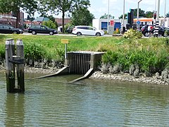 Outfall sluice

![Windmill Nooitgedacht [nl] in Spijkenisse.](http://upload.wikimedia.org/wikipedia/commons/7/76/Spijkenisse_molen_Nooitgedacht.jpg)
![Mannetjes op de krom by Bert Kiewiet [nl]](http://upload.wikimedia.org/wikipedia/commons/8/8a/Spijkenisse_kunstwerk_mannetjes_op_de_krom.jpg)


References
- "Kerncijfers wijken en buurten 2020" [Key figures for neighbourhoods 2020]. StatLine (in Dutch). CBS. 24 July 2020. Retrieved 19 September 2020.
- "Postcodetool for 3201EL". Actueel Hoogtebestand Nederland (in Dutch). Het Waterschapshuis. Retrieved 24 August 2013.
- "Gemeente Spijkenisse". Spijkenisse.nl. Retrieved 2014-02-10.
- Spijkenisse Online - geschiedenis Archived June 7, 2011, at the Wayback Machine
- Kristen Allen, "Euro Bridges: An Uncommon Monument to the Common Currency", Spiegel Online, 4 November 2011. Retrieved 13 January 2014.
- Benjamin Starr, "Bridges on Euro Banknotes Were Fictional, But This Dutch Designer Built Them Anyway", Visual News, 17 December 2014. Retrieved 23 March 2015.
- Those fantasy bridges on euro notes? They’re real, now, and all in one place Coin World (www.coinworld.com). July 24, 2017. Retrieved on 2017-07-25.
- Euro Banknote Bridges Atlas Obscura (www.atlasobscura.com). Retrieved on 2018-06-25.
External links
Places adjacent to Spijkenisse | |
|---|---|
Authority control | |
|---|---|
| General |
|
| Other |
|
На других языках
[de] Spijkenisse
Spijkenisse ( anhören?/i) ist eine Stadt in den Niederlanden. Sie befindet sich in der Provinz Südholland auf der Insel Voorne-Putten. Sie hat eine Gesamtfläche von 24,17 km². Im Jahr 2020 lag ihre Einwohnerzahl bei 71.985.[1] Zu der Stadt gehören auch die Dörfer Hekelingen, Den Hoek und Beerenplaat. Am 1. Januar 2015 wurde Spijkenisse in die Gemeinde Nissewaard eingegliedert.- [en] Spijkenisse
[ru] Спейкениссе
Спейкени́ссе (нидерл. Spijkenisse) — город и община в провинции Южная Голландия (Нидерланды). Часть городской агломерации Роттердама. Находится на левом берегу основного устья Рейна (Роттердам находится на правом берегу).Другой контент может иметь иную лицензию. Перед использованием материалов сайта WikiSort.org внимательно изучите правила лицензирования конкретных элементов наполнения сайта.
WikiSort.org - проект по пересортировке и дополнению контента Википедии