world.wikisort.org - Netherlands
Tynaarlo (pronounced [tiˈnaːrloː] (![]() listen); Gronings: Tynaorl) is a village and municipality in the Northeastern Netherlands. Although it is located in the province of Drenthe, many of its communities serve as suburbs of the neighbouring city of Groningen, capital of the eponymous province. In 2019, the municipality of Tynaarlo had a population of 33,698.
listen); Gronings: Tynaorl) is a village and municipality in the Northeastern Netherlands. Although it is located in the province of Drenthe, many of its communities serve as suburbs of the neighbouring city of Groningen, capital of the eponymous province. In 2019, the municipality of Tynaarlo had a population of 33,698.
Tynaarlo | |
|---|---|
Village and municipality | |
 Waterwijk in the municipality of Tynaarlo | |
 Flag Coat of arms | |
 Location in Drenthe | |
| Coordinates: 53°5′N 6°35′E | |
| Country | Netherlands |
| Province | Drenthe |
| Established | 1 January 1998[1] |
| Renamed | 1 January 2000[2] |
| Government | |
| • Body | Municipal council |
| • Mayor | Marcel Thijsen |
| Area | |
| • Total | 147.70 km2 (57.03 sq mi) |
| • Land | 143.00 km2 (55.21 sq mi) |
| • Water | 4.70 km2 (1.81 sq mi) |
| Elevation | 6 m (20 ft) |
| Population (January 2019)[6] | |
| • Total | 33,698 |
| • Density | 236/km2 (610/sq mi) |
| Time zone | UTC+1 (CET) |
| • Summer (DST) | UTC+2 (CEST) |
| Postcode | Parts of 9000 range |
| Area code | 050, 0592, 0598 |
| Website | www |
History
The municipality of Tynaarlo was established in 1998 as the merger of the former municipalities of Eelde, Vries and Zuidlaren; it was supposed to retain the name of the latter, but after the two first voiced their discontent, the name of the smaller central village of Tynaarlo was chosen.
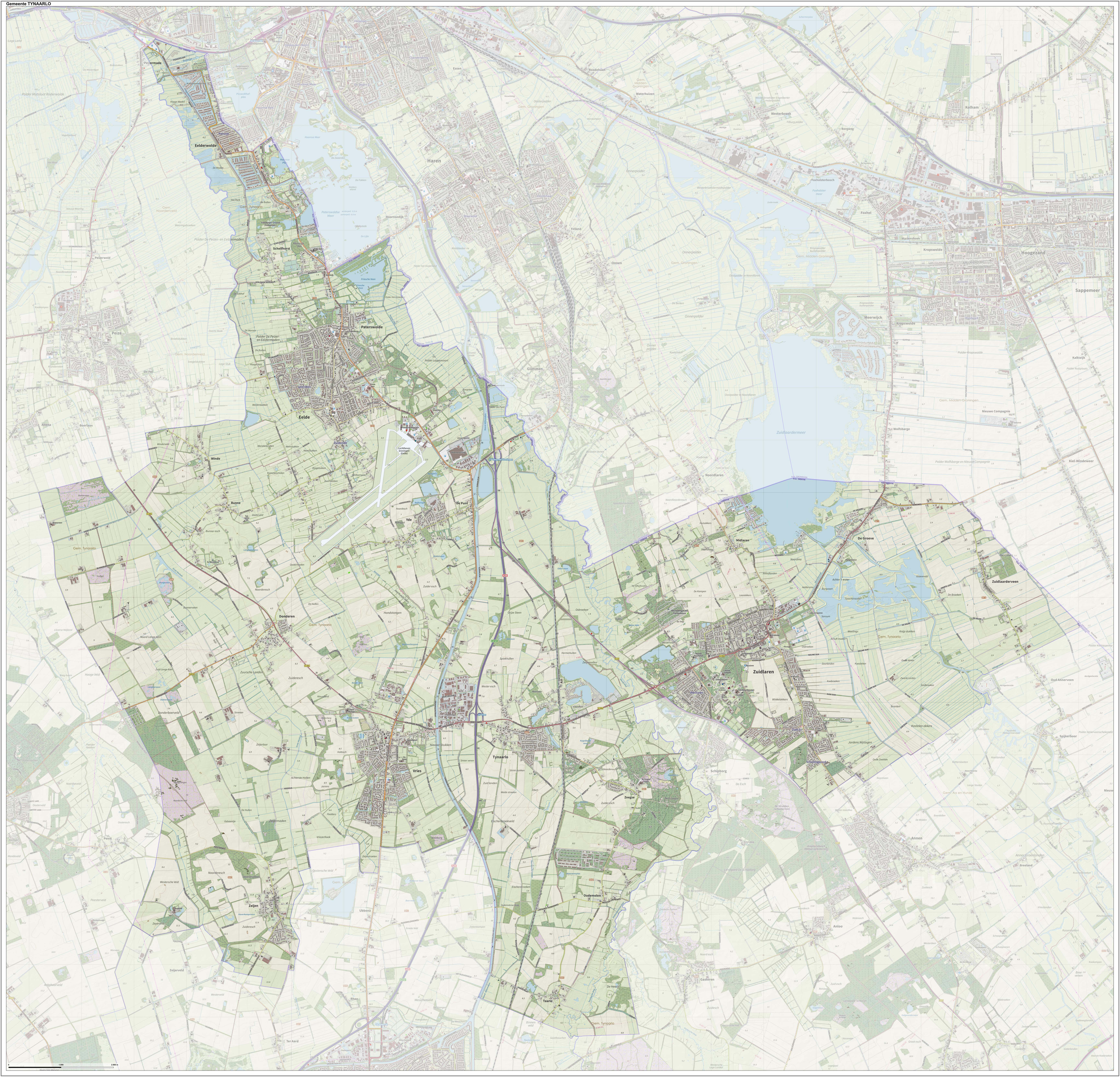
Population centres
Topography
Village of Tynaarlo

The village of Tynaarlo is a part of the municipality and lies about 9 km (5.6 mi) north of Assen. It is situated between the three largest villages of the municipality: Zuidlaren, Eelde and Vries. Tynaarlo is located close to the motorway A28, which is a connection to the south and the west of the country.
In 2001, the village of Tynaarlo had 1,009 inhabitants. The built-up area of the village was 0.29 km2 (0.11 sq mi); it contained 427 residences.[7] The statistical district of Tynaarlo, which also includes the surrounding countryside, has a population of 1,920.[8]
Notable people

- Menso Alting (1541 in Eelde – 1612), a Dutch Reformed preacher and reformer
- Lodewijk van Heiden (1772 in Zuidlaren – 1850), a Dutch admiral
Sport
- Jaap Helder (1907 in Paterswolde – 1998), a Dutch sailor who participated in the 1960 Summer Olympics
- Roelof Koops (1909 in Zuidlaren – 2008), a Dutch speed skater who competed in the 1936 Winter Olympics
- Paul Matthijs (born 1976 in Paterswolde), a Dutch footballer with over 300 club caps
- Jos Hooiveld (born 1983 in Zeijen), a Dutch footballer with over 300 club caps
- Willemijn Bos (born 1988 in Eelde), a Dutch field hockey defender, team silver medallist at the 2016 Summer Olympics
Gallery

References
- "Gemeentelijke indeling op 1 januari 1998" [Municipal divisions on 1 January 1998]. cbs.nl (in Dutch). CBS. Retrieved 11 October 2013.
- "Gemeentelijke indeling op 1 januari 2000" [Municipal divisions on 1 January 2000]. cbs.nl (in Dutch). CBS. Retrieved 11 October 2013.
- "Dhr. P. Adema" [Mr. P. Adema] (in Dutch). Gemeente Tynaarlo. Archived from the original on 11 October 2013. Retrieved 11 October 2013.
- "Kerncijfers wijken en buurten 2020" [Key figures for neighbourhoods 2020]. StatLine (in Dutch). CBS. 24 July 2020. Retrieved 19 September 2020.
- "Postcodetool for 9481AW". Actueel Hoogtebestand Nederland (in Dutch). Het Waterschapshuis. Retrieved 11 October 2013.
- "Bevolkingsontwikkeling; regio per maand" [Population growth; regions per month]. CBS Statline (in Dutch). CBS. 1 January 2019. Retrieved 1 January 2019.
- Statistics Netherlands (CBS), Bevolkingskernen in Nederland 2001. (Statistics are for the continuous built-up area).
- Statistics Netherlands (CBS), Statline: Kerncijfers wijken en buurten 2003-2005. As of 1 January 2005.
External links
Places adjacent to Tynaarlo | ||||||||||||||||
|---|---|---|---|---|---|---|---|---|---|---|---|---|---|---|---|---|
| ||||||||||||||||
Municipalities of Drenthe | ||
|---|---|---|
 | ||
| ||
На других языках
[de] Tynaarlo
Tynaarlo ( anhören?/i) ist eine Gemeinde in den Niederlanden, Provinz Drenthe, mit 34.195 Einwohnern (Stand 1. Januar 2022). Sie bildet den nördlichsten Zipfel der Provinz und grenzt an Haren, Provinz Groningen. Die Stadt Groningen liegt fünf Kilometer nördlich.- [en] Tynaarlo
[ru] Тинарло
Тинарло (нидерл. Tynaarlo) — община в нидерландской провинции Дренте. Образована в 1998 году за счёт слияния общин Зёйдларен (голл.), Элде и Врис. Изначально общину хотели назвать Зёйдларен, но это вызвало протесты жителей Элде и Вриса, и потому было решено выбрать нейтральное название. Административный центр — город Врис[en]. В состав общины входит 18 населённых пунктов.Другой контент может иметь иную лицензию. Перед использованием материалов сайта WikiSort.org внимательно изучите правила лицензирования конкретных элементов наполнения сайта.
WikiSort.org - проект по пересортировке и дополнению контента Википедии