world.wikisort.org - Netherlands
Paterswolde is a village in the Dutch province of Drenthe. It is a part of the municipality of Tynaarlo, and lies about 8 km south of city of Groningen. Paterswolde and Eelde has merged into a single urban area, and are often referred to as Eelde-Paterswolde, however they remain separate villages.[3]
Paterswolde | |
|---|---|
Village | |
 Mansion Vennebroek in 2004 | |
  Paterswolde Location in the province of Drenthe in the Netherlands 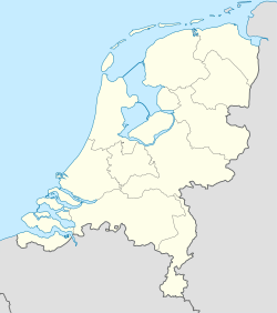 Paterswolde Paterswolde (Netherlands) | |
| Coordinates: 53°9′N 6°34′E | |
| Country | Netherlands |
| Province | Drenthe, Groningen |
| Municipality | Tynaarlo, Groningen |
| Area | |
| • Total | 6.89 km2 (2.66 sq mi) |
| Elevation | 2.6 m (8.5 ft) |
| Population (2021)[1] | |
| • Total | 3,795 |
| • Density | 550/km2 (1,400/sq mi) |
| Time zone | UTC+1 (CET) |
| • Summer (DST) | UTC+2 (CEST) |
| Postal code | 9765[1] |
| Dialing code | 050 |
A small part of the village, on the south end of the lake Paterwoldsemeer, lies in the province of Groningen, in the municipality of Groningen.
History
The village was first mentioned in 1408 as Potterwolt, and means "the woods of Potter (person)".[4] Paterswolde is a road village from the Early Middle Ages which started to develop when peat was excavation in the nearby raised bog.[5]
During the 18th and 19th century, villas and estates were built in Paterswolde mainly by nobility and industrialists from the city of Groningen.[5]
Paterswolde was home to 795 people in 1840.[3] The Paterwoldsemeer and the Friesche Veen became a water sports and recreational area during the 20th century. Between 1955 and 1956, the Assumption of Mary Church was built in Paterswolde.[5]
Gallery
 Assumption of Mary Church
 Villa in Paterswolde
 Roundabout art
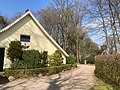 House in Paterswolde


References
- "Kerncijfers wijken en buurten 2021". Central Bureau of Statistics. Retrieved 12 April 2022.
- "Postcodetool for 9765AA". Actueel Hoogtebestand Nederland (in Dutch). Het Waterschapshuis. Retrieved 12 April 2022.
- "Eelde-Paterswolde". Plaatsengids (in Dutch). Retrieved 12 April 2022.
- "Paterswolde - (geografische naam)". Etymologiebank (in Dutch). Retrieved 12 April 2022.
- Ronald Stenvert (2001). Paterswolde (in Dutch). Zwolle: Waanders. ISBN 90 400 9454 3. Retrieved 12 April 2022.
External links
 Media related to Paterswolde at Wikimedia Commons

Authority control | |
|---|---|
| General |
|
| National libraries | |

 | This Drenthe location article is a stub. You can help Wikipedia by expanding it. |
Другой контент может иметь иную лицензию. Перед использованием материалов сайта WikiSort.org внимательно изучите правила лицензирования конкретных элементов наполнения сайта.
WikiSort.org - проект по пересортировке и дополнению контента Википедии