world.wikisort.org - Netherlands
Snelrewaard is a hamlet in the Dutch province of Utrecht. It is a part of the municipality of Oudewater, and lies about 2 km east of the city of Oudewater. A small part of the hamlet is in Montfoort.[3]
Snelrewaard | |
|---|---|
Hamlet | |
 Street view | |
 Coat of arms | |
 Snelrewaard Location in the Netherlands  Snelrewaard Snelrewaard (Netherlands) | |
| Coordinates: 52°1′59″N 4°55′1″E | |
| Country | Netherlands |
| Province | Utrecht |
| Municipality | Oudewater Montfoort |
| Area | |
| • Total | 9.72 km2 (3.75 sq mi) |
| Elevation | −0.1 m (−0.3 ft) |
| Population (2021)[1] | |
| • Total | 780 |
| • Density | 80/km2 (210/sq mi) |
| Time zone | UTC+1 (CET) |
| • Summer (DST) | UTC+2 (CEST) |
| Postal code | 3425[1] |
| Dialing code | 0348 |
Snelrewaard was a separate municipality from 1817 to 1989, when it was merged with Oudewater.[4]
It was first mentioned around 1307 as Snoyelrewaert, and means "land near water belonging to Snel (polder)".[5] Snelrewaard has place name signs. In 1840, it was home to 140 people.[3]
Gallery
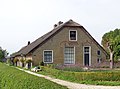 Farm in Snelrewaard
 Farm in Snelrewaard
 Milk churns


References
- "Kerncijfers wijken en buurten 2021". Central Bureau of Statistics. Retrieved 27 March 2022.
- "Postcodetool for 3425EJ". Actueel Hoogtebestand Nederland (in Dutch). Het Waterschapshuis. Retrieved 28 March 2022.
- "Snelrewaard". Plaatsengids (in Dutch). Retrieved 28 March 2022.
- Ad van der Meer and Onno Boonstra, Repertorium van Nederlandse gemeenten, KNAW, 2011.
- "Snelrewaard - (geografische naam)". Etymologiebank (in Dutch). Retrieved 28 March 2022.
Wikimedia Commons has media related to Snelrewaard.
This Utrecht location article is a stub. You can help Wikipedia by expanding it. |
Текст в блоке "Читать" взят с сайта "Википедия" и доступен по лицензии Creative Commons Attribution-ShareAlike; в отдельных случаях могут действовать дополнительные условия.
Другой контент может иметь иную лицензию. Перед использованием материалов сайта WikiSort.org внимательно изучите правила лицензирования конкретных элементов наполнения сайта.
Другой контент может иметь иную лицензию. Перед использованием материалов сайта WikiSort.org внимательно изучите правила лицензирования конкретных элементов наполнения сайта.
2019-2026
WikiSort.org - проект по пересортировке и дополнению контента Википедии
WikiSort.org - проект по пересортировке и дополнению контента Википедии