world.wikisort.org - Netherlands
Papekop is a village in the Dutch province of Utrecht. It is a part of the municipality of Oudewater, and lies about 3 km northwest of the city of Oudewater.
Papekop | |
|---|---|
Village | |
 Street view | |
 Coat of arms | |
 Papekop Location in the Netherlands  Papekop Papekop (Netherlands) | |
| Coordinates: 52°2′47″N 4°51′5″E | |
| Country | Netherlands |
| Province | Utrecht |
| Municipality | Oudewater |
| Area | |
| • Total | 5.08 km2 (1.96 sq mi) |
| Elevation | −1.4 m (−4.6 ft) |
| Population (2021)[1] | |
| • Total | 385 |
| • Density | 76/km2 (200/sq mi) |
| Time zone | UTC+1 (CET) |
| • Summer (DST) | UTC+2 (CEST) |
| Postal code | 3464[1] |
| Dialing code | 0348 |
Papekop was a separate municipality between 1818 and 1964, when it merged with Driebruggen. Between 1821 and 1989, when it became part of Oudewater, the village was located in the province of South Holland.[3]
The village was first mentioned around 1307 as Papencoip, and means "(peat) concession of Pape (probably a clergy)".[4] In 1840, it was home to 284 people. Between 1858 and 1936, there was a railway station in Papekop.[5]
Gallery
 School in Papekop
 Painting of a farm in Papekop
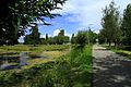 Landscape
 Social sofa in Papekop


References
- "Kerncijfers wijken en buurten 2021". Central Bureau of Statistics. Retrieved 27 March 2022.
- "Postcodetool for 3464HK". Actueel Hoogtebestand Nederland (in Dutch). Het Waterschapshuis. Retrieved 27 March 2022.
- Ad van der Meer and Onno Boonstra, Repertorium van Nederlandse gemeenten, KNAW, 2011.
- "Papekop - (geografische naam)". Etymologiebank (in Dutch). Retrieved 27 March 2022.
- "Papekop". Plaatsengids (in Dutch). Retrieved 27 March 2022.
This Utrecht location article is a stub. You can help Wikipedia by expanding it. |
Текст в блоке "Читать" взят с сайта "Википедия" и доступен по лицензии Creative Commons Attribution-ShareAlike; в отдельных случаях могут действовать дополнительные условия.
Другой контент может иметь иную лицензию. Перед использованием материалов сайта WikiSort.org внимательно изучите правила лицензирования конкретных элементов наполнения сайта.
Другой контент может иметь иную лицензию. Перед использованием материалов сайта WikiSort.org внимательно изучите правила лицензирования конкретных элементов наполнения сайта.
2019-2026
WikiSort.org - проект по пересортировке и дополнению контента Википедии
WikiSort.org - проект по пересортировке и дополнению контента Википедии